With edits to June 2025
Viewing
these pages
Use
your internet browser "find" or
"search" tool for keywords such as ‘Langley’
‘kelsey’ etc. also try
spelling
variations e.g. ‘Sympsons, Symsons or Simpsons, Beckenham,
Beghenham,
Beccaham,
Bekynham, Bruyn, Brun etc. Queries to boermund@gmail.com
Several earlier and other histories of Beckenham only describe the main manors and estates or the most recent events. We aim to fill some gaps, correct some errors and cover some missed events.
We have used the timeline approach taken from the Beckenham Place Park history formed the foundation of this account but more emphasis will be put on the other estates and areas of Beckenham until a more comprehensive picture emerges. Some caution has to be exercised as Beckenham had several spelling variations and which may apply to other places or people with that or a similar name. Another Beckingham is in Lincolnshire sometimes spelt Beckyngham. Other names particularly of families are prone to spelling variations and aliases such as Brun/Brune/Bruyn and Rochelle/Rokele/Rokeley.Entitled “A History of Beckenham” because Beckenham has been written about by numerous historians but this account may reveal hitherto undiscovered aspects and change or challenge parts of some previous accounts which have perpetuated errors. Also, it cannot claim to represent a complete history as the amount of detail available from archives and other accounts is formidable. There will be regular updates shown by the edition date. Following on from our work related to Beckenham Place Park we found the impact of events concerning the other parts of Beckenham and nearby parts of Bromley and Lewisham were of particular interest and we embarked on this account. Some writers whom we mention took the work of previous writers and added contemporary information. That process sometimes perpetuated errors or omitted available detail from archive records. We have reviewed information from earlier times and found it appropriate to amend some information and add a bit more substance to some accounts.
For the earliest events we were led to varying extents by the works of John and Thomas Philipot, “Villare Cantianum” 1659, Edward Hasted's “History and Topography of Kent” first edition 1778 and second edition 1797, Daniel Lysons “Environs of London” 1792/96. These certainly provided information, clues and leads. They were essentially brief summaries and directories of the gentry but were also the basis for many other histories of Beckenham written later. While reciting the work of these writers we are also correcting some obvious errors in that material and adding information gleaned from various archives and sources. Some writers have found misconceptions in all of these earlier works and we try to clarify any differences with substantiating evidence. Most writers have taken the main estates and written about them separately but as the evolution of one estate was often affected by overlaps, divisions and jointures with others I have attempted to merge the accounts into a timeline which enables relating transfers of property from one owner to another and relationships with other events. This also reveals in some cases more links between various people and places than hitherto realised. We also reveal events and facts unrecorded in many other accounts such as the small body of land connected to the Manor of Old Court in Greenwich which is mentioned as early as the 14th Century.
Some answers to outstanding questions only give rise to yet more questions in an apparently never ending process. I only discovered in January 2021 that it was Thomas Philipot's father, John, who wrote the survey of Kent and that Thomas had it published. They both lived in Eltham and there are charitable almshouses named after Thomas.
Philipot wrote about the Manor of Beckenham, the Manor of Foxgrove, Langley, and finally Kelsey or Kelseys. Hasted repeated the format adding Kent House. Lysons also followed this format. Later writers such as Robert Borrowman (1910) and Rob Copeland (1967) added more recent contemporary information but still relied greatly on Philipor and/or Hasted for early history which Inman, Tonkin, Manning and others continued. Len Hevey took a fresh approach revisiting documentary evidence and expanded and corrected the early history up to the 14th Century, citing Robert Borrowman 1910 as a post 14th C. writer but we question some of Borrowman's material obviously drawn on Hasted etc. Pat Manning published books on the Cator family as well as other publications. Copeland, Inman, Tonkin and others generally worked from Hasted and Lysons with added local records and reminiscences. We unwittingly adopted Hevey’s approach of revisiting source material initially having later become aware of his work some way into our investigations but this reinforced the validity of our approach.
Research
into the various people
mentioned does reveal some interesting stories of intrigue which would
be too
lengthy to fully repeat here. A note on internet searching; we find
that
'googling' doesn't always return a result and you have to go to various
archive
catalogues for searches. Although several archives have been searched
this is not
exhaustive
as each person or place name would have to be searched in every
archive. Some archive catalogues are better than others.
The
Historians and Sources
A word of warning regarding all accounts. There are errors in every publication (including this one no doubt) and some material in one publication may not necessarily get transferred to more recent ones. Therefore it is probably that reading several accounts is necessary plus a bit of your own research. We have endeavoured to check sources and accuracy but not all material has been 'audited'.
The previous writers include:
John Philipot author, published by his son Thomas Philipot 1659 History of Kent “Villare Cantianum”. This is in some ways a genealogy of the gentry and directory of family seats. As a work relating to the whole of Kent the parts regarding Beckenham are by necessity quite short.
Edward Hasted 1778 1st edition Topography and History of Kent and 2nd edition 1797/99, Similar to Philipot upon whom Hasted draws some information, it continues with genealogies and a directory information.
Daniel Lysons 1796 Environs of London, The Beckenham section is somewhat shortened compared to Hasted and this edition prompted the second edition of Hasted but Lysons refines some detail.
W.H.Ireland 1828 A New and Complete History of Kent, Continues the approach of Philipot and Hasted with additions. Ireland was described as England’s Topographer, I’m not sure why.
Robert Borrowman 1910 Beckenham Past and Present. Borrowman was church warden and a local councillor and historian but drew on Hasted etc for some early history. His contemporary information is interesting as well as some other discoveries he included from parish records including church memorials and a record of the earlier church which was damaged and subsequently rebuilt etc. Though he says his studies were for self interest and not anticipated for publication he asks for forgiveness for any errors or inacuracies in his preface.
Rob Copeland 1967 Manors of Beckenham and other publications, seemingly drawn upon Hasted and Borrowman but kept the interest in local history alive
Nancy Tonkin and Eric Inman "Beckenham" circa 1990, again drawn upon earlier histories with some contemporary material and updates.
Len Hevey 1994 "The Early History of Beckenham" (from the Iron Age to 14th C.), and A History of Shortlands and History of Elmers End. Len carried out a review of source material and took a similar approach to ourselves.
Eric Inman 1995 a series of articles on the History of Beckenham Place Park written for the Friends of Beckenham Place Park, and "Beckenham" co-written with Nancy Tonkin. Eric's account sparked some curiosity to research further.
Pat Manning 2000 Cators of Beckenham and Woodbastwick and other publications on Rivers, Churchyard Memorials, etc.,
Ian Muir, Beckenham History www.beckenhamhistory.co.uk
Bromley Borough Local History Society, Bromleag magazine and various resources.
The Gordon Ward Collection circa 1950 at Kent Archive.
Mother Mary Baptiste thesis research material at Bromley Historic Collections
G.W.Tookey research material at Bromley Historic Collections
With apologies to those we have omitted.
Some if not all of these writers drew, as we do, on the works of their predecessors and contemporaries. Hasted refers to Philipott, Lysons to Hasted, etc. Sometimes fiction is written as fact such as we believe some assumptions referred to later in this account. But I also indulge in a few speculative scenarios based on available evidence. However, some discoveries and corrections by one writer did not get picked up in other contemporary or later publications.
Some material in Bromley Historic Collections and county archives was at some time derived from other archives such as the British Library. Our rediscovery of some of this material has contributed toward our reassessments of the various aspects of Beckenham's History. It must be said that the research is not exhaustive as more records are available which could reveal untold detail in increasingly minute detail. Although some of the above writers knew of this material they may not have been so focussed on specific areas or timeslots in order to analyse the content. The archive catalogues searched include: The British Library, The National Archive, National Library of Scotland (maps), Bromley Historic Collections, Surrey Archive, West Sussex Archive. Some archives do not have an online catalogue i.e. Lewisham, Lincolnshire, etc. where we know some records are stored. British History Online, History of Parliament online and various other internet sources have made some research much more convenient. Digitized books on Google etc have also aided research. County archives have not been exhaustively searched due to limitation of time and access conditions.
The types of documents researched are wills, Post Mortem Inquisitions, feet of fines, Close Rolls, Patent Rolls, genealogy sources. These are in the form of transcripts in most cases and some transcription errors and spelling variations are evident. Wills vary in their informative content but can explain some famly tree details as well as property. The same goes for P.M.Inquisitions. Feet of Fines have often been taken to evidence the sale or transfer of a property but as very often the property in question returns to the original land owner the Foot of Fine (Final Accord) can often relate to a lease or enfeoffment. Transcripts are very often abbreviated but the suspicion is that viewing any available original document may be laborious as ancient handwriting, English and Latin would have to be dealt with. We have attempted to gather together transcripts of relevant documents from several sources and note that both variations in spellings or misreads of old text lead to disparities in the names of people and places.
In May 2020 we acquired a copy of Len Hevey's Early History of Beckenham which confirms some of our findings from independant research and also contains additional material which we will incorporate into the timeline but Len’s books are good reference works.
In October 2022 some material was recovered from G.W.Tookey’s collection (BHC) which shows he had conducted some detailed research into original documents, calendars of old records (Close, Patent and Fine Rolls etc) and at the British Museum, British Library and Maidstone Archives. He had not apparently published any works but had given lectures and exhibitions of his material circa 1950-60? Further inquiry into his material is ongoing but his account of the passage of Langley and Kenthouse is detailed and both marries with our assessment and adds more depth.
The Internet has also revealed sources as books become available in e-book form and various archives become electronically indexed. Google books and other versions include: Philipott’s, Hasted’s, Lyson’s, and Ireland’s histories, Collinson’s letters, Memorial of Humphrey Marshall and John Bartram, Life of Dr. Johnson, Hester Thrale, Lady D’Arblay, Memoirs of George IV and Memoirs of William IV, etc. Beckenham History and Bromley Borough Local History Society websites contain material. Some of this we would question but for the most part it contributes valuable information and personal recollections.
We aim to represent as accurately as possible the evolution of the town of Beckenham and its environs. Dated estate plans in the British Library, Kent Archive and Bromley Historic Collections have enabled the analysis of landholdings by landlords at specific dates. This has allowed for discovering detail which is not in the earlier written records. I doubt we will be able to relate everything in a fully comprehendable manner as the chain of events and occupation is not complete. Just as today it would be difficult to relate all transfers of property it is even more difficult from old archives. The small windows we have on the past add some colour to events.
I certainly started by accepting the previous accounts of others, but where prior information is proved to be wrong or doubtful we draw attention to it here. I say 'we' as I am reliant on leads and information from a fellow researcher Keith Baldwin. I should add that we are not attempting to entirely replace former accounts which all have a lot of information to offer. This account may even be viewed as a supplement to others.
As research evolved we discovered several maps only to find that earlier historians were aware of them and had made various studies. Notebly, Mother Mary Baptiste of Coloma College and Gordon Ward of Sevenoaks. Mary Baptiste listed maps in her degree thesis. Her description is available on this Kent Archaeology link.
She described an intention to analyse the maps in one overall map for the mid eighteenth century but found the task difficult because of missing data. Maybe she was aware of Gordon Ward of Sevenoaks who constructed a composite map from information in several maps but seemingly did not discover all of them or did not complete the task. We reproduce parts of it in this history and his collection is at Kent Archive. Since most maps were to record the property of the landlord who commissioned the map there are gaps and overlaps where properties existed but were not mapped or maps have not been discovered if they existed at all.
Part of the Gordon Ward composite map which demonstrates that he saw most available maps but did not discover all of them.
The maps we have employed come from Bromley Historic Collections (BHC), British Library (BL), Kent Archive (KA), The National Library of Scotland OS map collection (NLS), and other sources such as Sir Charles Burrell and Richard Mason. I suspect that several maps came from Burrell records donated to the British Library.
The main maps are;
Beckenham Manor 1623 redrawn 1768 (BL)
Foxgrove Manor 1720 redrawn 1766, original drawn for Lancelot Tolson? and copy for Jones Raymond? (BL)
Burrell Kelsey maps 1723 and 1735 (Sir Charles Burrell, bart.)
Woolsey’s Farm 1735 belonging to Peter Burrell (BL)
A Property at Penge (Pench) 1735, Peter Burrell (BL)
Langley map 1735 copied 1820? for Gwydir sale, signature of Gwydir appended (KA)
Sympson’s Place (Hugh Raymond) 1735 (BHC )
Thomas Motley’s Old and New Farms at Elmers End, Thayers Farm and The Mead 1736 (KA)
Langley property Southern part belonging to Jones Raymond c.1750 (BL) copied from an earlier 1735? map and a northern section missing.
Foxgrove Manor reduced or core area 1776 (BL)
Plans of property of John Cator and Amy Burrell small exchange agreement 1777 (BL)
Langley,
Kelsey, Eden Park areas assumed to be 1780 showing Cator property which
would be part of 1793 exchange with Burrell, Lord Gwydir. described as
damaged (BL) described as damaged but I believe it was separated to in
which case the part transferred to Cator is missing.
Plan of Clockhouse belonging to Joseph Cator 1782 (BHC)
Lodge Farm, Bromley belonging to Edward Peach, by James Taylor 1794 (BHC)
Burrell Estate (Langley, Simpsons and Kelsey) 1809 (BL)
Burrell estate book of leased properties 1809 (BL)
Cator Estate 1833 (BHC)
Tithe Maps and schedules 1838/42 for Beckenham, Bromley, Lewisham, West Wickham and Hayes. (KA, BHC)
Cator Estate 1864 (Richard Mason)
Cator Estate 1864 updated to 1898 (BHC)
OS maps circa 1860 onwards (NLS)
Composite map created by Gordon Ward (Gordon Ward Collection KA)
Various Ordnance Survey Maps from 1799 to 1950's (BL and NLS)
The maps although having different publication dates allow for piecing together much of the parish but several gaps occur where property was owned by yeomen landowners. More work could be done collating small plans from deeds perhaps we will attempt that in the fullness of time.
The earliest detailed map is the 1623 Beckenham Manor map illustrating how the manor was divided between Sir Henry Snelgrave and Sir John Dalston of Cumbria. We only have the 1768 copy and regrettably only photographed parts of it from the British Library, a further visit to the library would allow completion of the task. Len Hevey made sketches of the map which he must have seen circa 1960. The early 18th century maps from several sources allow comparison of Kelsey, Foxgrove, Langley and Elmers End properties bearing in mind that documentary references explain land exchanges and disposals ie Thomas Motley acquiring Elmer Farm from Hugh Raymond in 1734 reflected in Motley’s map of 1736.
What is evident from the available maps is that several other maps were used as the source data ie 1623 Beckenham Manor copied in 1768, 1720 Foxgrove copied in 1766 etc and that those maps are either lost or evading discovery.
In terms of reproduction of images we are limited by some copyright restrictions but thank various archives and individuals for waiving such restriction or allowing limited reproduction on a not for profit basis and partial image reproduction.
Some
errors found in publications
Errors are unavoidable even if they are just simple typos or transcription errors. Some factual errors that we have found, without naming the publisher are described here;
Some examples are; The daughter, Maud or Matilda de la Rokele brought Beckenham Manor in marriage to Maurice le Bruyn, not Isolda to William Bruyn. The husbands of Alice and Elizabeth le Bruyn sometimes are either omitted or in the wrong order. The passage of Beckenham Manor from the le Bruns through to the St.Johns is wrong in some publications. Some errors relate to Langley as Len Hevey disputes any involvement of the Violets and John Style is now definitively identified as dying in 1505 with an accurate lineage whereas some accounts identify a different John Stile. John Cator’s arrival in Beckenham is now found to be 1757/60 instead of the 1773 which is commonly quoted. Carl von Lynne (Linnaeus) could not have known John Cator but Cator’s father in law Peter Collinson did meet him in 1735 and had a life long correspondence on scientific matters. A note in Peter Collinson's Hortus Collinsonianus records John Cator's house at Stumps Hill being built in 1760 and Beckenham Place is on former Foxgrove Manor property rather than Beckenham Manor land. The passage of Foxgrove Manor during the medieval has been described with errors and its division post 1712 from Francis Leigh to Tolson and Tilly and their heirs is often unexplained or incorrect. Omissions also lead to some confusions, Kent House can be traced to long before the Lethieulliers acquired it but only warrants a mention in some histories after the wealthy Lethieulliers moved in. Piercy Brett’s occupancy of Clockhouse was probably short term and maybe only leasehold but the lack of some information infers he resided there or owned it for a considerable time but there is evidence that John Cator acquired Clockhouse from John Green Lethieullier circa 1776 and probably leased it to Brett.
Of course the absence of records causes some conclusions to be drawn which may not be accurate.
Hasted’s record includes an appendix of errata; he observes that Kent House is a farm at the time of his writing in 1778 and makes other corrections. Having put a book into print it is probably out of date the day after publication which is one reason we have decided to keep this account as an internet based document permitting regular updates and corrections.
Some
Landmarks in Beckenham's History
1100 - William de Insula (de Lisle) granted land in Beckenham land which had been Picot's and then Reginald Gahit to Christ Church, London
1150/60 - Some Beckenham and Clayherst land granted to Holy Trinity by King Stephen and Empress Matilda during "The Anarchy" when the crown was disputed between Stephen and Matilda.
1250 - Beckenham Manor Park, (The demesne lands around the manor, not Beckenham Place Park which occupies the land of Foxgrove Manor) was medieval and already established by the 1250s when mentioned in the land grant (in the British Library) by Sir Richard de la Rochelle to the Hospital of St Katherine next the Tower of London. In this grant the land included Beckenham Park, heriots and reliefs in the village of Beckenham, and the course of Hawk's brooks 'running from my park of Beckenham towards the land of the friars and sister of St Katherine with Hawk's brooks running from it. Rokeles are landlords.
1274 - Kent Hundred Roll, inquiry into Beckenham, first record of Foxgrove by name
1294 - Beckenham Manor; Post Mortem Inquisition; PHILIP DE LA ROKELE. His daughter Maud becomes heiress and ward of Richard de Chiggewell.
1300 - Beckenham Manor Inquisition to establish the age of Maud Rokele. Beckenham Manor passes from Rokele to Sir Maurice Bruyn by marriage to Maud/Matilda Rokele
1334 - Lay Subsidy Roll of taxation records payments by local landowners
1362/70 - (circa) Robert de Marny seizes control of Beckenham Manor as second husband of Alice Lacer, widow of William Bruyn,
1388 - Kenthouse seized into the King's hands, both landlord and lessee had died it seems.
1461 - Beckenham Manor divided between sisters Alice and Elizabeth Bruyn. The manor follows their respective husbands lines until the 17th C.
1484 – Beckenham Manor is seized by the King (Richard III) and restored to the heirs of Alice and Elizabeth Bruyn having been seized by William Brandon.
1500 – (circa) John Style d.1505 purchases Langley, inherited by his wife Elizabeth then to son Humphrey Style
1539 – The Reformation and beginning of parish records of baptisms, burials and marriages
1574 (circa) - Foxgrove acquired by Sir John Oliffe and will descend via his daughters marriage into the Leigh family of Addington and Hawley until 1712
1619 - Snelgrave and Dalston are subject to a case in the Court of Chancery regarding Beckenham Manor which probably results in the settlement of ownership as described in the 1623 map.
1623 - Map of Beckenham Manor drawn for Henry Snellyer(Snelgrave) and John Dalston (only survives as a 1768 copy)
1639 and 1651 The St. John family of Wiltshire and Battersea purchase the two halves of Beckenham Manor
1659 – John and Thomas Philipott's Villare Cantianum, History of Kent published
1688 Kelsey is bought from the Brograves by Peter Burrell I
1712 Sir Francis Leigh of Hawley, landlord of Foxgrove dies, it passes by sale to the Tolsons in 1716
1720 Map of Foxgrove Manor (only survives as a later copy 1766)
1723 and 1735 Maps of the Burrell's Kelsey estate
1732 Hugh Raymond buys Langley and Simpsons Place
1735 Maps of Langley (referred to in archive and copied later 19th C) and Sympson's Place
1736 a map of Elmers End, Thayers Farm and The Mead in Beckenham High Street for Thomas Motley
1737 Hugh Raymond dies leaving his son Jones Raymond as landlord or Langley and Sympson's Place
1735/50 Jones Raymond's Map of the Southern part of Langley Place
1745 John Rocque produces a map of London and surrounding area which shows a ‘messuage’ on Stumpshill, described as Stoms Hill on his map.
1757? John Cator acquires Stone Farm, Barnfield Wood etc from Joseph Groves who had inherited from Mary (Tolson) Tilly
1759/60 John Cator acquires the site of Beckenham Place Park mansion and some other fields in the Manor of Foxgrove and builds a fine stately house by 1762.
1766 redrawn map of Foxgrove Manor
1768 redrawn map of Beckenham Manor
1769 Andrews, Drury and Herbert’s map shows a house at Beckenham Place with a similar footprint to the current mansion on the site of the Rocque ‘messuage’.
1769 Jones Raymond dies and Langley, Parts of Foxgrove and Sympson's Place become Peter and Amy (nee Raymond) Burrells
1773 John Cator buys the Manor of Beckenham from Viscount Bolingbroke but the purchase is fraught with problems until 1780, very little of Manor of Beckenham land becomes or remains part of Beckenham Place Park.
1777 John Cator exchanges fields called Pill Crofts and Hop Ground adjoining his Stumps Hill house property from Amy Burrell, widow of Peter Burrell II
1785 John Cator closes roads crossing his estate and diverts the Beckenham to Southend road enclosing (enparking) his ‘park’. The lake may have been constructed at this time.
1793 John Cator exchanges land with Peter Burrell IV, Lord Gwydir to consolidate their estates, Cator effectively owns “North” Beckenham and Burrell most of “South” Beckenham
1799 An Ordnance Survey map drawing shows Bromley and Beckenham (Brit.Lib.)
1806 John Cator dies and his nephew John Barwell Cator inherits the Cator estates
1809 A map and estate book of the Burrell estates of Kelsey and Langley.
1820 Sir Peter Burrell IV, Lord Gwydir dies and the Beckenham estates of the Burrells of Langley, Kelsey and parts of Beckenham and Foxgrove Manors are sold.
1825 John Barwell Cator and trustees in the Cator family acquire a Private Act of Parliament which allows changes to the estates
1833 map of the Cator Estates
1840 to 1927 A series of tenants occupy Beckenham Place
1913 – Langley House fire destroys the house
1927 – The London County Council decides to buy Beckenham Place Park from the Cator Estate.
1929 – Beckenham Place Park Opened as a Public Park
1972 – Ownership of Beckenham Place Park passed to London Borough of Lewisham from the GLC
There is certainly an imbalance in history accounts as they focus on more high profile personalities because their records are more easily found. Here we focus first on the places and then the people who passed through. The deeper we delve into detail then the more complex it becomes so some generalisations will be inevitable. Previous writers have tended to write about the main estates: Manor of Beckenham, Manor of Foxgrove, Langley estate and Kelsey estate. Then some histories consist of personal reminiscencies. Not much is known of events the further back we go but some individuals had connections with national events. If these are relevant I will include them. We have delved into various archives via online catalogues but only scratched the surface in many respects. But this has added some substance to the account. Various errors, potential errors or misunderstandings have been found in most accounts and if any are noticed in this version please bring it to our attention. Reviewing the transcriptions of old documents reveals that although a property appeared to ‘belong’ to a particular landlord it was often ‘held of’ someone else and was under a form of lease or enfeoffment. And then of course we can only get so far down the chain of occupation depending on surviving records.
We cannot address the history of Beckenham in total isolation from its neighbours as the constituent properties and their ownership often spread into neighbouring parishes or boroughs. Indeed the current borough boundaries evolved from earlier parish boundaries and even they can be confused by boundaries between lathes and hundreds. Boundaries moved in the past, sometimes purely because parish boundary lines were forgotten.
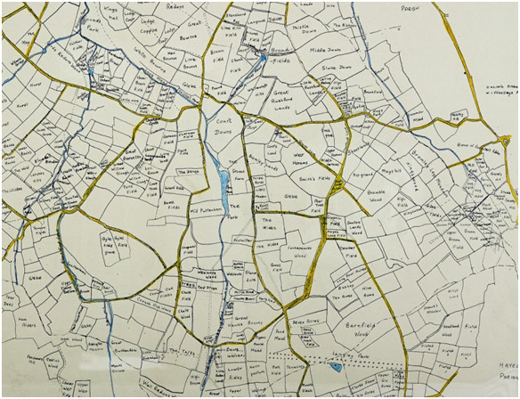
Len Hevey gives a good account of the boundary of Beckenham and compares Robert Borrowman's description but one detail, particularly the tongue of land extending upto Rockhills (Crystal Palace) which was explained by Borrowman's tale of an unclaimed body is apparantly a myth as the real explanation is that part of Beckenham Manor extended to Rockhills and the outline of the Beckenham Manor map fits exactly into the parish boundary, image below needs to rotate as North is toward the bottom right corner. .
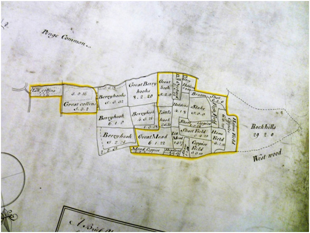
The righthand map has been rotated to match the Beckenham Manor map (left).
More
recently the Boundaries Commission moves administrative
boundaries so we have former
Bromley postcodes BR now being part of Lewisham SE. At one
time
Beckenham Council had responsibility for West Wickham before they both
came under the Greater London Borough of Bromley. The
range of maps available show that the parish boundaries moved slightly
over time. The northern boundary of Beckenham Manor has become the
boundary between Bromley(Beckenham) and Lewisham(Bellingham) but modern
boundary changes such as are deemed by the Boundary Commission can
modify current day boundaries as Beckenham Place Park which straddled
the Beckenham/Lewisham boundary is now entirely in the Borough of
Lewisham and parts of Downham with BR postcodes are now in Lewisham..
For
example
Langley and Kelsey spread into West Wickham and Hayes with parts even
in
Bromley parish. Some Kelsey property extended into Croydon and Surrey.
Some
property in Beckenham
belonged to manors based elsewhere ie Old Court Manor in Greenwich had
a small
property which came down to Morden College along with Old Court land.
Foxgrove
Manor straddled the Beckenham, Bromley and Lewisham borders. The
landlords of
Beckenham manors and estates often held property in other counties and
their
Beckenham property may have been secondary to their other estates i.e.
the
Rokeles and Bruyns having property in Essex and Hampshire with Essex
appearing
to be of higher status. Penge was more associated with Surrey and
Battersea but
became attached to Beckenham especially after the inception of the
Greater
London Boroughs a significant chunk of Surrey became Bromley, Kent and
the
proximity of Kent House to the boundary became almost irrevelant.
During the
period of the Beckenham Urban District Council some parts of Hayes and
West
Wickham were ‘within’ Beckenham but that was
superceded by the Greater
London
Council and creation of Bromley as the overall governing body. During
these
changes in administrative boundaries the council offices in the first
place
took over the Old Manor House opposite St. George’s and
subsequently
built a
town hall behind what is now Marks and Spencer’s car park and
that was
demolished when the Greater London Borough of Bromley was established.
Rivers running through the area are not navigable and the only canal, the Croydon Canal which ran through parts of Sydenham and Penge was short lived and soon taken over as a route for a railway. The main rivers are the Ravensbourne close to the eastern boundary of the area and the Beck which runs through the middle of Beckenham. This latter river is arguably The Hawksbrook (Hawks Brook) which is mentioned in ancient documents and survives in the name of Old Hawksbrook Lane. The Ravensbourne has some minor tributaries of spring fed streams and the the Beck has several tributaries such as the Chaffinch Brook which when it joins the Beck in what is now Cator Park they both become the Pool River. The Boundary stream which formed part of the Kent/Surrey border also joins the Pool in Cator Park. The Pool joins the Ravensbourne near Catford Bridge and the Ravensbourne joins the Thames at Deptford Creek after the Ravensbourne and Quaggy merge near Lewisham railway station. 20th Century flood prevention has put several rivers into culverts and some earlier 19th Century land improvement for agriculture rerouted and straightened some stretches of rivers while land drainage ditches diverted ground water into the river network. There is a network of both named and unnamed drainage watercourses. Some are seasonal and some spring fed. From the map record we can see ponds and lakes which have either changed over time and in some cases dried up or filled in.
This account may focus largely on the early history of Beckenham up to 1900 which is more of a mystery as the later and recent history has probably been adequately covered in various other publications, not least those of Rob Copeland, Patricia Manning, Eric Inman, David Johnson et al. The beckenhamhistory.co.uk website has drawn together several of these accounts. We offer some corrections to parts of those accounts.
The population explosion from the late 19th Century makes recording individual histories of various personalities a gargantuan task and the history of many lesser known people pre 1900 has been overlooked in many histories.
Maybe Beckenham has always been a bit of a backwater as it isn't on a
major
road to anywhere and this might have retarded its urbanization for
longer than
nearby places on major roads and perhaps made it an attraction for
country
retreats up until the 19th Century.
The A21 and A22 byepass it and radial routes such as the South
Circular
and A232 pass north and south of it. A Roman road which is said to have
passed
through the area from London to Lewes has not survived as a noticeable
local
road but its route is noticeable through some open spaces.
However some notable personages resided or held property in and around
Beckenham from Religious Orders, Lords Mayor of London, Aldermen,
Merchants,
Large Landowners and Knights, Baronets or Peers of the Realm.
It is difficult to separate Beckenham from its surrounding neighbours as land ownership was not confined by parish boundaries. The same landlords would hold property near and far and what they held in Beckenham could often be a minor part of their property. And many of the landlords were mainly absentee, residing elsewhere for the most part but deriving income from their Beckenham tenants and leaseholders.There are also instances of the smaller landowners leasing additional land from the larger estates.
In the earliest times when all land was owned by the King estates were awarded for enfeoffment, more often than not to knights who did service to the King. They in turn could enfeoff others by some form of lease and so on until one comes to the tenants who actually worked the land or carried out some form of craft usually paying rents to landlords. As time went by some people acquired a form of freehold property (fee simple) being yeoman. There were a few large landowners with tenant farmers and workers, also, some smallholdings and private houses, some of which were described as mansions or great houses. Below that was a level of Husbondmen or husbandman; the old word for a tenant farmer below the rank of yeoman. A husbandman usually held his land by copyhold or leasehold tenure and may be regarded as the ‘average farmer in his locality’. The words ‘yeoman’ and ‘husbandman’ were gradually replaced in the later 18th and 19th centuries by ‘farmer’. Either as gentlemen farmers owning their own land or tenant farmers. The county of Kent had a custom of gavelkind which meant that inherited property was divided among the sons and hence the properties became divided into smaller holdings. When the Styles acquired Langley they succeeded in ‘disgavelling’ the property so that it followed primo geniture.
Property was often held in a trust so that heirs could not dispose of the main body of their estates and wills would often prescribe that property was inherited ‘in tail’ by the next generation or most senior heir. This happened with the St. John’s of Beckenham Manor until Frederick St. John acquired an Act of Parliament permitting him to dismember the St. John estates. Also Jones Raymond, Peter Burrell and John Cator acquired an Act to exchange lands in 1759 which was carried out in stages upto 1793 and later John Barwell Cator acquired an Act to allow exchange, lease and development of the Cator estates in 1825. Lack of a full evidence trail often raises questions as to how particular landlords acquired property or how estates became fragmented.
We have relied here to a very great extent upon the transcriptions made of early documents by untold scholars often from Latin and in ancient handwriting. Sometimes errors were made in transcriptions but we can bring some attentions to likely errors. Several documents mention sums of money in pounds sterling or in marks. The value of a mark has been generally assumed to be 13shillings and 8pence since 1066. Some scholars have appeared to translate 1mark to 1pound. Some documents cite donations of 6shillings and 8pence (half a mark) or 3shillings and 4pence (a quarter of a mark) to churches for memorial functions like lighting of candles to saints or to the poor of the parish. So some form of tariff is likely to have existed. If my estimation is correct then £1 = 1.5 marks (13s/4d + 6s/8d). If 1groat was worth 4d then there would have been 40 groats to 1mark or 60 groats to £1.
With a small population recorded as 1,000 in 1801 which rose to 26,000 in 1901 development or growth was slow. The only way to estimate earlier populations would be through “Bills of Mortality” which were only calculated for London assessed from church baptisms and burials. A similar process for Beckenham would be difficult as the church registers are not fully transcribed and are in a poor condition. The transcription we have for burials is of unknown origin but from an earlier work in the late 1800’s and someone has put it into a spreadsheet which though not perfect is a solid foundation. But church registers only began in 1539 and anything before that date is only recorded in other documents. Robert Borrowman who made some assessment from parish records before those records became damaged would be worth re-reading for some enlightenment.
The burial register can give some indications dependent upon certain assumptions. For instance if the average lifespan is said to be 40 years then taking the total of 40 yearsworth of burials should give an indication of average population. From 1539 to 1578 inclusive total burials were 550. St.George’s was the only cemetery in the parish until the late 18th C. Average lifespan is said to have risen to about 50 years so if we take burials from 1701-1750 inclusive being 1249 that could make a reasonable comparison, do tell me if you disagree.
Another thing the burial records tell us is perhaps an indication of diseases. We find that some families suffered a number of deaths in a particular year. The Violets for instance had six deaths from March to May 1575 all being the children of Henry Violet but we don’t know their ages or whether Henry is the one buried in 1561. So much more could be revealed if births and marriages were available. We are thankful however for the work of others in producing the burial data in a useable electronic form. Again Borrowman found some information in wills with references to ‘pestilences’ which could be plague or smallpox.
The burial records also permit some investigation into family trees and wills alongside genealogy websites. The thus far absence of any transcription of christening or marriage records for Beckenham is hampering research to a large extent but some of the wills researched are revealing more about the yeomen and husbondmen at least where wills are present. This still leaves large gaps where no will existed or survived.
Baptism and christening records alongside burials are interesting in that they illustrate the degree of infant mortality and birthrate although we are left wondering about the degree of non-conformist worship between 1539 and about 1700 when non-conforminty was relaxed. Also, prior to 1539 there are no parish records. Increasingly after 1700 the number of 'other' places of worship multiply and different brands of Christianity come to the surface.
Marriage records indicate a large number of persons from outside the Parish being married here while many parishoners must have married in other parishes i..e. it was customary for the husband to marry in the wife's parish but not always.
The large landowners were either long term family inheritors or people who had purchased estates as a means of ‘banking’ their wealth. Many if not most have been found to be absentee landlords and their Beckenham property part of much wider ranging estates. The estates did change hands fairly regularly and the landowners’ names are also associated with estates elsewhere so Beckenham was not by any means a sole family seat for many. The long term landowners included the Leighs of Addington who inherited Foxgrove Manor through intermarriage, the St. Johns/Lords Bolingbrokes of Beckenham Manor whose main base was in Battersea, the Brograves of Kelsey and the Styles of Langley. The Burrells arrived in the late 17th Century buying Kelsey and the Raymonds in 1732 who bought Langley. Wealth accumulated from business was often invested in land purchase which in turn generated rents and other income. The Cators made their presence felt from the mid 18th C and other names of note were Burrell, Raymond, Lethieullier, Batt, Brett, King, Motley, Austin, Hoare, Eden. Some family lines died out or merged with other families via female heirs and widows. In the medieval period widows could not hold property and they were 'married off' to suitors often chosen by the monarch. This may have been the case with Alice le Brun who was matched with Robert de Marny. Heirs who had not reached their majority would be placed under guardianship as with Ingram or Ingelram Brun.
Often the absence of an heir led to sale of estates as with the Styles of Langley whose female heiress married into the Elwills who then sold to Hugh Raymond, or heirs favoured other places and sold their Beckenham property as with Frederick St. John/Lord Bolingbroke in 1773 and the Burrells in 1820 after the death of Peter Burrell IV/Baron Gwydir, and the Cators gradually from about 1808. More than one landlord needed to sell estates to pay off debts as with the heirs of Francis Leigh of Hawley who owned Foxgrove at his death and the Brograves of Kelsey who had unpaid debts. The Styles of Langley also had cash flow problems perhaps associated with the English Civil War. The histories written by Thomas Philipot (1659) and Edward Hasted (1778 and 1797) relate the chain of exchange of ownership but these also miss some fine detail. Other significant landowners were the Tolsons, Motleys, Austins, Pughs, Willis, Humphrey and Lethieulliers. Maps and land deeds discovered show the patchwork of fields and estates with ownership almost jumbled in some cases. Large estates were divided into farms with for example Langley being divided into 4 or 5 farms with all but one being leased to tenants. In 1737 Thayers Farm and Elmers End Old and New Farms were owned by Thomas Motley who also owned a fine house and grounds in Beckenham village. Around this time the Lethieulliers owned Kent House Farm and the site of Clockhouse. A few generations later and the land was either left or sold to others.
We find common links with the South Sea Company or East India Company, sometimes both. These were sources of income and wielded significant power. Often the landowners were members of parliament not necessarily for Beckenham but for other areas ie the Burrells for Haslemere and Boston and Cator for Wallingford and Stockbridge. Being a member of parliament and a member of the South Sea or East India Company enabled them to influence decisions in favour of their interests. Some smaller land or property owners had businesses such as Dying and Tanning in London or Southwark, just as the Cators would start with a timber business. It is surprising how many landowners were in the legal profession and held administrative posts from Sherrif to Justice of the Peace. In the medieval period several knights were close to the monarch, from whom they derived their property and power.
Each century had its periods of turmoil both domestically and internationally which often impacted local affairs such as the Wars of the Roses, The Dissolution of the Monastaries, The English Civil War, the Great Plague, the Restoration of the Monarchy, wars between Britain and France, such as the War of the Spanish Succession, The 7 Years War, The war of American Independence and the later Napoleonic Wars. The social conditions bordered on the barbaric both domestically and internationally. Felons could be transported to the Americas up to the time of the American Revolution and to Australia thereafter or hung for quite minor offences. The working class, poor and slaves were all treated harshly. Felons could be transported into slavery and apprentices were indentured for 7 or more years into a situation of indentured ownership by their masters. The two World Wars affected the population with the loss of life among soldiers in the First World War, and both soldiers and civilians in the Second World War. In WW1 several buildings were used by the military and in WWII bomb damage was significant in the borough and at least 2 POW camps were established which themselves narrowly missed being hit by bombs.
Religion has not left any visible signs of turmoil although the parish church would have been Catholic prior to Henry VIII's split from Rome. After Henry VIII’s split from Rome the Protestant/Catholic divisions gave rise to recusant families who were subject to some fines and property confiscations and this affected at least one family in our researches, the Vaux’s or Vaus of Northamptonshire, also known as Lords Harrowden of Essex. They were landlords of Foxgrove for some time. Whether it was due to their noble status, we find that their prosecution was restricted to fines although of substantial value. Though some claims have been made that dissenters such as the Cators as Quakers suffered persecution, that persecution often was only in the form of fines for not attending the recognized Church of England or for not paying tythes or taxes and it seems that the nonconformists could in most cases afford the fines levied upon them.
The Law played its part in various land processes as the Court of Chancery commonly has records of disputes and settlements regarding Beckenham properties. Some comparisons brought up by this account show that Bolingbroke entered into a subterfuge with Cator amounting to thousands of pounds with no penalty whereas someone stealing a couple of window frames was transported for 7 years and others sentenced to death for theft of low value goods. Earlier in 1720 several notable persons committed large frauds and embezzlements under the South Sea Bubble affair and in most cases quite minor financial penalties were applied.
Beckenham was one of many places easily in reach of London but away from the pollution and dirt of the City of London and hence a place to have a country house. A long list of London merchants, aldermen, lawyers, sea captains took up residence. Admiral Sir Piercy Brett moved into Clockhouse in the 18th Century and John Cator’s brother Joseph moved in after Brett’s death in 1882. The village had large houses such as The Mead, The Ridge, Beckenham Lodge, The Manor House and a substantial Rectory. The mid to late 19th century saw the building of large villas with coach houses and stables.
Frederick St. John (Lord Bolingbroke) had married Diana Spencer but his debts and subsequent broken marriage led him to dispose of estates in Battersea and Beckenham but there is no evidence that the St.Johns ever resided in Beckenham though some resided in the Manor of Battersea.
Investing money in a landed estate which brought in rents from tenant farmers and house rents was akin to ‘buy to let’ as it is carried on today. Even the middle class and aristocracy often rented property as opposed to buying it. Many documents relate to leases of property although in isolation they may be seen as transfers, several releases of property are later reversed by a return of the property to the original holder. For example the Bruyns Beckenham Manor fell under the influence of Robert de Marny as he married the widowed Alice Bruyn, then it was transferred to the local rector or clergyman Martham, only to be returned to the Bruyns under Ingram Bruyn. The reasons for these transfers are mostly unknown but basically financial or enfeoffments for some service. The Fines or Final Accords which evidenced these transfers and leases often lack detail. Since we only have the ‘Foot of Fine’, the third part, then the other two parts which the buyer and seller or lessor and lessee have may hold more details?
For some background I would recommend ‘London Life in the Eighteenth Century’ by M.Dorothy George, which is probably out of print, as being well researched and probably used since as source material by other authors.
The Monarchs of England
As early documents usually cited the regnal year of the monarch in their dating system it helps to have some understanding of the order of Monarchs. It was never my strong suit at school so references to websites such as https://www.britannica.com/topic/Kings-and-Queens-of-Britain-1856932 or Wikipedia are useful. Also understanding that ‘year 1’ of the particular monarch is when they came to the throne as no dates cite ‘year 0’ which I didn’t grasp for some time so year 1 Richard III is 1483. This is sometimes confused by the month in which the monarch came to the throne as 'year 1' might run from any month in one year to the same month the following year but can only put us out by a matter of months. Apart from the dating system the impact on local history comes from the governance which comes down from the monarch. Examples being that lands were granted to prominant persons or confiscated and seized into the crown's possession. Some of our local landlords had significant positions in government and the royal court. On occasion the crown passed from one monarch to another through conflict which also affected local history such as the changes in possession due to the 1066 Conquest.
Pre-history to the Medieval Period
Evidence in the landscape shows that geologically the area was under a shallow sea 54 million years ago in the Eocene period as in some areas the Blackheath and Woolwich Beds or Harwich Formation of shingle emerge through the London Clay. In one area of Beckenham Place Park there is an exposed conglomerate (concretion) of the Blackheath Beds which is shingle cemented together with lime and sand. In other areas the London Clay is on the surface in varying depths covered with a thin layer of topsoil being leaf mould, loam or silt deposits. Some valleys have accumulations of silts forming meads and meadows. The geology would affect the later use of the land and economy. Clay soil has always been difficult to work for crops so often left for grazing or woodland. Valley silts and loams were probably favoured for arable farming. Locally there have been brick fields utilising clay and sand. Gravel pits and lime kilns were present all using the natural resources laid down geologically. The nature of the ground would affect the economy as some land was poor for agriculture such as Penge Common. Clay areas and woodland were a major source of fuel and building material. There are a few references to lime kilns which would need both chalk and woodland fuel for the improvement of soil. At least one lease agreement requires the lessee to manure and lime the land regularly. There are some records of landowners providing timber for naval dockyards. The Chalk is mostly several metres below the surface but the existence of lime kiln fields indicates that some chalk was available, maybe coming from the Chislehurst Caves or similar places where chalk is nearer the surface.
During the Mesolithic, Bronze and Iron ages there was probably occupation although not much by way of remains has been found. On the land of Langley Park, a Bronze Age metalwork hoard was found: it comprised four socketed axes, three winged axes, weapon fragments and copper ingots. There are hill forts and earthworks within walking distance at Keston, Halsted and Westerham, also some mention of flint tools found near West Wickham. An overview of this period can be drawn from Len Hevey's "Early History of Beckenham". He draws attention to Kingswood Glen, an area of woodland that was bequeathed to Beckenham Council in 1962 by its owners, two sisters, who stipulated it should be preserved and protected. Research undertaken over the years has established that the land had remained unchanged for up to 800 years and may once have been the site of an Anglo-Saxon hill fort, the ponds believed to be fire pits. Tree and plant species suggest it is ancient woodland and the park is designated as an important site for nature conservation.
During the Roman occupation of Britain a road passed through the Beckenham area en route from Lewes in Sussex to Londinium. Different projections for the route of the road exist and as Beckenham has been redeveloped several times I would have thought more evidence would have surfaced, literally. The visible evidence is found by scorch marks in Sparrows Den, West Wickham and on Langley Park Golf Course as well as across a sports ground adjacent to Langley Park School. An archaeological dig in Bellingham also revealed evidence of the surface. It seems to have been mainly of gravel construction probably as that was the most readily available material. It is perhaps logical or a coincidence that several ancient settlements are close to its route.
The Roman town of Novio Magnus is said to have been adjacent to what is now St. John’s Church near Wickham Court and straddled the London to Lewes Roman Road. The proximity of places such as West Wickham, Langley, Kelsey and Stone Farm, Beckenham Manor, Foxgrove Farm etc to the route of the road may be indicative of other Roman settlement along the road. Much of this may have disappeared as building materials were recycled and robbed out.
Roman remains exist not far away at Keston, Titsey and Orpington. In the area where the roman road is projected to have crossed Beckenham Place Park before the park was established there was a quarry or gravel pit and a lane called Limekiln Lane maybe indicating that there were lime rich deposits or chalk here. Whether these were part of the Blackheath Bed conglomerate or underlying Chalk near the surface we cannot say. I’m told the chalk would be about 100 feet/30metres below the surface. A property redevelopment in 2021 in the private road of Beckenham Place shows a deep dell on the position of the gravel pit or quarry. As much of Beckenham has been redeveloped more than once it is curious that so few historic remains have been found. The Roman road structure was said to have been mainly gravel and as the area is largely of gravel composition then over time the road may have fallen into disrepair, the course became obscured and diversions created around areas which may have become impassable. Also we have to consider the local waterways, although not considerable, would have required crossing with bridges or fords and this may have caused the road to deviate from the accepted Roman practice of building straight roads wherever practical. One source suggests the road crossed what is now Langley Park Golf course and may have gone through Kelsey Park. Certainly some aerial photos show the route of the road across some of this area. Some local roads though not straight do approximately follow these lines. Various landlords had roads diverted around their estates and the various stages of settlement and farming could have erased or buried many features. The course of the road is plain to see through Edenbridge and several other places but does not seem to have survived in any form through Beckenham.
The course of the Roman Road near Langley Park School across Old Dunstonians sports field, also visible at Sparrow’s Den and New Addington.
Any evidence we have for an ancient road system can be compared to the route of the Roman road and the roads on the earliest maps circa 1720-40. Before roads were metalled with gravel, cobbles or tarmac they would have increasingly meandered around boggy or subsided stretches in many cases. We can imagine the Roman road deteriorating through wear, erosion or subsidence and becoming disused while settlements along it still needed tracks, paths and roads. The 18th century saw several road diversions, installation of new roads and turnpikes and rerouting to improve transport links.
Part of the Gordon Ward composite sketch map showing the road pattern (Kent Archive)
Unfortunately, very little survives locally of any Ango-Saxon, Medieval and Tudor etc. One of the oldest structures is the lych gate of St. George’s. It is said that parts of the Old Manor house survive in the facade and interior of the building opposite the church which is now a restaurant. Even the church was rebuilt in the Victorian period after fire damaged the previous medieval incarnation but some old memorials remain. The Alms houses next to the church and the George Inn are dated to the 17th century. The Anglo-Saxon administration survives in the old maps as the Park is in the Hundred of Bromley and Beckenham which is in the bailiwick or Lathe of Sutton at Hone. We do have recourse to documentary evidence about Beckenham and surrounding areas in various archives certainly from the Domesday entry and documents related to land transfers and taxation. These will be inserted into the timeline where available or discovered. Thanks to Keith Baldwin for diligent research here.The Black Death introduced the bubonic plague here in the 14th Century and fairly regular outbreaks occurred which impacted the population. Other diseases such as smallpox, diptheria, measles etc were also serious and these kept the population in check regardless of wealth.
The works of Thomas Philipot and Edward Hasted revealed an ever changing web of ownership, intermarriage, selling and transfer of properties all over Kent. In some cases estates were handed out by the Crown only to be seized again when some misdemeanour took place e.g. The Boleyn’s having Hever confiscated by Henry VIII after Anne Boleyn’s alleged adultery and his subsequent award of it to Anne of Cleves when he repudiated her. And later, the St. Johns had a chequered history, with one being excluded from Parliament on the Restoration of Charles II, Another being convicted of murder but a pardon purchased from the Crown, Henry St. John, Viscount Bolingbroke may or may not have been a landlord of Beckenham Manor, but he was attained for treason for supporting the Jacobites, exiled in France for some time and subsequently had his properties and titles restored to him which some might say was lucky for him. He however died without issue. Frederick St. John who sold the Manor of Beckenham lands to John Cator had a failed marriage with Diana Spencer and seems to have dissipated the St.John estates almost single handedly. The manors and estates around Beckenham had complex histories which are explained in the following timeline.
The Reverend William Rose had a Georgian rectory built to an Adam Brother's design but that gave way to a town hall and now a branch of Marks and Spencer and its car park which cover the site. He also had designed if not built sumptuous stables as he appears to have been a keen horseman at a time when horses were the equivalent of fast cars.
Perhaps the George public house in the high street is the oldest most complete structure locally and that passed through the hands of the Cator Estate and is listed in the 1825 Act properties along with the Crooked Billet in Penge.
Those are some of the unknowns which await the discovery of firm evidence.
Over the course of time some family names disappear and others take their place. Before the start of parish baptism, marriage and death records in 1539 we have to rely on other documentary evidence for records of names. Only the major personages got recorded for the most part such as large land owners or some of their tenants. To date the most informative records are the St.George’s burial records which have been transcribed by other historians and we can process the data quite easily. This was complicated by the fact that St.George’s records were damaged in storage during WWII. Some early registers such as muster rolls and tax rolls reveal some old names and we mention the Lay Subsidy Rolls which list several familiar names. The emergence of some names leads to recognition of smaller landowners and raises the question as to how yeomen landowners acquired their property as it was thought that ‘lords of the manor’ and other landlords owned all of the land.
Prior to 1539 the names are derived from various Court Rolls, Inquisitions and Fines. Eventually these names will have links to more extensive family information.
Rokele, Burghersh, Bruyn, Burrell, Raymond, Leigh, Snelgrave, Batt, Kempsall, (more to be added). But this 'Families' section may grow to warrant its own page via a link.
The Rokeles of Beckenham Manor (circa 1220-1490)
The Rokeles are among the earliest families we have some records for and Beckenham Manor is listed among the possessions of Richard de la Rokele 1220-1277 who was a justiciary for Ireland for King Henry III. In 1254 Richard was granted free warren of his lands in Wiltshire and Essex. Rokele also held land in Ireland and his position deemed that he spent substantial time there. So we assume he was mostly an absentee landlord of Beckenham. He and his wife Cecily's eldest son Philip de la Rokele 1247-1294 inherited the estates and apparently sold the Irish properties to the Butler family, but Beckenham Manor descended via his daughter Maud or Mathilda's marriage to Sir Maurice Brun (le Brun). Maud was described as being aged 10 in Philip's post mortem inquisition and as 14 when married in 1300 and an inquisition was held with a jury of local landowners to establish her age. She had been made a ward of Richard de Chigwell after the death of her father who seems to have married her mother Joan. Other accounts describing Beckenham Manor coming to the Bruns via Isolda, mother of Maurice le Brun's to his father Sir William le Brun have been found to be incorrect by several historians. Rokele's career is described in other sources..
The Brun/Bruyn/le Brun Family
The Brun's commencing with Maurice then had property in Hampshire, Kent, Essex and the main base was Wokendon (South Okenden, Esses). Some records show that a Brun must have sat in local courts to administer estates but there are no burials recorded locally and no indication of a substantial Manor House. Maurice's son William followed and he married Alice le Lacer but upon William's death she remarried Robert de Marny who controlled the estates. During de Marny's period of control Beckenham and some other manors were devolved to John Martham, priest of this and other parishes. The role of priest could often be as lord of the manor and often more of a political role than a religious one. William and Alice had a son Ingram who was the rightful heir but de Marny held sway over the estates until they were restored to Ingram. Then another Sir Maurice followed succeeded by his son Sir Henry. Henry had two daughters Alice and Elizabeth who divided the estate between them and the respective halves followed the lines of their husbands, complicated by the fact that each had three husbands. The first husbands heirs had prior claim for each half of the manor but some untimely deaths and other factors such as wars of the Roses, changes of sovereign, complicated matters further. But effectively this was the end of the Brun connection and we have to follow the lines of Thomas Tyrell on Elizabeth's side and Berners, Harleston and Heveningham on Alice's side as some heirs died determining that property followed 2nd or 3rd husbands, ultimately coming down to Clement Harleston, descendant of Alice's second husband. The marriages of Elizabeth and Alice have confused several earlier writers including Philipot and Hasted who had the order of husbands and sometimes the number of husbands wrongly recorded. Revisiting post mortem inquisitions has, we believe, corrected the order.
The Burrells of Kelsey
and Langley and the Raymonds of Langley circa 1688 to 1820
These families can be take together due to an early intermarriage
related to Beckenham. There were four or five Peter Burrells which
leads to some confusion.
The first Peter Burrell purchased land at Kelsey from the Brograves who
had fallen into debt. This was in 1688 and Peter became Peter Burrell
of Kelsey. His son Peter Burrell II married Amy Raymond, daughter of
Hugh Raymond of Saling, a ships captain with the EIC and director of
the South Sea Company. Shortly after the marriage the Langley estate
including Simpson's Place came up for sale and was purchased by Hugh
Raymond in 1732. On Hugh Raymond's death Langley etc passed to his son
Jones Raymond who had no direct heir so he left Langley etc to his
sisters including Amy in 1769.
The numbers I assign to the Peter Burrells is different to that
assigned by history of Parliament as PB I did not sit in Parliament but
PB II did and is therefore often described as PB I there as the
following PB's also sat in parliament for constituencies like
Haslemere, Dover and Boston (Lincs.)
So the connection to the Raymonds is restricted to Hugh Raymon, his son
Jones Raymond and daughter Amy. As other sisters had died Amy took
possession of Langley etc which became jointly hers along with Kelsey
as she had been widowed in 1759. Amy apparently had significant control
over the estate as she did not remarry and her husband had
followed a political career. Apparently a strong willed person she
repurchased her earlier family home at Saling which her brother had
sold. Her sons Peter Burrell III b.1723 and William b.1732 occupied
homes on the estate, while Amy apparently favoured Langley but later a
new mansion in Kelsey was built for her. She is recorded as living in
several homes such as Saling and a house in London. Peter III was
following a political career and is listed as PB II on History of
Parliament and William seems to have had a hand in managing
estate affairs. William left an archive of history of Sussex with the
British Library and not apparenlty much interested in business or
politics but married well and his direct descendants still have a
collection of material related to Langley and Kelsey. William
married a cousin, Sophia Raymond, daughter of Sir Charles Raymond
connected by Hugh Raymond's brother John.
Peter Burrell IV who became Baron (Lord) Gwydir inherited the estates
on PB III's death in 1775 but his grandmother Amy lived until 1789
still holding sway over affairs as she exchanged some property with
John Cator in 1777 and PB IV did not exchange further property until
1793 after her death. Any complications about property occupied in
dower may confuse the matter futher. PB IV also inherited his baronetcy
via his wife, Lady Priscilla Bertie, plus he deputized for her in a
hereditory position as Lord Great Chamberlain. PB IV was
created
Baron Gwydir in 1796. He had acquired property in Whitehall and built
Gwydir House which is now the Welsh Office. The History of Parliament
online references are interesting reading.
On Burrell's death in 1820 the next Peter Burrell who's name was
changed to Peter Drummond Burrell via his marriage, to put
the
estates up for sale as the interests of the Burrells had moved north.
Cator circa
1757 to 1940?
The history of the Cator family is covered by Pat Manning's book The
Cators of Beckenham and Woodbastwick which is linked to the contents of
this site.
John Cator 1728-1806 had risen up through his father's Bankside,
Southwark timber
business and other business activities and began purchasing Beckenham
property circa 1757. His father also named John (the elder) had retired
to Bromley whether to a house John the younger had bought or not isn't
known but after John the elder died his wife and daughters were
baptised into the Church of England at Bromley parish church and the
record refers to a house across from the church. John the younger had
bought property from the Valentines and
some parts of Foxgrove Manor from heirs of the Tolson/Tillys. In 1759
he was exchanging some land with Jones Raymond and Peter Burrell. A
British Library map shows Cator had substantial land around Kelsey and
Langley which had been parts of the Foxgrove Manor estate. Cator also
purchased much of Beckenham Manor from Frederick St. John (Lord
Bolingbroke) in 1773 but this was fraught with several legal issues.
However John was able to exchange land with Peter Burrell IV in 1793 to
establish a large estate in the northern part of Beckenham while the
Burrells then had much of the southern part of Beckenham.
John Cator and his wife Mary only had one child, a daughter who died in
infancy. Mary was the daughter of Peter Collinson the quaker merchant
and botanist.
Johns brother Joseph had worked for the East India Company as a writer
(merchant/trader) and retired to Clockhouse in 1782.
John Cator died immensely wealthy in 1806 having acquired more property
is Surrey and Kent and the estate was left to his primary heir John
Barwell Cator (JBC), son of Joseph along with several family trustees.
JBC is said to have improved the estate and he and his trustees sold
off parts of the estate while purchasing other land to consolidate a
local estate as shown in estate maps of 1833, 1864 and 1898.
In 1825 JCB with the other trustees sought a private act of parliament
to essentially overturn restrictions set by John Cator's 1806 will. The
act lists all the property then in the estates possession and the
passing of the act permits the sale of land for development provided
other land is
bought to replace it so JCB had been building up his estate in
Woodbastwick, Norfolk as well as other land dealings locally which
centralised holdings.
The estate passed down via JCB's son Albemarle, then to Albemarle
junior, then his son John who dismantles the estate among family
trustees
and sells the remaining Beckenham Place to the London County
Council in 1927. The remaining Woodbastwick estate passed to Henry
Cator after 1944. John Cator (d.1944) is mentioned in local property
deeds as the one who sold much of the local land for housing and
perhaps sold former leases converted to freehold?
Eden circa 1780 to 1820
William Eden 1745-1814 leased property which was part of the Kelsey estate belonging to the Burrells from about 1780. A house called Bune Gate on a 1769 map shown occupied by one of the Peter Burrells was leased to Eden along with a substantial parkland and farmstead and renamed Eden Farm by William Eden. Eden's career often took him abroad and sometimes with Peter Burrell who were both active politically. As well as the map image of 1769 we have a painting of 1789 and a print of 1812 showing the house. The Burrell estate map of 1809 also shows the footprint of the house and layout of the parkland.
Some younger children of the Eden's were christened in St. George's but some were born either abroad (Paris) or at other Eden residences before the Eden's acquired the lease. The family tree shows 12 children. Two dying in childhood, Frederick William died by drowning at Westminster presumably in a accident. George Eden inherited the unexpired part of the lease but gave it up for the Burrell 1820 sale as the next landlord, John Woolley, demolished Eden Farm and built a new mansion also called Eden Farm. (see Woolley or timeline 1820).
The Edens have been written about extensively and letters from a daughter Emily survive adding some insight to the family. George became Earl Auckland and Governor of India with one or more sisters who remained unmarried often travelling with him. The daughter Mary Louisa married Andrew Colvile and they leased Langley Farm from the Burrells. Langley Farm was created out of land which the Burrells either previously owned or acquired in exchanges with John Cator after 1793. It is a little curious that the presence of the Eden family for little more than forty years has enabled the name to be applied to the area and perhaps more curious that the site of the house is now a public open space named after a Beckenham Corporation councillor named Crease (Park).
These are extracted records from St. George's burials
| Buried | surname | first name | place of death | Age | DOB | |
| 16 Jun 1794 | 1794 | EDEN | Henry | 8 | 1786 | |
| 1798 | 1798 | EDEN | Charles(Hon) | 7 | 1791 | |
| 27 Feb 1810 | 1810 | EDEN | Fred'k William (Honble) | 26 | 1784 | |
| 1810 | VANSITTART | Catherine Isabella (nee Eden) not in register | from Ancestry.co.uk | |||
| 03 Jun 1814 | 1814 | AUCKLAND | William (Lord) | Beckenham | 71 | 1743 |
| 25 May1818 | 1818 | AUCKLAND | Eleanor (Lady) | Beckenham | 59 | 1759 |
| 05 Jun 1821 | 1821 | EDEN | Norton (The Hon.) (Morton) | Grays Inn Sq. Lincolns Inn | 27 | 1794 |
| 6 Dec 1824 | 1824 | COLVILLE | Eleanor (daughter of Mary Louisa & Andrew Colvile) | Beckenham | 16 | 1808 |
| 2 May 1849 | 1849 | EDEN | Frances Harriet (Hon) | St Margarets, Westminster | 47 | 1802 |
| 6 Jan 1849 | 1849 | EDEN, Earl | George(Auckland) | The Admiralty | 64 | 1785 |
| 17 Feb 1851 | 1851 | VANSITTART | Nicholas(BaronBexley) | Foots Cray Place | 84 | |
| 11 Aug 1869 | 1869 | EDEN | The Hon Emily | Eden Lodge, Kensington Gore | 73 | 1796 |
Goodhart 1820 to 1910
When the Burrells sold their Beckenham estates the properties were sold in several lots ranging from large parts of the estate down to individual cottages. Emanuel Goodhart 1772-1853 a sugar refiner who had migrated from Germany purchases Langley mansion, Langley Lodge and Langley Farm. The schedule of the 1838 tithe map lists his properties and the tenants or leaseholders of parts of his holding. Emanuel had two sons and three daughters. The sons Henry and Charles inherited but it seems Henry led an alternative lifestyle shrouded in some mystery. Charles took over the estates and businesses. Census records from 1840 onwards provide some detail of which part of the estate the Goodharts resided in, either Langley mansion or the Lodge. Henry died in 1879 in Warwickshire described as a lunatic which may be a way of describing of unsound mind or dementure? Charles 1819-1903 had two wives and 12 children. The estate was divided between the children upon Charles' death and sold to property developers, some of it becoming the Langley Park Golf Club. Langley mansion was used as the golf clubhouse but burnt down in 1913. Langley Lodge had been demolished. A new clubhouse was built and the golf club still operates with some parts of the Langley landscape still visible.
Kempsall
also Kempsal, Kempsel, Kemsal
The Kempsall name is in parish registers from 1540 to 1756 and also mentioned in Henry Violet's will of 1505. A record shows 32 acres (additionally?) being acquired by Kempsall from Holden in 1507. They were originally a yeoman farmer family and the name is shown on the 1720 Foxgrove map as Henry Kempsall yeoman as having land bounded by Chancery Lane, Wickham Road and a road that ran from Oakhill to Shortlands Green. It was a neighbour of Stone Farm. The land holdings were probably larger as Henry d.1623 was of Battersea (Penge?). The Kempsall name also appears in registers for Hayes, Bromley and West Wickham. The last members of the family recorded, John a shipwright of Stepney, Henry possibly a ships blockmaker of Deptford, his son Thomas and two daughters Mary and Arabella are mentioned in John Kempsall's will of 1740 which refers to land in Beckenham. The land, after the death of John's wife Jane, was destined to pass to Henry's daughters but Arabella is shown as dying in 1755 so perhaps Mary and any husband inherited the land.
In any case the map attributed to Burrell circa 1780 shows it as Coot's Land let to Porson and the 1809 Burrell estate map shows it as Burrell property.
The Kempsall family divided along several male lines and possibly a larger amount of property became divided although often the eldest son was the main beneficiary. A few wills and other documents give us some insights into the status of the family locally with one Kempsall citing Edmund Style as a friend along with another local family Lewynne/Lewin who are witnesses to the will.
The Styles: Rise and Fall of Langley circa 1500 to 1720
The Styles of Langley may have been the most significant family locally to Beckenham for some time from about 1500 because the holders of Beckenham Manor were mostly absentee landlords and the manor was also divided from 1461. There is more evidence to support the view that Langley was a more significant estate in several ways. A fairly complete transcript of St. George’s burials has come to us via Ian Muir and we have processed its data to select out various families. This has been compared with any available genealogy. Apparently most Bruyn burials took place at St. Nicholas Church, South Ockendon, Essex which seems their favoured base although Henry Bruyn d.1461 had a career based in Hampshire.
The Style family is traced back to Ipswich and William Style d.1475 and he and his wife Isabelle Bolle had two sons and a daughter, William, John and Amy.
John Style (or Stile), may have married well, to Elizabeth Wolstan, daughter of Sir Guy Wolstan and became a city of London mercer in the cloth trade. He purchased Langley, Beckenham circa 1500 and also acquired at least half of Kent House and Sympson’s Place, Bromley although the Sympson’s acquisition was fraught with legal problems which went on after John’s death (source; Horsburgh). Style’s first mention with Beckenham is 1501 in relation to collection of a debt relating to Kent House Farm. This John Stile has been confused with two or three others of the same name and period but we can confirm he died in 1505 from the record of his will which mentions Bekynham (sic) and Langley and in which he requests burial at St. Thomas of Acre in the City of London. He amassed a substantial estate extending into parts of Beckenham, Bromley, Hayes and West Wickham. He died in 1505 while his children were in their minority and his wife remarried James Yarford d.1527 who was guardian to the children. An eldest son, John mentioned in John senior’s will was intended to inherit most of the property but he died before reaching majority and before records of Burials began in 1539. So the son Humphrey (c.1502-1552) inherited. His mother Elizabeth lived until 1548 and requested to be buried near James Yarford at St. Michael Bassinshaw, City of London. The church was demolished for safety reasons in 1900.
It is tempting to read between the lines of the wills as James Yarford’s will which mentions Humphrey Style’s sister Bridget and her husband Edmund Kempe and makes his wife Lady Elizabeth and Edmund Kempe his executors but I see no mention of Humphrey Style? Either he considers Humphrey well provided for, or pursuing a career, or perhaps some tension in the relationship.
Humphrey was knighted and became High Sheriff of Kent in 1543, a post held for one year by any appointees. He is also described as an esquire of the body to Henry VIII in Philipot 1659 and Hasted 1778 but I haven’t been able to independently verify that. However, there were more than one esquires of the body and it was a title conferred on some regional dignitaries like county sheriffs. Humphrey’s memorial plaque survives in St. George’s Church, Beckenham describing his two wives and several children.
Humphrey is described as having the estates ‘disgavelled’. Gavelkind was a Kent tradition intending property to be equally divided between descendants so disgavelling means that rather than all property being equally shared between descendants that the estates could either follow a form of primogeniture or be divided in line with bequests. Style property extended further afield than Bromley, Beckenham, Hayes and West Wickham as The City of London, Orpington, Norfolk and Essex etc are mentioned in wills and other references.
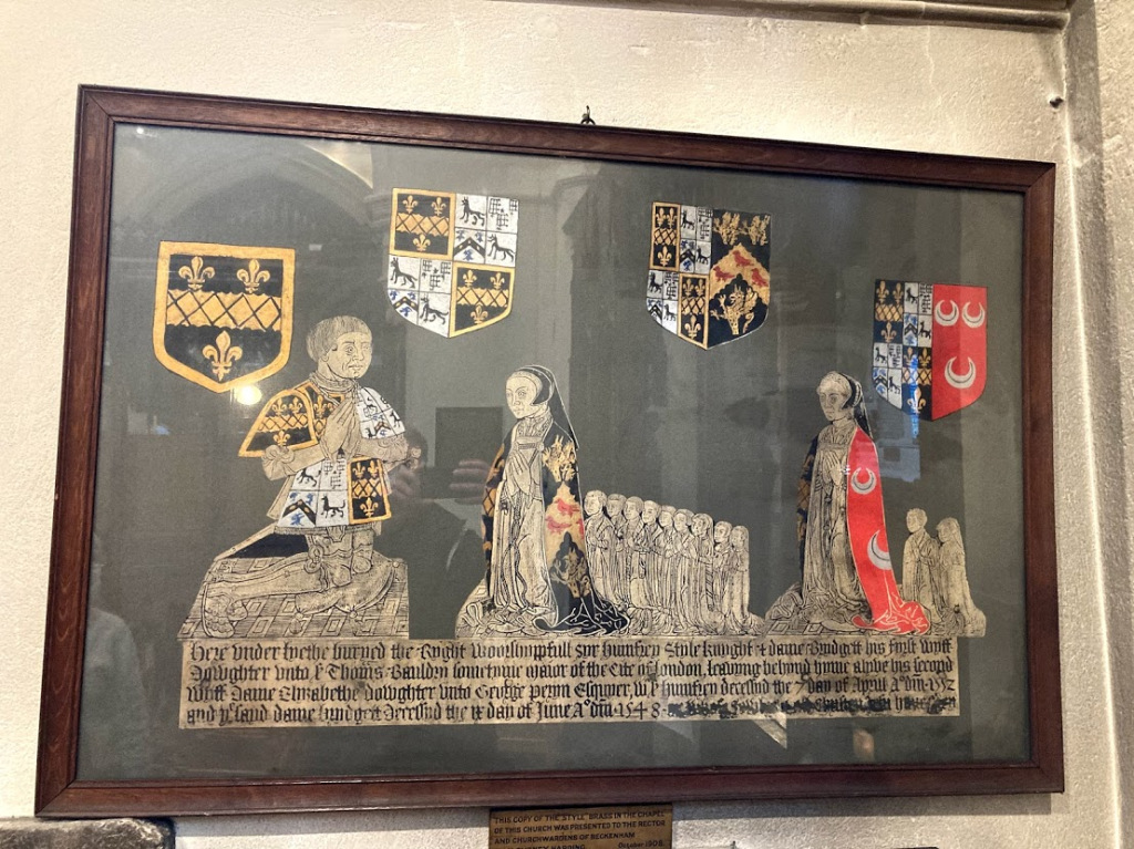
Humphrey’s memorial plaque reproduced in this clearer copy in St. George’s shows Bridget Bauldrey’s nine children and Elizabeth Peryn’s two children (Humphrey 1550-55 and Maria b.1551 married Lawrence Meade) Similarly to his father’s first born son it seems Humphrey’s first born named Humphrey died in infancy or before 1539 so the next eldest surviving son, Edmund (c1539-1617), inherited the estates. So two children named Humphrey did not survive, one dying before 1539 and the other by Humphrey’s second wife Elizabeth Peryn in 1555. Untimely deaths would determine the fate of Langley. Luckily the historian Lysons recorded some early Style baptisms circa 1796 long before St. George’s records were severely damaged in WWII. The children lined up on the memorial show 9 by Bridget with two drawn smaller maybe indicating infant death and two by Elizabeth. Elizabeth subsequently remarried Thomas Townesend.
Sir Humphrey’s will of 1552 is interesting as within the many bequests he provides for the mending of roads between Bromley and Farnborough and from Lewisham Mill (Southend) to Beckenham Church, which would have been the driveway now passing through Beckenham Place Park which was the main road at that time. “From the foot of Stumpes Hyll unto the myll towards Bekenham/Bekengam”
The handwriting of the will is probably the scribe of Prerogative Court of Canterbury who transcribed wills into a ledger. There are, so far as I can make out, no bequests of property to children so I’m led to believe that Humphrey’s act of disgavelling the estate meant that he divided property between his surviving sons so perhaps Oliver acquired Wateringbury this way and Nicholas acquired the London property and business as he becomes a London Alderman. Some property in the city came to this line from a cousin also named Edmund, son of John Style’s brother William, who had no children.
Humphrey’s son Edmund did not inherit the knighthood or baronetcy, so was buried as plain Esq. and describes himself as such in his will. His will mentions lands in ‘Sippenham’ (Sydenham) and also a windmill in Bromley. A full transcription of the will may be of interest at some point and more revealing of Edmunds life as nothing significant can be found elsewhere. His son William is left Langley and his son Edmund is left the Sydenham property. Another son, Humphrey, predeceased him.
It would be too complex to follow the minor lines of the family although some like Oliver Stile of Wateringbury, son of Sir Humphrey were prominent in their own right.
To continue with William Style (c1560-1624) who had two marriages and several children, the eldest Humphrey (c1596-1659) would inherit Langley but various other bequests to his numerous children included lands in West Wickham and Sheppey as well as money and effects. The property in the will may indicate that some more property was accumulated during William’s lifetime.
The eldest son Humphrey is described as Knight and Baronet so already
knighted
by James 6th and 1st (of Scotland and England) and is a Gentleman of
the Privy Chamber. In 1632 Sir
Thomas Style
of Wateringbury, is High Sheriff of Kent, and a letter from Sir
Humphrey Style
of Langley survives describing preparations for a perambulation of the
County.
Humphrey is also a commander of a troop of horse for Charles I during
the Civil
War and we are tempted to wonder what the effects of the War were on
Humphrey’s
properties. We know that he has some cash flow problems and raises
loans from
the family of his first wife Elizabeth who was the widow of Sir Robert
Bosvile and daughter of Robert Peshall. Elizabeth died in
1641
and buried as wife of Sir Humphrey, baronet. Humphrey had an only
child, Charles,who died in 1654 presumably named in honour of King
Charles I so
after Humphrey’s death the estate passed to William, a half
brother of
Humphrey’s via his father’s second marriage to Mary
Clarke. Humphrey’s second
wife Hester Style nee Wright survived until 1671 remarried to John
Scott of
Hayes, another Gentleman of the Privy Chambeer, but was buried at St.
George’s as The Lady Hester Styells. Humphrey's memorial
plaque in St. Georges reads:
In ye
Vault within this Isle appropriated to that family, resteth ye
corps of
Sir
Humphrey Style, owner of
Langley, in this Pirish Kt &
Baronett
of England
& Ireland
King
Charles, one of his cup bearers in ordinary and
by them
boath successively intrusted
Hee
dyed yc
ioth of November in ye 64th yeare of
his age. Ao
Dni
1659.
William Style (1603-1679) had been
educated as a lawyer and
published some books during Cromwell’s time. He probably
didn’t expect to
become landlord of Langley but held it for twenty years. He is recorded
in
print and portraiture. William’s marriage to Elizabeth
Duleing bore four
children but only two outlived him, a daughter Mary and a son, another
Humphrey
(1648-1718). The deceased son of William, also named William d.1668
b.c1628,
may have been the first born but did not survive and listed as Mr.
William
Style in burials.
Humphrey (1648-1718) was married to Mary Hovell and there were six children of whom three or four predeceased their father. The two surviving children were a son Humphrey and daughter Elizabeth. Of the four deceased we cannot trace the fate of Hovell Style (it was common for some children to have the family name of the mother as the first name). In 1711 Humphrey Style was High Sheriff of Kent
The burial records show the son Humphrey Style being buried in 1744 but why he did not inherit Langley is unclear, perhaps he was of unsound mind but no details have been discovered. There seems no expectation that the son, Humphrey, would have a marriage or offspring for whatever reason. He is however provided for in Humphrey’s will seemingly to receive income from leased properties via a trustee and executor, Mr Edward Gilbert of Broadstreet Hill. But the daughter Elizabeth married Sir John Elwill in 1712 at the age of 26 and apparently the marriage settlement assigned Langley to Sir John and Humphrey’s will confirms that he has settled the Kent estates upon Sir John and his daughter. There was a child born of Elizabeth and John Elwill, also named John who died in 1714 under two years of age and no other children are recorded.
However, some conditions of the will question the status of John Elwill as ‘landlord’ as a clause expresses that Sir John should not have control of the estates, it being expressly for the daughter Elizabeth and any issue from the marriage. Peter Burrell of Kelsey is named as a trustee or executor of the will. There are conditions pertaining to payment of certain sums of money. A complication of Humphrey’s life revolves around a relationship he had with a Frances Shippe from Norfolk as he says he ‘brought her out of Norfolk from her parents’ and the implication is that there was a partnership and Humphrey provides accommodation for her at Kenning Hall
Sir John Elwill died in 1727 and Elizabeth Style died in 1731 after remarrying Sir Henry Bartelott. But according to the marriage settlement Langley had become Elwill property and was sold to Hugh Raymond in 1732. I still have questions as to how the estate became Elwill’s apparently in contravention of Humphrey Style’s will?
No doubt there are some legal processes remaining to be discovered and the involvement of Peter Burrell who was acquainted with Hugh Raymond may have influenced matters. (Peter Burrell’s son Peter married Hugh Raymond’s daughter Amy). There are several Court of Chancery cases pertaining to Langley, Elwill and Style, some mentioning Peter Burrell and we would have to research the findings to explain the outcome. Suffice it to say that Langley and Sympson’s Place etc became Hugh Raymond’s in 1732.
Of the several court cases regarding Langley referred to in The National Archive, some mention an infant named John of four years of age who is the child of John Elwill’s brother Edmund.
|
Buried |
year |
baptized |
Surname |
Date
of Birth |
Firstname |
|
24/12/1540 |
STYLE
(from Lysons) |
1540 |
John
s. of Sir Humphrey |
||
|
?
Married |
19/3/1551-2 |
STYLE
(from Lysons) |
1551 |
Maria
d.of Sir Humphrey+Elizabeth |
|
|
6
Apr 1542 |
1542 |
4/3/1538-9 |
STYLE |
abt1538 |
Bridget
(d of Humphrye) |
|
9
Jun 1548 |
1548 |
STYLE |
abt1502 |
Bridget
w of Humphrye (Sir, Knighte) |
|
|
7
Apr 1552 |
1552 |
STYLE |
abt
1502 |
Humphrye
Sir, Knight) |
|
|
9
Apr 1555 |
1555 |
11/7/1550 |
STYLE
(bap.lysons) |
Humphry
s of Humphrye (Sir, Knight)+Elizabeth? |
|
|
23
Aug 1556 |
1556 |
21/1/1546-7 |
STYLE
(bap.lysons) |
Edwarde
s of Humfry (Sir, Knight) |
|
|
9
Mar 1565 |
1565 |
STYLE |
Humphrye
s of Edmunde Esq |
||
|
30
Dec 1571 |
1571 |
STYLE(d.23.12.71) |
Marye
w of Edmunde Esq+ |
||
|
20
Aug 1596 |
1596 |
STYLE |
Anne
w of Wm gent |
||
|
London |
1614/15 |
12/1/1545 |
STYLE
(from Lysons) |
1545 |
Nicholas
s.of Sir Humphrey |
|
15
Feb 1617 |
1617 |
STILE |
Edmund
(Mr Esq) |
||
|
4/3/1622
Wateringbury |
1622 |
25/12/1542 |
STYLE
(from Lysons) |
1542 |
Oliver
s.of Sir Humphrey |
|
27
Oct 1624 |
1624 |
STYLE |
William(
Esq) |
||
|
1625 |
STYLE |
1603 |
Richard
s of William |
||
|
15
Dec 1626 |
1626 |
STYLE |
Edmond(Mr) |
||
|
27
Nov 1641 |
1641 |
STYLE |
Elizabth
w of Humph,bart(in Latin)+ |
||
|
28
Jul 1643 |
1643 |
STYLE |
Michaell(Captaine) |
||
|
7
Jan 1643 |
1643 |
STYLE(in
Latin) |
Chrisogones
Prestcott w of Robert |
||
|
1648 |
STYLE |
Mary
d of William |
|||
|
6
Feb 1654 |
1654 |
STYLE |
Charles
s of Humpfry(Sir) |
||
|
29
Feb 1656 |
1656 |
STYLES |
Hester
d of Mr Jhon |
||
|
22
Nov 1659 |
1659 |
STYLE |
1585 |
Humpfry(Sir,
knight & barronett) |
|
|
23
Nov 1659 |
1659 |
STYLE |
Katerine(Mrs)
widow of Mr Edmond |
||
|
1666 |
STILE |
Richard |
|||
|
12
Mar 1668 |
1668 |
STYLE |
William(Mr) |
||
|
23
Aug 1671 |
1671 |
STYELLS |
The
Lady (Hester) |
||
|
1677 |
STYLE |
Thomas
s of William d.1624 |
|||
|
12
Dec 1679 |
1679 |
STILES
d.7.12.1679 |
William
Esq(in wool, attested)* |
||
|
19
May 1681 |
1681 |
STYLES
d.16.5.1681 |
Mary,
d of Humphry Esq(in wool) |
||
|
15
Jun 1689 |
1689 |
STYLES |
James
s of Humphry Esq (in wool) |
||
|
8
Jun 1689 |
1689 |
STYLES |
William
s of Humphry Esq |
||
|
5
Nov 1702 |
1702 |
STYLE(in
wool, d 26.10) |
Mary(Mrs)
w of Humphry Esq |
||
|
22
Jul 1714 |
1714 |
ELWILL |
1712? |
John
s of John (Esq) |
|
|
3
Apr 1718 |
1718 |
STYLE |
Humphry(Esquire) |
||
|
20
Sep 1727 |
1727 |
ELWILL |
John
(Sir, Baronet) |
||
|
22
Jun 1731 |
1731 |
ELWILL |
1686 |
(Lady)Elizabeth
nee Style |
|
|
14
Jun 1744 |
1744 |
STYLE |
Humphrey(Esq) |
In this table
James, Mary and William 1681/89 are
children of Humphrey d.1718 and his probably eldest son Humphrey died
in 1744.
From 1667 it was directed that bodies were shrouded
in wool as a measure to protect the wool trade and several burials
record this.
Violet circa 1450
The Violet family have given rise to several outstanding questions. They are referred to as selling Langley to John Stile(Style) but this is disputed by local historians Hevey and Tookey as they believe Fabian may have sold Langley to Stile. However the parish registers and other evidence show the Violets as being resident in Beckenham from before 1505 shown by the will of Henry Violet of Beknam (sic) and several baptisms and burials until 1631. The Visitation of London lists a Henry Violett undated as an alias of Villett who may be the one dying in 1505 or 1561?
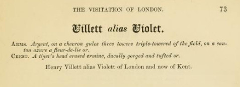
The family tree is difficult to trace as it seems to divide down two or three sons of Henry and the usual recycling of names, Henry son of Henry etc. adds to complication. A branch of the family appears to have moved into Bromley but as the parish boundaries meet almost anything could be the case.
Henry Violet's will of 1505 leaves property in Lewisham and Bromley to his son Stephen and property in Beckenham, lands and tenements to his son Robert. It seems likely that a son named Henry may have pre-deceased him and buried before records began. The will also mentions a William Violet who could be a brother or nephew in case either Stephen or Robert didn't survive. There were also three daughters Isabel Kateryn and Margery. Henry also specified that his woods in Beckenham be sold and the money divided between the two sons. The description of lands and tenements implies holdings that were rented out to others. see 1505 in the timeline for the transcription of the will.
We cannot say whether the Violets retained some possession of land or perhaps leased from the Stiles but we know that parts of estates were leased ie several farms as part of Langley plus the later lease of Eden Farm by the Burrells. Changes in family fortunes and division of wealth if gavelkind is applied could determine property changes hands and some members of families moved away as with the Brograves, Burrells, Cators, etc etc.
This table shows burials with a few estimated dates of birth from baptisms. Parish records began in 1539 so any earlier reference depends of other sources.
| Buried | family nm | given name | DOB? | |
| 1505 | VIOLET | Henry | Beknam, Kent (PCCwill) | |
| 4 Sep 1539 | 1539 | VIOLET | Agnes d of Robert | |
| 29 Jan 1543 | 1543 | VIOLET | Mary | |
| 8 Nov 1547 | 1547 | VIOLET | Jhon | |
| 22 Nov 1548 | 1548 | VIOLET | Nicolas | |
| 23 Jan 1559 | 1559 | VIOLET | Robert | 1541 |
| 30 Mar 1561 | 1561 | VIOLET | Henry | |
| 8 Apr 1574 | 1574 | VIOLET | Robert s of Henry | |
| 13 Apr 1575 | 1575 | VIOLET | Alice d of Henry | |
| 20 Mar 1575 | 1575 | VIOLET | Henry s of Henry | |
| 6 Apr 1575 | 1575 | VIOLET | Jhon s of Henry | |
| 7 Apr 1575 | 1575 | VIOLET | Thomas s of Henry | |
| 14 May 1575 | 1575 | VIOLET | Wm s of Henry | 1554 |
| 14 May 1575 | 1575 | VIOLET? | Creside (she was with Violet) | |
| 20 Mar 1576 | 1576 | VIOLET | Johane wydowe of Robert the elder | |
| 30 Dec 1584 | 1584 | VIOLET | Richard | |
| 6 Jun 1585 | 1585 | VIOLET | Robert | 1549 |
| 1 Aug 1597 | 1597 | VIOLET | Jhon | |
| 2 Oct 1603 | 1603 | VIOLET | Alice w of Humphrey | |
| 18 Nov 1604 | 1604 | VIOLET | Willm | |
| 1 Sep 1604 | 1604 | VYOLET | Annis, wodow (Agnes?) | |
| 17 Feb 1608 | 1608 | VIOLET | Humfrey | 1548 |
| 11 Jan 1628 | 1628 | VIOLET | Humph. The younger | |
| 22 Jan 1631 | 1631 | VIOLETT | Joane d of William |
| 14 Dec 1623 | 1623 | SNELGAR/SNELGRAVE | Christian d of Sir Henry Kt# |
| Dec 1624 | 1624 | SNELGARR/SNELGRAVE | Chauncey s of Sir Henry (Kt) |
| 9 Jan 1625 | 1625 | SNELGARR/SNELGRAVE | Lettice w of Sir Henry (Knight) |
| 1651 | 1651 | SNELGRAVE | (Mrs) the elder |
| 1650 | 1650 | SNELGRAVE | (Mrs) the younger |
| 26 Apr 1639 | 1639 | SNELLGRAVE | Rob s of Sir Henry |
| 10 Mar 1643 | 1643 | SNELLGRAVE | Thomas (Esq) |
The Manors and Estates of Beckenham
Any explanation of the divisions of Beckenham from the earliest times is bound to be confusing. There are many gaps in the record of land transactions and explanatory maps did not appear until the 17th and 18th Centuries. The presumption has been that the "Manor" covered the whole area but that can't be explained. As land was distributed by the monarch then apportionment should be explained through various court rolls. Research often discovers new material which could be added to this account.
The early writers recorded Beckenham by referring to its major landowners and estates divided into Beckenham Manor, Foxgrove Manor, Kelsey and Langley. Philipot did not record Kent House although it had been documented in records since the 14th Century. It was briefly recorded by Hasted and Lysons but only from the late 17th Century when the Lethieulliers occupied it. Essentially these early writers only recorded the gentry and substantial estates. But those accounts overlooked substantial other properties around the district owned by yeomem or leased to husbondmen (tenant farmers). What has become more evident is the number of other properties of various sizes that existed alongside these major estates which we attempt to explain in references to ‘other properties’ in both the preamble and the timeline. If one takes the names of the landlords and searches for instance Philipot or Hasted's accounts for the rest of Kent we find that most large landlords held diverse properties often in several counties. Also, Philipot and Hasted as well as contemporaries and later writers were almost producing directories of landlords, their estates, lineages and locations. Along with the maps of Rocque and Andrews, Drury, Herbert these formed a who's who and A to Z of Kent. The brevity of early accounts overlooks some interesting detail which we and writers like Len Hevey have tried to include.
We have found that Philipot and Hasted also made some errors or wrong conclusions perpetuated by others which we attempt to identify and rectify here.
The land constituting the main estates was perhaps more fluid in ownership and was often exchanged or purchased between landlords. Several instances of exchanges and purchases are recorded and we wonder what other ‘movements’ of ownership occurred without any surviving record.
The manors and estates survived until the 18th Century when significant exchanges, divisions and sales of land effectively changed boundaries and could be said to have dissolved estates, particularly in the early 19th Century when further divisions, sales and developments took place.
The absence of maps or plans of land holdings and the omission of detailed descriptions makes the comprehension of property ownership even more difficult to grasp.
The numbers of land owning Yeomen and leaseholding Husbondmen or farmers is significant and where we find records of messuages, smallholdings and farms we will attempt to add them. They are often discovered in Feet of Fines, leases, wills and on some maps. The family names then appear in burial records in many cases after 1539.
I'll quote Philipot's and Hasted's passages but then I'll divide them into their relevant timeslots on the timeline. Hopefully this will put things into context and demonstrate which events were contemporary with one another. It will also correct or dispute some of their statements based on rediscovered evidence and the substantiated accounts by others. We have perhaps found more discrepancies than we anticipated.
We have to give credence to the early writers as they, in many cases, consulted landlords for access to deeds and family histories. But some errors could have occurred even now we find some families have slightly distorted or limited records of their own histories.
It bears repeating that the landholdings were interwoven by complex ownership of sometimes individual fields quite distant from the landlords’ base. So it is difficult and even impossible in some instances to clarify all property ownership especially when the land holding extends over parish or county boundaries as was often the case. The properties held by yeomen were intermingled with the larger estates and sometimes consumed by them in purchases as well as the smaller properties themselves being divided and leased. Often the resident landowner, yeoman or farmer would lease parts of other estates, for instance, in the 18th Century Beckenham Manor under Frederick St. John (Lord Bolingbroke) was leased to several neighbouring landlords and tenants including Cator and Burrell prior to his sale to Cator. Similar details can be found for the earlier Manor of Beckenham under the Bruyns who seem to have favoured Essex as a family seat for some of the time.
Several instances of apparent change of landlord have been discovered to be transfers within the same extended family which even if not by inheritance but by sale has influenced the transaction.
Feet of Fines or Final Accords which are thought to be evidence of sales of property are often used to transact leases with property eventually returning to the original landlord. Some writers including us have been confused by some of these documents. Other Feet of Fines can be put together to evidence a chain of exchanges.
Along
the way we see several or even countless Court of Chancery cases
dealing with property issues which arose through inheritance, sales and
the
contesting of wills. We have added whatever documents we can find
acknowledging
the work of diverse people who have transcribed documents, produced
indexes and
directories over the years and the subsequent transferring of data onto
the
internet. Some documents confuse matters as they imply land was
transferred
permanently but is subsequently returned to or reclaimed by the
original owner
rendering the document as a lease rather than a freehold transfer. As
all
property was held by grant from the crown then in some cases
reclamation by the
crown deprived the landlord of ownership.
Apart from a few insights we can't fully trace the occupancy of land as
many
landlords had tenants to manage farms. An undated map of Langley circa
1740-50
records some tenants and surrounding landowners and an estate book of
1809 of
the Burrell etates shows leased occupancy. Material exists for the
Cator estate
circa 1860 through maps and records. Probably the full picture would
hold so
much munitiae as to be uninteresting but we will try to show a more
comprehensive picture than hitherto published. As we research families
from
burial records and documents we discover the wills of people that
describe land
and tenants which are frustratingly difficult to accurately place but
nevertheless insightful. Various records give some evidence occupation
and
tenancy such as court disputes, marriage settlements and indentures. By
searching the main protagonists through The National Archive we can
find numerous
Court of Chancery cases relating to property but without getting sight
of the
documents it is impossible to unravel the details which might be quite
tedious
in most cases.
Along the way various purchases and exchanges of land changed the structure of the manors and estates. The most significant changes came during the 18th C. when the estates of Langley and Kelsey became merged under the Burrells. Foxgrove became divided between the Raymonds, Burrells and Cator. Then in the last decade of the century the exchange between Cator and Burrell effectively dissolved the manors of Foxgrove and Beckenham although the epicentre of Foxgrove was in Cators possession and parts of Beckenham Manor were in Burrells possession. If the ancient manors and estates had any fixed origins at all then they had been redistributed to a great extent.
Charles
Dickens probably got his Jarndice versus Jarndice idea from some of
these
events in the same way that Jane Austen used her experiences of her
extended
family for her novels.
Several references have been dated by translating the Regnal Year ie
'18 Edward
II' is 1324. Edward II reigned from 1307-1327, 1307 is year
1.
There are
some discrepancies here as regnal years did not always run January to
December
but are based on the date on which the sovereign claimed the throne or
was
crowned.
To assist with appreciation of the complexity of research this extract from Lincolnshire Archive related to Burrell estate records explains how records have become dispersed.
| Description | Royal
Commission on Historical Manuscripts; Report on a section of the
Ancaster papers; mainly deeds and settlements relating to the Burrell
family, Barons Gwydir. Contents: 7-ANC/1 Deeds relating to Kent (Burrell family) 1583-1829 7-ANC/2 Deeds relating to Surrey, etc (Godschall family) 1706-1803 7-ANC/3 Settlements, wills, mortgages, etc (Burrell and related families) 1722-1826 7-ANC/4 Miscellaneous Ancaster papers 1654-1899 7-ANC/5 Miscellaneous other papers (Warren family, etc) 1847-1900 and nd Introduction: The papers described here were formerly in the custody of Messrs Warrens, the London solicitors, and were deposited in the Lincolnshire Archives Office in 1969 through the British Records Association (BRA 1602), receiving the Lincolnshire Archives reference 7-ANC as part of the Ancaster collection. The papers include a few miscellaneous Ancaster documents (7-ANC/4), but the bulk relate to the Burrell family (7-ANC/1,3). Lady Priscilla Bertie, heiress of the Lincolnshire and Welsh estates of the Dukes of Ancaster, married in 1779 Peter Burrell, created Baron Gwydir in 1796. Their son succeeded his father as second Baron Gwydir in 1820 and his mother as Baron Willoughby de Eresby in 1828. The rise of the Burrell family of Beckenham (Kent) began with Peter Burrell (d1718), a London merchant who purchased the estate of Kelseys in Beckenham in or shortly before 1688. His son Peter Burrell (d1754) married in 1722 Amy, the daughter of Hugh Raymond of London and Great Saling, Essex, who acquired the manor of Langley in Beckenham in 1732. Following the death of Jones Raymond, grandson of Hugh, in 1768, Langley and other property in Beckenham passed to Amy Burrell, and on her death in 1789 it descended to her grandson Sir Peter Burrell, afterwards Baron Gwydir. The Foxgrove estate in Beckenham, purchased by Jones Raymond in 1765, also came to the Burrells. These properties, with others in Beckenham and the neighbouring parishes, were sold in the early 1820s, following Lord Gwydir's death, and were therefore, in legal terms, never incorporated into the Ancaster estates. Messrs Bray and Warner would seem to have sorted through the Kent estate papers at the time of the sale, transferring the bulk of the title deeds to the purchasers of the different lots but retaining a residue consisting mainly of early deeds, family settlements and some estate and family papers. In 1940 Warrens handed over a quantity of papers to the British Records Association for despatch to appropriate repositories (BRA 301, 305). Some Ancaster and Gwydir papers were sent to the Lindsey Muniment Room (Lincolnshire Archives, Lind Dep 64, 97) and to the National Library of Wales, but a collection of Burrell deeds and papers for Kent was sent to Kent Archives Office (see below, Related Collections). The further group of deeds and settlements sent to Lincoln in 1969 is, though less varied, closely related to this earlier deposit at Maidstone. The Godschall deeds (7-ANC/2) have no connection with the Ancaster papers, but represent part of the papers of another client of the firm. In this case the link between firm and client was an exceptionally close one. The Godschalls of Weston, in the parish of Albury (Surrey), were related to the Brays of Shere, and the Brays were in turn related to the Warrens. William Bray of Shere, the solicitor and historian of Surrey, was in fact the senior partner in Messrs Bray and Warren. (For a group of Godschall papers among the Bray papers now in Guildford Muniment Room see below, Related Collections.) The Warren family wills (7-ANC/5/1) are a further stray from the collection of firm's and clients' papers formerly held by Messrs Warrens. R J OLNEY G H MANDELBROTE June 1993 |
The Manor of Beckenham
This Manor has a complicated history because of its transfers of
ownership and
later division into two moieties or parts under the two Bruyn sisters,
its descent down two different family lines, sale into different
proprietors and a
subsequent rejoining by two purchases by the St.Johns circa 1635-1650.
Philipot
even indicates that one moiety was divided further between Henry Parke
and
Ralph Warren but that is assumed by Lysons to be related to loans or
morgages
as that part of the manor returned to the Tyrells.
A comparison of Philipot, Hasted and Lysons reveals several differences and some modern day sources also bring some of their details into question.
How the Manor came to be held by the Rokeles is unclear as it presumably passed from Ansgot of Rochester who held the manor at the time of Domesday and by mid 1200's it was held by the Rokeles. In 1276 the manor passed from Richard de la Rokele to his son Philip aged 30. Since land was assigned by the monarch then the early manor probably changed hands more than once. Some info regarding the Rokeles is on https://www.dib.ie/biography/rochelle-rokele-rokesle-rupella-rupellis-richard-de-la-a7756. Records for Richard de la Rokele show he held land in Essex and that appears to have been the main family base while Beckenham Manor was held at arms length by many of its landlords. There was some confusion that Isolde (Rokele) carried it to the Bruyns in marriage but she is now thought to be of unknown family and it was Maud de la Rokele as the heiress who brought the Beckenham Manor into the Bruyn/Brun family by marriage to Sir Maurice le Bruyn circa 1290. Eric Inman and and Nancy Tonkin’s publication ‘Beckenham’ is one of the publications recording this correction but their publication then mentions ‘Anne Boleyn’ instead of Anne of Cleves in another reference of a legend pertaining to Beckenham Manor. The earliest map of the Manor lands copied in 1768 from a 1623 original shows the lands were also spread and divided geographically from near Beckenham Parish Church St. George's up to Rockhills which is now Crystal Palace Parade with other isolated fields and messuages. As Kelsey is thought to emerge as land acquired from the Bruyns it is certainly possible that Kelsey was once part of Beckenham Manor as it lies between the two parts or moieties and other dismembered parts of Beckenham Manor but also possible that much of Kelsey was separate from the Manor lands and mention of Kelshulle acquiring some manor land may have been a small section. So much is undiscoverable without any illustration of the pre 1623/1735 situation..
Several ‘foot of fine’ records which were thought to relate to sales have been found to relate to leases so there is the probability of the property being leased to Parke and Warren.
During a particularly turbulent time in its history the manor was in the hands of John Martham the priest of St. George’s as lord of the manor under what appears to be a lease from the Bruyns and the Marnys. The widowed Alice Bruyn nee le Lacer took a second husband, Robert de Marny, and the manor subsequently returned to the Bruyns under Ingram or Ingelram Bruyn.
The Manor does not appear to be a primary residence of any of its landlords, probably being leased or let for much of its existence. The Rokeles had South Ockendon in Essex (Ockenden Rokele) and the Bruyn's apparently favoured Essex. The St.Johns based in Battersea had come from Wiltshire. Maybe members of the extended families resided at Beckenham? Certainly most of the landlords had other residences.We are also dependant upon the translations from Latin of early documents. Research is revealing that the descent of the manor via the Bruyns was complex and involved with several other manors in Essex, Hampshire and elsewhere. Although Beckenham Manor may not have featured very highly in state affairs it was connected with several events through its owners.
Various disputes about ownership drew in several families. Robert de Marny more or less seized ownership from the Bruyns after marrying Alice the widow of one Maurice Bruyn and later William Brandon did the same after marrying Elizabeth, one of the daughters of Henry Bruyn and a widow of Tyrell. Some of these protagonists were close to the crown and held high positions. Sometimes they fell foul of the crown and were attained for treason as with William Brandon under Richard III and Walter St.John under William and Mary.
Writers such as Robert Borrowman speculate that the odd outline of Beckenham Parish is due to the finding of a body which was claimed by the Parish when the most likely reason is that part of Beckenham Manor extended to Rockhills which is demonstrated on the 1623 map according to the 1768 copy. One reference describes one half or moiety of Beckenham Manor having 40 messuages giving some idea of the number of tenancies in the manor from farmsteads to smallholdings.
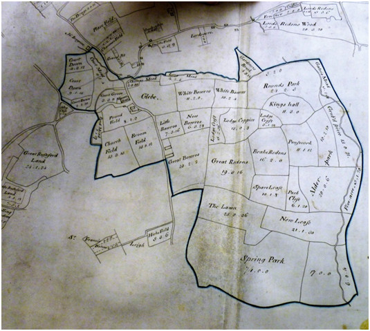
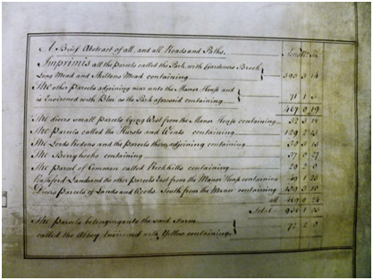
Philipott says: (dates
inserted might be a 1 year difference)
“Bekenham near Bromley helps to give Name to the Hundred wherein it is placed, and of old time was held by Gentlemen, called in Latine Records de Rupella, in French de la Rochel, and in English Rokeley, and were in their original Etymologie extracted from Rochel in France, Richard de Rokeley died seised of this Mannor, in the fifth year of Edward the first,(1276) and was succeeded in the Possession by Philip de la Rokeley, and he held it likewise at his Death, which hapened in the 23 year of Edw. the first,(1295) and left it to his Sole Daughter and Heir Isolda de la Rokeley matched to William Bruin, by whom She had Issue Sir Maurice Bruin, Chamberlaine to K. Edw. the third, honoured with the Summons to Parliament as Baron amongst the Peers of this Realm, who by a Right derived to him from his Mother, was possest of this at his Death, in the twenty ninth of Edward the third,(1356) and transmitted a wide and spreading Revenue to his Posterity here, at Southokenden in Essex, and at Roumere in Hantshire, which last was given in Appendage to a younger Son, from whom the Bruins of Athelhampton in the County of Dorset, are lineally descended. But when after a fair continuance this Family had flourished at this Place, the Distaffe prevailed against the Speare, and Sir Henry Bruins two Daughters and Coheirs about the Beginning of Edward the fourth (1461), divided his Inheritance, each of them having a first and second Husband: Alice the eldest was first married to Robert Harleston of Essex Esquire, and after to Sir Thomas Heveningham; and Elizabeth second Daughter was wedded first to Thomas Tirrell of Heron in Essex Esquire, and after his Decease to Sir William Brandon Knight, who was Standard-bearer to Henry the seventh at Bosworth Field,(1485) where he was slain in asserting his Cause and Quarrel against Richard the third, and he had Issue by her Sir Charles Brandon Duke of Suffolk (1484), the Flower and perfection of English Chivalrie in his Time, who sometimes kept his Residence at this place, (not as Proprietarie, but onely as Lessee, for the Sole Inheritance upon the Division of Bruin's Estate accrued to Tirrell;) and here entertained Henry the eighth, with all the Cunning Pompe of Magnificence, as he went to bestow a Visit at Hever, on his discarded, and repudiated wife Ann of Cleve (1540-45). But to go on, this Mannor as I said before, being annexed to the patrimony of Thomas Tirrell, Humphrey Tirrell his Grandchild to whom it descended, passed away one Moietie of it in the thirty fifth year of Henry the eighth (1543) to Ralph Warren, and the other to Henry Parke; Warren alienated his Proportion not long after to Bradbury, from which Family about the latter End of Q. Eliz.(1603) it came over by Sale to Serjeant Gent,(not traced) who gave it in Dower with his Daughter to Sir George Dalston of Cumberland,(married 11 Feb. 1605, Catherine (bur. 22 July 1614), da. of John Tamworth of Halsted, Leics.) (History of Parliament online) who in our Memory conveyed it to Sir Patrick Curwin of the same County, and he some few years since sold his Interest in it to Sir Oliver St. John of Batricksey in Surrey,(abt 1635) who upon his Decease (1639) gave it to his Son then Mr. Walter, but now upon the Death of his Nephew (1657), Sir Walter St. John Baronet, the other Moitie by Joan sole Heir of the abovesaid Henry Parke, came to be the Inheritance of Mr. Robert Leigh descended out of Cheshire, whose Successor about the latter End of King James (1625) alienated it to Sir Henry Snelgrave, from whom it descended to his Grandchild Mr. Henry Snelgrave, who not long since passed it away (1648 to the Evelyn brothers then in 1651) to Mr. Walter, now Sir Walter St. John Baronet, who lately hath exchanged the whole Mannor, for other Land with his Brother Mr. Henry St. John.”
What
can we add?
Hasted's account is different in several respects extending and perhaps
correcting
Philipot? It can be found at https://www.british-history.ac.uk/survey-kent/vol1/pp527-550
. And Hasted's second edition volume 2 includes some corrections to the
entry in volume 1 which in turn raise some additional questions
regarding accuracy.
The
situation surrounding the division of the manor requires some
explanation not least in which parts were the manor divided. One record
describes the widow of Bruyn holding one third of the manor which may
then have
been divided between the two daughters but as widows often held all or
part of
a property in dower then such property would pass to the heirs on the
widow’s
death. Philipot describes the two Bruyn daughters as having two
husbands each
while Hasted describes, more accurately, three each although he has
some in the
wrong order. Other writers put the husbands in different orders.
However, a
Post Mortem Inquisition can be taken as a correction and we record it
in the
timeline. Philipot describes Dalston marrying a daughter of Sergeant
Gent
whereas Hasted and History of Parliarment state he married a daughter
or sister
of Thomas Tyrrel/Tirrel. The mention of one moietie being purchased by
Robert
Leigh has been traced to his burial in 1567 and a record refers to this
Leigh
also leasing the other moietie of the Manor circa 1570. Complicated by
the
existence of other Leigh families or different strands of the same
family this
Robert Leigh is not connected to the Leighs of Addington or the Leighs
of
Hawley branch of that family which acquired Foxgrove who descend from
the
Addington Leighs. In 1639 Henry Snelgrave
died in Beckenham and is buried in St. George's. His will mentions
several
properties in other counties. Circa 1659 Clement Harleston sold his
moietie to
Oliver St. John
In 1648 and 1651 there are records in Surrey Archive for transfers of
money and
property between Henry Snellgrave (Grandson of Sir Henry) and Richard,
George
and John Evelyn the latter being the famous diarist. A case in
the
Court of Chancery shows John Evelyn as plainiff and Henry
Snelgrave, grandson of Sir Henry as defendant. It appears that the
Evelyns advanced money in the form of a mortgage and maybe Snelgrave
was unable to repay
The
Evelyns
subsequently
sold this part and Henry Snelgrave is included on the document probably
as having some share of the ownership in 1650 to two St. John brothers
Walter and Henry. Sir
Oliver
St. John's part was left to his son, John who died young and it became
the
property of his uncle Walter St. John who also aquired the baronet
title. The
two halves of Beckenham Manor were thus joined under Walter St. John.
It
descended to Frederick St. John who exchanged the manor house and Court
Downs
for Woolseys Farm with Peter Burrell in 1757 and sold the rest to John
Cator in
1773, but that is a simplification of events which will be explained in
the
timeline. The map of 1623 copied in 1768 is the best illustration we
have of
the complexity of the Beckenham Manor properties.
There is certainly more to discover or explain.
The
early
assessments of the 'de la Rokeles', Rokell or Rokeleys have been
revised from
Philipot and Hasted’s as Maud de la Rokele was married to Sir
Maurice
le
Brun/le Brune/Bruyn and not Isolde de la Rokele. Isolde was married to
Maurice's father William le Brun and no one knows her family name but
she is
described as of the 'House of Queen Eleanor' as a Maid of Honour
(source: Sir
John Maclean 1876). Another name attributed to Philip de la Rokele is
Philip de
Rupellis. As well as the manor of Beckenham, Matilda(Maud) carried the
manor of
Okendon in Essex to the Bruyn family. The biography of Maurice le Brune
would
indicate very little direct contact with Beckenham except as landlord
so leases
and tenants would be of more interest. Manors with alternative names
such as
Wokyndon Rokell or South Wokyndon are mentioned and Hasted connects
Rokele with
several Kent manors.
Later we find that another Maurice le Bruyn married to Alice le Lacer
assigned
his property to Robert de Marney, de Marney later married Alice when
she was
widowed and de Marney had a reputation for riding rough shod over
anyone
connected with him. See History of Parliament for his entry which
describes his
ruthless nature. But Beckenham Manor and other land return to Ingram
Bruyn and
his heirs circa 1400.
We take issue with several details of both Philipot and Hasted such as
the
omission of the manor passing through the hands of the Evelyns although
briefly
and detail about John Cator's acquisition in Hasted is wrong in several
respects ignoring or not discovering that Cator arrived in Beckenham
before
1760 and that Beckenham Place is not based in Beckenham Manor but
mostly in
Foxgrove.
Lysons in his Environs of London in a very brief summary quoting
largely from
Philipot and Hasted states:
The manor of Beckenham was held of King Edward the Confessor, by
Anschil. When
the survey of Doomsday was taken Ansgot, of Rochester, held
it under Odo,
Bishop of Baieux. Richard de la Rokele died seised of it in
1276 . His son Philip left a daughter and sole
heir, Isolda ,
married to Sir William
Bruyn; from whom
this manor descended to
Sir Henry Bruyn, who
died in
1461, leaving two daughters, coheirs. Alice the eldest had, by
her first
husband John Berners, Esq. a son, who died without issue; upon which, a
moiety
of this manor was inherited by John Harlefton, son of her second
husband . Clement Harleston sold it,
in 1530, to
Robert Legh, Esq., whose descendant of the
same name, in
1610, aliened it to Henry Snelgar, or Snelgrave,
Esq. (afterwards knighted).
About the
year 1650, it was sold, by his grandson Henry Snelgrave, Esq. to Walter
St.
John, Esq., in whose family the manor
became again
united.—Elizabeth, second daughter of Sir Henry Bruyn,
married, to her
first
husband, Thomas Tyrrell, Esq. whose
descendants
inherited the other moiety of this manor; one of them, whose name also
was
Thomas, left a daughter and sole heir, married to Sir John Dalston, by
whom she
had two daughters. Catherine, one of these coheirs, married Sir Henry
Curwen. About the year 1650, Sir
Patrick
Curwen, his son, sold a moiety of the manor of Beckenham to Oliver St.
John,
Esq.; from whom it came to Sir Walter St.
John, Bart. already possessed of the other moiety. The manor, thus
united,
continued in the St. John family till the year 1773, when Frederick,
the late
Viscount Bolingbroke, sold it to John Cator, Esq., the present
proprietor, who
resides in an elegant mansion, which he built soon after his purchase
of the
estate, and called Beckenham-place. It stands on an eminence, and
commands a
beautiful, though not a very extensive prospect.
And from this we can find Robert Leigh the elder dying in 1567 and
buried at
St.George's Beckenham and trace his descendants through Nicholas Leigh
to the
next Robert Leigh. Some dates by Lyson are estimates and some
information
incorrect from other sources and we have found more accurate and
supplementary
information which is placed in the timeline. John Cator’s
involvement
is much
oversimplified requiring fuller explanation as we do in our timeline.
Ultimately the early history of Beckenham is a brief overview in the accounts of Philipot, Hasted and Lysons which have often been repeated in other accounts. We attempt to put a bit more meat on the bones.
We have very few images of the Manor House or grounds apart from the 1623 map drawn for the then joint manor landlords Snelgrave and Dalston and two or three photographs. It is only recently (2024) that I convinced myself that the first image below is indeed the old manor house as it was shown in Borrowman 1910. The second image also from Borrowman shows the Publich Hall with Old Manor House next door which had been adopted as a Town Hall. The third image is a cropped section of the second hopefully showing some architectural detail. For example, the ballustraded edge of the roof and upper floor windows. We might assume that the front wall in the first image was removed along with the adjoining building to the left and a portico added for the use as a Town Hall. The portico or arcade at the front of the Public Hall has since been removed.
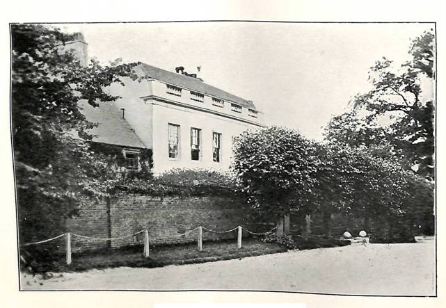
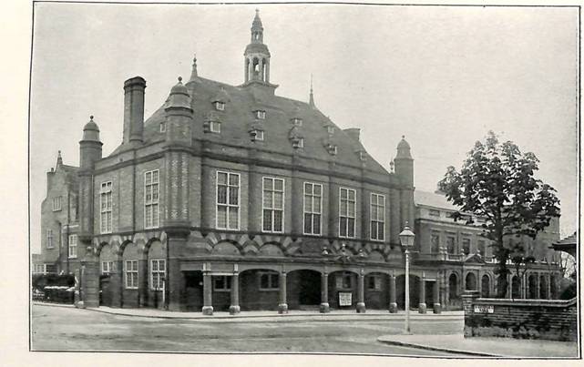
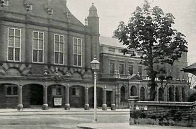
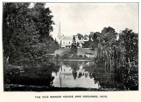
These map extracts may help, the first from 1863-70 and the second from a map revised to 1910. We may deduce a main building with a porch entrance and outbuildings attached in the first while in the second the front may be extended and the outbuildings removed with the Public Hall to one side and the bank building to the other plus significant built development of the grounds.
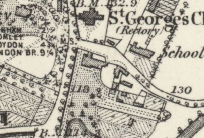
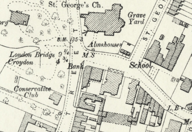
On re-investigation of evidence available today from archives, catalogues and calendars we have discovered additional information and some errors in early accounts. We shouldn’t judge them too harshly as Philipot and Hasted were covering the whole of Kent and relying on some land owners for records and deeds. However, later accounts which repeated their chain of events are also erroneous.
The first maps we discover which can illustrate the extent of Foxgrove were produced in the 18th Century, a 1720 map drawn for Lancelot Tolson but later copied in 1766 for Jones Raymond of Langley and after the manor had been fragmented under the bequests of Mary Tilly, the daughter of Lancelot Tolson. We can only assume that the extent of the manor described in that map gives a reasonable idea of its extent and relationship with other estates.
We commence with Philipott’s account with original spellings (f for s etc.). I have inserted dates in the account based on Philipott’s timeline references to monarchs.
Philipot’s account: Foxgrove is the last place of Account in this Parish, it had in elder times Proprietaries of this Sirname; for I find John de Foxgrove paid respective Aid for it in the twentieth year of Edward the third (1346), at making the Black Prince Knight. After this Family succeeded Bartholomew Lord Burwash, and he held it at his Decease, which was in the twenty ninth year of Edward the third (1355). and from him it descended to his Son Bartholomew Lord Burwash, who in the forty third year of the abovesaid Prince (1370), passed it away to Sir Walter de Paveley, and in his Family it remained untill the latter End of Richard the second, (1399) and then it was conveyed to Vaux of the County of North-Hampton, and there made its abode untill the latter End of Henry the sixth (1461), and then it was alienated to John Grene Esquire, and he died possest of it in fourth year of Edward the fourth (1464); and in this Family did the Title reside, untill the Beginning of Henry the eighth (1509), and then it was demised to Beversea, and Humphrey Beversea, I find held it in the eighteenth year of Henry the eighth (1526), and his Descendant passed it away to Luke Hollingworth, and he about the Beginning of K. Edward the sixth (1547), sold his Interest in it to Alderman Sir Jo. Oliff of London, and he dying (1577) without Issue Male, Joan (his daughter) matched (1563) to John Leigh of Addington Esquire, was his sole Heir (1577), and in Right of this Alliance, did it come down to Sir Francis Leigh (d.1644) late of East-Wickham; whose Widow Dowager the Lady Christian Leigh, is now in Possession of it. (1659 she died in 1660)…….end of quote.
Philipot starts with a reference to John de Foxgrove about 1346. The Lay Subsidy Roll of land taxation for 1334 shows a John Foxsegrove under the Lathe of Eyllesford (Aylesford) but not the Hundred of Beckenham. Whether even at that time Foxgrove was under absentee landlords has not as yet been established but is most likely given that the landlords had wide ranging estates which included Foxgrove. However, we find an earlier reference to Foxgrove in the Kent Roll for 1274 and a jury witness also named John of Foxgrove who may have been the father of the 1347 'John de Foxgrove' given the time between the two? Like all the manors and estates of Beckenham Foxgrove was widely spread and divided, centred upon Foxgrove Manor farmhouse but reaching beyond Kelsey and Langley to West Wickham, almost to Southend, Lewisham with parts at Plaistow, Bromley. It may have begun as one property and acquired additions over time but we cannot be certain apart from some exchanges in the timeline.
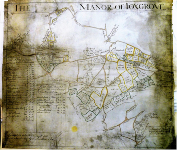
Manor of Foxgrove 1766 amended for Jones Raymond acquisitions from a 1720 original (courtesy of British Library)
Before any mention of the name “Foxgrove Manor” the property is identified as being held by Robert Aguillon and Henry de Clyf. At this point Len Hevey’s Early History of Beckenham” is worth reading as he made research similar to ours. After the first recording of the name of Foxgrove it is said to be held of Robert Aguillon. Then Bartholomew Burghersh ‘held it of Thomas Bardolf’ implying that Bardolf was the higher possessor and leased the property to Burghersh? It does however remain in the Burghersh estates and descends to Walter de Paveley, probably in connection with family intermarriage and heredity as the two families are linked by the marriage of Maud Burghersh to Walter de Paveley probably around 1320. At this point Philipot has the order of descent through the families in the wrong order. There is a question as to how Foxgrove passed from the Paveleys to Sir Thomas Green or Grene. Around 1375/79 a Walter Paveley left property in his will to ‘his companion’ Elizabeth who is not fully identified and she may dispose of property through her heirs and assigns. But in 1399 a Thomas Hakkethorp quitclaims Foxgrove to Margaret Despencer who is daughter to the last Bartholomew Burghersh and married to Nicholas Vaus. This appears to be the mechanism by which Foxgrove enters the Vaus or Vaux family. There are some unrecorded ‘relationships’ in the earlier accounts as we find several intermarriages and connections with families based some distance from Kent. In Foxgrove’s case the Vaus/Vauxs, Pavelys, Grenes are of Northamptonshire. For that and other reasons it is difficult or impossible to identify actual occupants of premises. Some clues in documents allow us relate names to burial records from St. George’s after the beginning of records circa 1540.
Subsequent
to this, as Hasted recounts after repeating Philipot up until
the Lady Christian Leigh, Francis Leigh 1651-1711 directed that
Foxgrove and
other land at Plaistow be sold by his Will but in fact the will does
not direct
it be sold, only that some of his estate is sold to settle debts and a
subsequent Chancery case in 1716 directs that Foxgrove is sold. Hence,
John
Tolson was said to have bought the land but he had died before 1716 so
it is
likely that Tolson’s brother Lancelot acquired Foxgrove to
join
Tolson’s
Bromley land (at Plaistow?), and it descended by complicated means to
his
nephew, Lancelot Tolson Tilly. But we find Hasted's account to be
either
inaccurate or too brief. The will of Francis Leigh and subsequent
events arrive
at a different conclusion.
What further detail can we add? Foxgrove existed before John de
Foxegrave and
whether it derived its name from a person or John derived his name from
the
name of the manor is debatable. Earlier than the name appearing in the
13th
Century (1274) certain coincidences have led us to believe that
“Claihurst or
Claiherst” was the original site of Foxgrove. Claiherst
appears as a
family
name in the 14th Century Lay Subsidy Rolls. The references
that survive
mentioning John de Foxegrave start in 1274 before Philipot's reference
as a
witness in the Kent Rolls which describe Foxgrove thus “Then
they say that a certain land called Foxgrove [Beckenham parish.] in the
village
of Beckenham is of the lord king’s fee and now John Malemains
holds
that of Sir
Robert Agillon (Aguillon) by the service of a fourth part of one
knight’s fee,
but from what time or how it was alienated they do not
know”. And a John de Foxesgrove
also mentioned in
the Lay Subsidy Roll in 1346 connected with Aylesford in the Hundred of
Ruxley.
The Book of Aid mentions John de Foxgrove and John or Joan de Rokesle
being
taxed in Beckenham and associated with Foxgrove whether by assumption
or actual
connection. John de Rokesle (Ruxley) was lord of the manor of
Lullingstone. The
time gap probably indicates two successive 'Johns of Foxgrave/Foxgrove.
We have
Henry de Clyf associated with the manor some time earlier. He is also
mentioned
in the Lay Subsidy Roll.
Although
Foxgrove has been described as a 'Manor' it is believed to have
been separated from the Manor of Beckenham and I have not found any
evidence of
a charter establishing a 'Manor'. Also the land of Foxgrove manor
covers
some parts
of Beckenham, Bromley and Lewisham parishes In several instances
Foxgrove is
described as 'held of' other parties implying leases so apparent
changes of
ownership are often followed by the property returning to a prior
landlord. The
Burghersh/Burwash family held wide ranging properties. Similar to
Beckenham
Manor the owners may not have been locally resident. Where documents
are
discovered they are recorded in the timeline. John Grene appears as a
local
lawyer/sheriff/escheator. We find Foxgrove held by Thomas Grene 2
Richard III
(1378) and a document describing rents from Foxgrove to be paid to
other
parties by his Feoffees. His son or descendant Thomas Grene 21 Henry
VII (1505-6)
had let it to Walter Fitz for a rent. We can trace the family tree of
Sir John
Oliff through his daughter Joan who married Sir John Leigh of Addington
and Foxgrove
went down through the Leigh family. John Oliff’s will states
he
purchased
Foxgrove from Reynold Hollingworth and not Luke Hollingworth. Francis
Leigh's
will of 1711 did not specifically say to sell the estate but the
executors he
named did not deal with the probate and his wife Frances Leigh was
awarded
probate. Francis directed that his bequests and debts be settled and
any
remaining property be passed to his son also named Frances. A Court of
Chancery
case of 1716 directed that Foxgrove be sold to pay his creditors and
this
raises a question as to whether Foxgrove passed to John Tolson in
1712/13 or
later to his brother Lancelot Tolson of Plaistow(Bromley). John Tolson
died in
1713 perhaps before Foxgrove was sold. Lancelot Tolson left Foxgrove to
his
nephew at his death in 1727 but the nephew Lancelot Tolson
Tilly
was only 11 years of age so the estate was in trust until he was 21 or
23 years old. Lancelot Tolson Tilly died aged 25, shortly
after
gaining his inheritance and left the Foxgrove estate to his parents
who in
turn left it in three or more parts. To Lancelot Tolson
Tilly’s
widow Elizabeth who in
her
turn left her part to Joseph Grove her uncle. Another part was left to
Deborah
Brydges (married to Reverend Edward Timewell) and eitheer a third part
to John
and Edward Brydges or they would inherit if Deborah Brydges died
without issue.
The timeline will explain more fully. For those interested in genealogy
it’s a
complex story and this branch of the Leigh family is connected but
different to
the branch at Addington. The wills and bequests of the Tillys certainly
confuse
me and I am discussing the processes with another researcher. Mary
Tilly leased
several woodlands to St.John Humphrey and it appears that upon
expiration of
the lease that the heir under Mary Tilly’s will then sold
some or
all
of the
woodlands to John Cator as in 1759 Cator was able to exchange some of
those
woods with Burrell and Raymond and apparently keep the rest which form
part of
Beckenham Place. It remains the case that some land acquisitions of
John Cator
cannot be dated other than by his assets listed in the 1825 Private Act
of Parliament.
Cators creation of Beckenham Place Park probably included some small
areas
outside of Foxgrove Manor being nearer Southend Village. As Foxgrove
under the
Cators became leased from the early to mid 19th C. then it
was
divided
between tenants of Beckenham Place and the farmers of Foxgrove Farm
while
certain parts were long leased to builders and property speculators.
Today what is left of the Manor of Foxgrove is covered by Beckenham
Place Park
perhaps accounting for about 150 acres and the remainder in built
development
and Foxgrove Cricket and Tennis club.
Kelsey or Kelseys and Kelsey Park
The origin of Kelsey is vague with the first firm evidence in the wills of some fishmongers in the 15th Century named Kelshull/Kelshulle or Kelshill (also using the name Conuerse). The family of Brograve owned Kelsey from the late 15th C until 1688 When Peter Burrell I took possession. it became melded with Langley under the Burrells and divided by the 1820 sale of Burrell estates. We might say that the 1820 sale effectively disolved or reallocated Kelsey, Langley and also parts of Beckenham and Foxgrove former estates. We can dispute some information about the origins of Kelsey as the connection with the “de Kelseys” as mentioned by Philipot and Hasted is discounted and later writers have said that the Kelshulles leased or purchased some land from the le Bruns of Beckenham Manor in 1408 which became Kelsey. Wills were written by John Kelshyll in 1432 and John Conuerse at dene (alias) Kelshulle of Beckenham in 1439 which we discuss more fully in the timeline. All the wills ar in Latin and this could be an alias or even related to a Conuerse/Converse (Connors?) of Kelsey as the latin text appear to say Conuerse at Dene Kelshyll. 'at dene' might be late known as (alias, which is the National Archive interpretation) or even late of Kelshyll. More wills in the names of Conuerse or Kelshyll/Kelshulle may be found as the cataloguing of names is easily misread in transcribing. An expert in old Latin texts may be able to assist here.
Kelshulle is described as leasing two meadows from le Brun of Beckenham Manor in 1408 but we cannot rediscover this evidence despite several searches. It would have been Maurice le Brun, but it doesn't preclude the possibility that Kelshulle owned other land and leased the two additional meadows to extend his holding. The le Bruns were mostly absentee and Beckenham Manor had a long history of being leased to others. Searches have not discovered the origin of this reference.
Some Kelshulles describe themselves as citizen and fishmonger of London in their wills which were written in Latin so translation is difficult.
Other wills of interest could be Alice Kelshull 26/10/1435, apparently widow of William Kelshull.,
Bermondsey Abbey is mentioned in some wills and we find that land belonging to Bermondsey Abbey in Beckenham, Bromley, Hayes and Orpington is gifted some time later in a transfer from Stanlowe to Shukbergh and Brograve. 1487 – Kelsey? Calendar of Close Rolls; Lewis, son of John Stanlowe esquire and Margaret his wife, to John Shukbergh and William Brograve, drapers of London, their heirs and assigns. Release and quitclaim of all those lands and tenements, rents, reversions and services, woods, meadows, lesues and pastures in the parishes of Bromlegh, Bekenham, Leuesham, Chesilhurst, Orpyngton and Hese co. Kent formerly of John and Margaret Stanlowe, which the said John Shukbergh and William held jointly with Robert draper, Thomas Ursewyk, recorder of London, William Alyngton, John Hungerford and William Poury deceased, by gift of John Bromlegh, abbot of Bermondesey, John Catesby serjeant at law, William Alisaundre, William Est, George Dawne chaplain and Thomas Guyne, with warranty against the abbot of Memorandum of acknowledgment, 5 December.Westminster and his successors. Dated 1 December, 5 Henry VII. (Calendar of Close Rolls)
Kelshulle is said to have sold his estate to William Brograve (1458-1503) who's will directs he be buried in Beckenham church alongside his wife Elizabeth. Until other evidence emerges we can only join the dots of what we have or suspect.The references which appear in other accounts about the purchase of some fields and the building of an oratory cannot be confirmed and no one has provided sources for these references. In 1475 William Brograve is plaintif in a Chancery case versus Thomas Horne (Foeffee) about the use of some land called ‘Grovelond’ and in 1487 William Brograve acquired land in Beckenham, Bromley, Chislehurst, Hayes and Lewisham which can be traced back to earlier landlords which he most likely added to any land he had acquired from Kelshulle. Both the Kelshulle and Brograve families seem to have emerged from Hertfordshire and places which are just a few miles apart and a placename "Kelshall" is still present. Both families were Aldermen of the City of London which could have led to property deals. Statements about "manor houses" are also difficult to confirm as the earliest maps indicate perhaps substantial houses and I’m tempted to put the description of "manor" houses down to fancy rather than fact. Most people will relate Kelsey to the current Kelsey Public Park which is really a small section of the grounds to the original estate. The extent of the Kelsey estate at one time stretched from Shortlands to Penge although not in one contiguous estate. In 1553 it passed from John Brograve to Henry Brograve in a Final Accord (Foot of Fine) and was described as; Manor of Kelsys with 6 messuages, 400a land, 100a mead, 200a past, 300a wood in Beckenham & Hayes. £600. The estimations of amount of land may be down to translating 'ploughs' and 'panages' as the Feet of Fines used are difficult to translate.
Tracing the lineage of Brograves is difficult because names were recycled with one Richard Brograve being the son of Nicholas who may have been one of the many children of William Brograve.Assigning parts of the property to different heirs for them only to be brought back under one heir by the conditions of wills e.g. heirs of the body....
Among the references to the Brograves, History of Parliament describes John Brograve MP (1538-1613) of Braughin and Hamells, Hertfordshire stood for Preston and described as the son of Richard Brograve of Kelseys, Kent. Richard describes himself as a Haberdasher of London (many Brograves followed this profession) in his will and is burial place is perhaps in a City of London church. Richard died young leaving bequests to his father and mother as well as his children. Then Kelsey seems to follow the line of one of his brothers, Henry who had a son John and a grandson John. Either or both of them may be the John Brograve identified on the Beckenham Manor map. Henry of Hamells, Leyston, Hertfordshire left a will of 1574 and leaves Kelsey in Beckenham and Hayes to his wife in dower and thereafter to his son John. The mention of Beckenham and Hayes indicates the extent of Kelsey at that time and allows some estimation when compared with the maps of Beckenham Manor, Foxgrove Manor and Langley. Land, tenements, rents and profits are mentioned in the will indicating that at least some parts of the estate are leased raising an income.
The presence of the Brograves in Beckenham led to one daughter marrying Sir Stephen Scott of Hayes. A William Brograve was left Kelseys but apparently died young without issue and the estate passed to his brother John.
These few burials recorded at St. Georges show a limited presence of the Brograves in Beckenham but William Brograve died 1503 prescribed that he be buried at St. Georges beside his wife Elizabeth. Parish records began in 1539. William names sons William (deceased) Edmund, Robert and Nicholas among other siblings in his will but the next Brograve burial appears in 1623. The residue of his estate in Beckenham is left to Robert and the will makes provisions for the absence of heirs.
Robert describing himself as of Beckenham Kent in his 1546 will but requests burial at St. Elen's in London. Possibly St. Helen's Bishopsgate? Robert had three daughters and leaves property to them and their husbands. He leaves the Beckenham house and lands to his daughter Mary but describes the house as being occupied by Leonard Margill and his wife. Hence a period of landlord absence and leasing of the property. Two other daughters and their husbands were left parts of the estate. But Mary may have had to fight for her inheritance as she sued John Brograve and one Wygmore in the Court of Chancery relating to land in Beckenham and Hayes. As the earlier William's will made provisions for heirs of 'Brograve' name then this may be the foundation for subsequent court cases challenging wills? Deeper research into Court of Chancery cases would be necessary to resolve the issue.
In 1574 Henry Brograve's will mentions his manor of Kelseys in Kellsell in Beckenham and Hayes to his wife Margaret and then to son John (??-1629)
We can only say that the property acquired later by Burrell was substantial.| bap/burd | ||||
| 14 Feb 1623 | 1623 | BROGRAVE | Margaret(Mrs) | |
| 16 Feb 1629 | 1629 | BROGRAVE | Margaret d of John Esq | |
| 1 Oct 1651 | 1651 | BROGRAVE | John (Mr) | |
| 14 Oct 1680 | 1680 | BROGRAVE | Thomas (Esq) | |
| 23 Nov 1734 | 1734 | BROGRAVE | Arabella (Mrs) spinster | |
| 20 May 1659 | 1659 | BROGROVE | Mary d of Thomas (gentelman) | |
| 27/7/1664 | 1664 | Bapd | BROGROVE | John Francis s. of Thomas and Mary |
| 8 Jan 1697 | 1697 | BROGROVE | Mathew (Mrs) | |
| 4 Jun 1700 | 1700 | BROGROVE | Mary(Mrs) |
John Brograve died 1621 burial unknown, next Beckenham heir son John d.1651. (Either of these could be the John Brograve annotated on the 1623 map.
In the later part of the 17th Century the Brograves were engaged in several Chancery cases over propert, some arising out of unpaid loans and some apparently between different members of the Brograve family (see TNA catalogue). In 1690 Peter Burrell was plaintif in a case with John Francis Brograve over the sale of Kelsey. A document regarding some case involving Povey describes the property held by the Brograves showing it was an extensive part of the estate later bought by Burrell and several of the tenants of the Brograves.
It can be visualized in the Burrell estate maps of 1723 and 1735. It was to some extent intermingled and overlapping with neighbouring estates of Beckenham Manor, Foxgrove Manor, Langley and Elmers End Farms. References to Burrell extending a small estate have little foundation as he appears to have purchased the aforementioned 1000 acres and made small additional purchases. In 1768 Kelsey joined Langley under the widowed Amy Burrell (nee Raymond) and her son Peter Burrell III. In 1768 a lease of a newly erected house from Peter Burrell III and his mother to R.H.A.Bennet who had married Elizabeth Amelia Burrell in 1766 may relate to a building on Kelsey Lane which is or becomes Kelsey Cottage. A later lease describes the messuage of Kelsey (Mansion) being reserved for Amy Burrell although Bennet has the lease for much or all of Kelsey grounds.
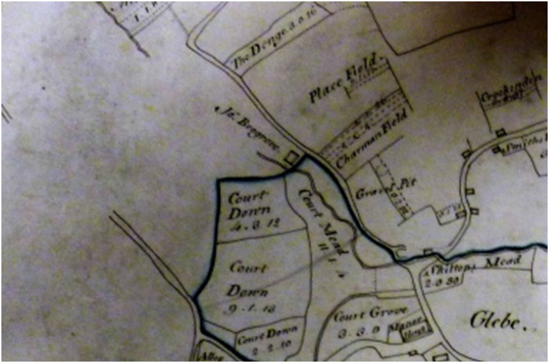
The 1623/1768 Beckenham Manor map showing John Brograve’s Kelsey house just above Court Mead.
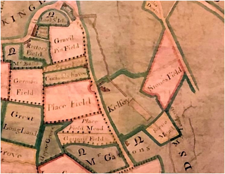
Kelsey 1723-35 showing the house on what is now Kelsey Park Road/Manor Way. The road had a dog-leg bend and a later straightened section became Kelsey Lane. The house on Mr Gatton’s may have become The Flint House occupied by Henry Alexander Bennett after a later rebuild. I assume the depiction of the lake in Kelsey as a rectangular is accurate and would later be landscaped in an informal outline.The lower pond is depicted as a canal as was the earlier fashion similar to water features in Langley. Closer inspection of the buildings of Kelsey shows what could be a mill either side of the river as it exits Kelsey.
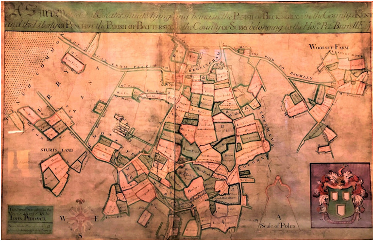
Burrell Kelsey map of 1735. Penge Common to Shortland (kind permission of Sir Charles Burrell of Knepp Castle)
From the representation of Kelsey in the 1723 and 1735 maps and also the 1748 Rocque map we can see that Kelsey lake was a formal rectangular shape. Circa 1780 a new house was built for Amy Burrell while most of Kelsey's parkland was leased to Richard Henry Alexander Bennett who had married a Burrell daughter. After Amy Burrells death the house may have been occupied by Bennett and his family as shown on the 1809 Burrell estate map and book of leased properties. The 1809 map shows a house and outbuildings on the west side of the lake. This house appears to have remained the same until the 1838 tithe map by which time it had come into the possession of Peter Hoare after the 1820 Burrell/Gwydir estate sale. Kelsey's estates became divided by the sale with parts going to Edward Grose Smith, Peter Hoare and John Woolley with Langley being purchased by Emanuel Goodhart.
Some time after 1838 the mansion was extended apparently adapting the footprint of the earlier house into its design.

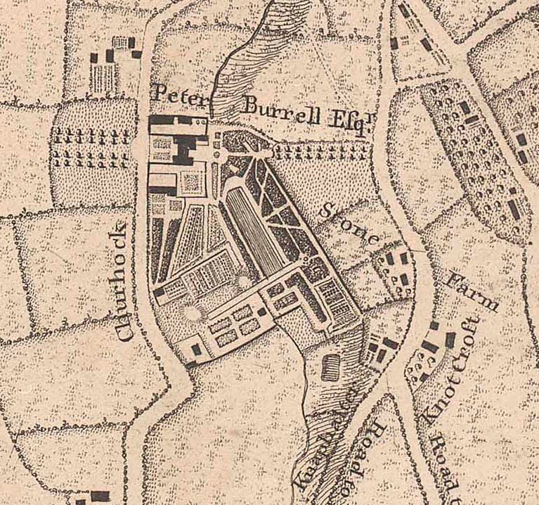
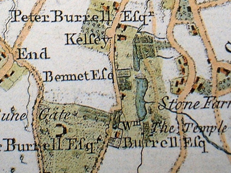
Kelsey 1735 (Knepp map courtesy Charles Burrell) Rocque 1749 notable inaccuracies Andrews Drury 1769 similar errors to Rocque
The first map shows the 'lakes' as a single formal water feature and the house near the end of the lower lake. The water feature seems to be where the lower lake is today and Rocque's map shows laid out grounds but the road pattern is distorted. At this time Stone Farm was further up Wickham Road and not in Burrell possession, pre 1757 it was part of the Foxgrove/Tolson-Tilly properties. The third map (Andrews) Show two lakes as we see today but some Rocque errors are continued as well as erroneously linking the Ravensbourne to the upper lake although a minor water course did/does enter the lake approximately here but now underground. Kelsey Houseis still shown near the park entrance. The road, Crouch Oak Lane was misnamed on Rocque as Churhock and its my belief that map makers had trouble understanding local people's Kentish accent which would be similar to any surviving West Country accent until taken over by the London accent.
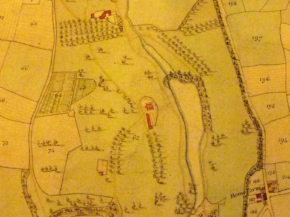
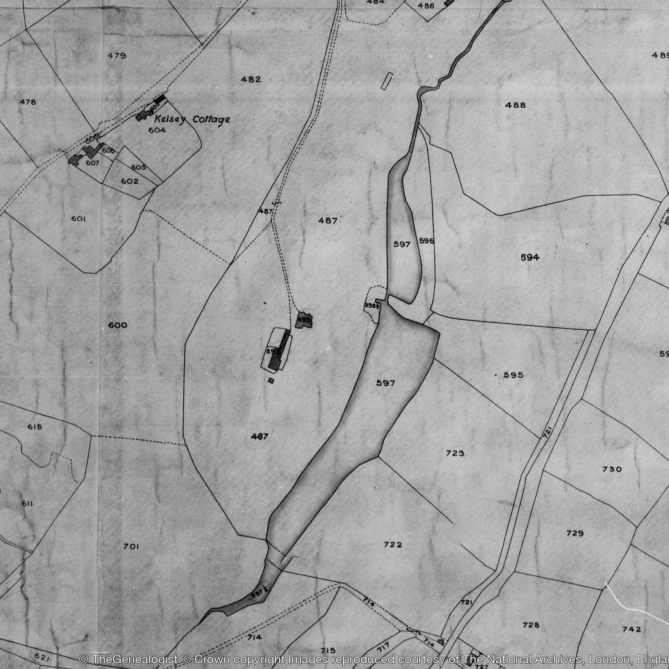
Kelsey 1809 Burrell estate map maybe using Ordnance Survey derived detail. Stone Farm had been absorbed into the Burrell estate through land exchanges with John Cator and the farm rearranged to become Kelsey Home Farm later renamed Stone Farm again and Kelsey parkland extended to Wickham Road. A new mansion had been built overlooking the upper lake and it looks like the 'old' Kelsey house remains near the bottom of the lower lake. The 1838 Tithe map shows the same footprint for the lake and mansion although very soon the mansion would be extended to the later Victorian property. Kelsey Cottage had been built by John Woolley some time after 1820.
The watercourses entering the lakes from the east as in the Andrews map may be evidenced by the water which enters the park from the allotments and also the regular sewer smell on the side of the upper lake where maybe some bad pipe connection has been made by property development.
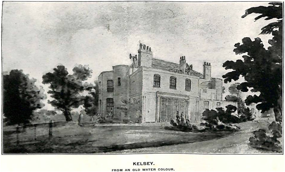
After reciting the following accounts of Philipot and Hasted we can discuss a few points:
Philipot wrote of Kelsey: Kelseys lies likewise in this Parish, and may justly exact our Notice; by Deeds written in a Character that hath an Aspect upon the Reign of Henry the third, John de Kelsey, William de Kelsey, and others of that Sirname are represented to have an Interest in this Seat, and from hence it is probable the Kelseys of Surrey did derive their first Extraction, however by the Injuries of Time they have been in succeeding Generations cast under the umbrage of an obscurer Fortune: But I return, After this Family had deserted the Possession of this place, which was before the latter End of Richard the the second (1399), I find the Brograves stepped in, and by purchase became Lords of the Fee, a Family which in very old Deeds writ themselves Burgrave, and sometimes Boroughgrave, though now a more easie Pronunciation hath melted it into Brograve, which represents the Etymologie of the Name, to have been in its Original perfectly Saxon. In the year 1479, there was a License granted (as appears by the Records of Rochester) to William Brograve by the then Bishop of that Diocess, to erect an Oratory or Chapple at his Mannor-house of Kelseys, the Vestigia or Reliques of which are yet obvious to an inquisitive Eye, and from this William did the Title and possession in an even Current come down to Mr. Thomas Brograve, who being not many years since deceased, his Widow Mrs. Martha Brograve now in respect of Jointure, enjoys the present Possession of it.(1659).
But having about 130 years more information Hasted quoting Philipot to a great extent and adding genealogies says;
KELSEYS
is a seat of note in this parish, which as early as the reign of king
Henry
III. had owners of that name, as appears by deeds written in a
character
seemingly of that time, wherein John de Kelsey, William de Kelsey, and
others
of that surname, are described as having an interest in this seat.
After this family
had deserted the possession of this place, which was in the reign of
king
Richard II (1377-99) the Brograves (sometimes written Boroughgrave)
were by
purchase become owners, and resided at it.
An ancestor of this family was Sir Roger Brograve, who lived in the
reign of
Edward I. and was of Warwickshire, who bore for his
arms, Argent
three
lions passant guardant gules; from whom descended William Borgrave of
Beckenham, to whom, in 1479, licence was granted by the bishop of
Rochester (as
appears by the records of that church) to erect an oratory, or chapel,
at his
manor house of Kelseys, the ruins of which are not now even to be
traced out.
At length, a descendant of this name and family, John Brograve, some
small time
before the year 1688, conveyed this estate by sale to Peter Burrell,
esq. who
was the ninth son of Walter Burrell, esq. of Holmstead-house, in
Cuckfield, in
Sussex, whose ancestors are said to have been originally seated in
Northumberland as early as the reign of king Edward I. but Randulphus
Burrell,
son and heir of Randulphus, having married Sermonda, daughter and
coheir of Sir
Walter Woodland of Devonshire, anno 19 king Edward II became in her
right
possessed of a great estate in that county. His direct descendant, John
Burrell, was a man of eminence in the reign of king Henry V. and left
several
sons, of whom Walter, the eldest, succeeded him in his estates; and
Gerardus,
the youngest, settled at Cuckfield, in Sussex, anno 1446, being vicar
of that
church, and archdeacon and residentiary of Chichester. He died in 1508,
leaving
his estate to his nephew, Ralph, who settled at Cuckfield. Thomas, his
son, by
Dorothy Weston, his wife, had Ninian Burrell, esq. of Cuckfield, who
married
Jane, daughter of Henry Smith of Surry, afterwards remarried to Peter
Courthope, esq. of Danny, in Sussex, and died in 1614, leaving several
sons and
daughters.
Of the sons, Walter, the eldest, married Frances, daughter of John Hooper of Stockbury, esq. in this county, by whom he had nine sons and three daughters. Of the former, Peter Burrell, esq. the ninth son, purchased the manor of Kelseys, some few years before the Revolution, as mentioned above. He afterwards settled here, and married Isabella, the second daughter of John Merrick, esq. of Essex, by whom he had six sons and four daughters. He died in 1718, and was buried in this church, leaving only two of his sons, Peter and Merrick, and three daughters, surviving; of whom, Frances married Richard Wyatt, esq. of Egham, in Surry; Isabella married Thomas Dalyson, esq. of Hampton, in this county; and Anne married Richard, brother to Sir Hugh Ackland, bart. of Devonshire.
Merrick Burrell, the youngest son, was of West Grinsted-park, in Sussex, and was created a baronet in the 6th year of George III to him and his heirs male, and in default of such, to his nephew, Peter Burrell, esq. of Beckenham, since deceased, and his heirs male. On Sir Merrick Burrell's death, s. p. the title of baronet descended to his great nephew, Sir Peter Burrell, the present baronet, since created Lord Gwydir, as will be farther mentioned below.
Peter Burrell, esq. the eldest son, succeeded his father in this estate, and resided at Beckenham. He served the office of high-sheriff of this county in 1722, and died in 1756. He married Amy, eldest daughter of Jones Raymond of Langley, esq. (should read Hugh Raymond of Langley) in this parish, by whom he had four sons and two daughters. Of the former, Peter Burrell, esq, the eldest son, succeeded him in this estate, and was of Beckenham; Raymond, the second son, died young; and William; the third, was bred to the civil law, commenced Doctor of Laws, and was chancellor to the bishops of Worcester and Rochester. He married Sophia, daughter of Charles Raymond of Valentine-house, in Essex, who was created a baronet in 1774, with remainder, in default of issue male, to William Burrell above mentioned, and his heirs male by Sophia his wife, which title, on his death, descended to Sir William Burrell, bart. above mentioned, who died in 1796, leaving his widow surviving, and by her two sons and one daughter. Of the two daughters, Amelia married Tobias Frere, esq. and Isabella died young. Peter Burrell, esq. married Elizabeth, daughter and coheir of John Lewis, esq. of Hackney, by whom he had one son, Peter, and four daughters, of whom Elizabeth-Emelia married Richard Henry Alexander Bennett, esq. of Cambridgeshire; Susanna married lord Algernon Percy, second son of the late duke of Northumberland, now lord Lovaine; Frances Juliana married Hugh earl Percy, now duke of Northumberland; and Elizabeth, the fourth daughter, married Douglas duke of Hamilton. He died possessed of Kelseys, in 1775 (ownership held or shared in dower by Amy Burrell nee Raymond), being succeeded in it by his only son and heir, Peter Burrell, esq. of Beckenham, who was afterwards knighted; and at length, on the death of Sir Merrick Burrell, bart. succeeded to that title by the limitation of the patent. He married in 1779, the lady Elizabeth Priscilla Bertie, eldest sister of Robert late duke of Ancaster. on whose death, s. p. she succeeded to the title of Baroness Willoughby of Eresby, and in her own right and person to the office of Lord Great Chamberlain of England, the office being executed by her husband Sir Peter Burrell, knt. and bart. who was, in May 1796, created Lord Gwydir of Gwydir, in Carnarvonshire. By her he has a son, Peter Robert, born in 1782, and other children, and is the present possessor of this estate. He bears for his arms, Vert three plain shields argent, each having a bordure ingrailed or. (end of Hasted's)
So what more can we say of Kelsey? The connection with the ‘de Kelseys’ is now refuted. Some previous writers have stated that Kelsey was part of Beckenham Manor that was sold to one Kelshulle but we have not rediscovered the firm evidence for this if there is any. The search continues for copies or transcripts of any documents and as with Langley and Foxgrove, the separation from Beckenham Manor if there was any is vague. Suggestions that Kelshulle purchased some meadows from the Bruyns might relate to a small transfer of land considering that the Kelsey estate was extensive. The name Kelshulle is quite common in records for the City of London ie one John Kelshulle is a Master Tapicer in the mid 14th Century ie a maker of tapistries or similar cloth. Others are fishmongers and the one that has been associated with Beckenham has been described as a fishmonger. So far we cannot say whether leaps of faith are responsible for the story. Two wills were written by William Kelshulle (alias Convers) in 1432 and John Kelshyll the elder of Beckenham in 1439 but transcriptions and/or translation from Latin is so far unavailable. One will states that Kelshulle is also known as Convers and this following earlier dated reference as well as others can be seen on British History Online; circa 1377
“Note: that Thomas Convers was chamberlain (camerarius) to lord Bartholomew Borwasch (Burwash/Burghersh) and was therefore called Thomas Chaumbyr and his son William was apprentice to William Kelshull and therefore called William Kelshull and he lived in the parish of St. Michael Crokydlane in 12Hy.IV.”
The reference is potentially interesting as Borwasch or Burghersh/Burwash held Foxgrove Manor for a time around 1355. So can we consider that parts of Kelsey were at one time part of Foxgrove? Given the intermixing of the various estates it is not impossible.
We have to apply some benefit of the doubt to the creation and passage of Kelsey until evidence is confirmed. The transition from Kelshulle to Brograve is rather clouded and there are some interesting references to the actions of the Brograve family and their dealings with other local personages. There are some transcripts of wills for members of the Brograves, Henry in 1574 and John in 1629. The Brograves leased much of the estate to tenants as did the other landlords. Often the tenant farmers of husbondmen were the true residents of Beckenham. The relatively few members of the Brograves who were buried in St.George’s reflects that the majority of the family resided elsewhere. The Brograves took out some loans in one or two generations and the later generations failed to repay debts which had some connection in their decision to sell to the Burrells. Documents related to the legal procedure to recover the loans gives some insight to the affairs of the Brograves and their tenants. We have evidence which later results in the sale to Peter Burrell in 1688/1690. The intermarriage of Burrells and Raymonds explains the merger of Kelsey with Langley. The error regarding Amy Raymond's father, being daughter of Hugh Raymond and not Jones Raymond who was her brother is perhaps connected with Hasted's error regarding Langley and Foxgrove whereby he believes there were two Jones Raymonds when in fact there was only one. Although Hasted's background information is interesting it does not cover the complex land acquisitions and exchanges whereby Kelsey, Langley and parts of Foxgrove and Beckenham Manor came into Burell ownership from Hugh Raymond of Langley and the Tolsons of Foxgrove including the involvement of John Cator who was moving into the area from circa 1757. The timeline attempts to clarify these transactions. From the time that Kelsey was seperated from the Manor of Beckenham by Kelshulle (if that is the case) then to the Brograves, it then passed to Burrell from whom it descended to the fourth Peter Burrell/Baron Gwydir on whose death in 1820 it was sold to Edward Grose Smith then to the Hoare family of banking renown. Having become rejoined with parts of Beckenham Manor, Langley and Foxgrove under the Burrells the sale of the 'Gwydir' estates divided the ownership of Langley, Langley Farm and Kelsey. The 1838 Tithe map and returns allows a snapshot of the division but leaves some questions. Not least that the 18th Century saw several bequests, sales and exchanges described in the timeline.
Langley:
Place or Park and Farm
Langley lies astride the parish boundaries between Beckenham, Hayes and West Wickham but the main house was in Beckenham. In early times West Wickham was just called Wickham (Wykham) but to differentiate more definitely from East Wickham near Bexley the 'West' seems to have been added perhaps because one local family, the Leighs, were of East Wickham and Addington as well. Langley later became paired with Sympson’s Place in Bromley under the Styles and Sympson’s extended into Beckenham. In the earliest days of Langley several members of the Langley or Langele family are recorded. Some sources say that the Style family may have resided at Red Lodge and the dates of the other houses within Langley aren’t known but from available prints or photographs look more Tudor or Georgian . Also the buildings went through alterations and rebuilds.
The earlier historians got a few things wrong understandably in trying to record the whole of Kent. Closer inspection of evidence leads us to make some corrections and seek the work of other researchers who have traced wills and family trees. Len Hevey has disputed the involvement of the Violets in the transfer of Langley. He states that Ralph Langley died in 1453 and property was transferred in 1461 to Stephen Fabian and then to his son in law Henry Fincham from whence it passed to John Style. As Fincham had been appointed an alderman of the City of London but excused because he did not have sufficient wealth to be able to perform the role then it is questionable whether he possessed Langley as well as Kent House. Keith Baldwin’s investigative skills have brought up references to the will of an Edmund Style d.1563 who was cousin of Sir Humphrey Style d.1555 which fills in some family tree blanks. Also John Style’s will of 1505 mentions family members such as in-laws and uncles. John Stile also mentions Guy Wolstan, James Yarford who would marry his widow, uncles John Style and Henry Bolle. These are best explained in the work of Anne Sutton in a publication of the Suffolk Archaeological Society where she produces a family tree and a description of the family’s activities as part of research into London Mercers. Some spelling variations of names occur in the tree and documents such as Welstone/Wolstan Bolle/Bulle. John Style’s will mentioned Ipswich which is the home town of the Styles and Bolles. Of course Suffolk was the epicentre of the wool trade which also propagated the wealthy mercers originating from there. Of some interest is the mention that Bridget, Florence and Humphrey, the children of Edmund Kemp are committed to the care of Humphrey. (to be investigated).
As most estates were subdivided between leases to tenants the same was true of Langley. Certainly from records in the 18th Century and the earlier records describing mostly absentee landlords.
A 1624 Marriage Settlement conferred property: William Stile senr. of Bromlye esq., to his son and heir Sir Humphrey Stile, Sir John Peshall of Sogonhill, co. Staffs., Dame Elizabeth Boswell widow of Sir Robert Bosvile, Thomas Stile of Watringberrie esq. and Edmond Stile of Beckenham gent., (brother of W. S. senior): prior to marriage of Sir Humphrey Style and Dame Elizabeth Boswell. Messuages and lands in Beckenham, Lewsham, Langlye Greene, Wickham and Deptford, co. Kent; and in Batrichsey (Penge?), co. Surrey (Tenants and rents specified. Mentions capital messuage called Langley, messuage called Kent House and lands called the Parkes, Tomshill, Southfield, Rudlies and Croftes, Dawes Grove, Gravely Croft, the Newe Orchard, Gilbertes, Gilbertes Brooke, Henly Grove, Feildes, Great and Little Toms Woodfeild, Bruehouse Field, the Wildes, Willmottes, Clayhersts, Tenn Acres, the Hopyard, the Ozier Yard, Wickersland Meade in Beckenham, Birchgrove in Wickham. Jenkyns and Issabell Field in Lessham). Witn. Stephen Scott, Robert Style, Ra. Massie, Richard Harvye, John Fryer, Edmund Savage. Endorsed with attornment of 34 tenants (26 April 1624) 1 item Hull ref; U DDBM/36/3. Hence the document shows ownership and leases and the extent of the estate to some extent including parts in Deptford, Lewisham, Battersea(Penge).
Langley Farm was a later division or development probably after 1793 when the Burrells consolidated their holdings in the area which then became Langley Court in the 19th Century but the earliest map of Langley belonging to Jones Raymond circa 1740 shows Langley House and the surrounding fields described as Langley Farm whereas when the Burrells acquired more land in the area in exchanges with John Cator the Burrells created the later Langley Farm on the site of a messuage called Cuts Croft.
The appearance of Langley relies upon few pieces of evidence. The earliest images we have of what Langley looked like are a sketch by the antiquarian The Reverend Stukely of 1713 and the later print which appeared in Hasted's first edition History and Topography of Kent 1778. These two images show what is thought to be the front and back of Langley mansion. The structure looks the same apart from the roof which may have been altered or may be a misrepresentation by either Stukeley or Hasted's artist? We see possibly similar artistic licence in a print of Beckenham Place of 1812.
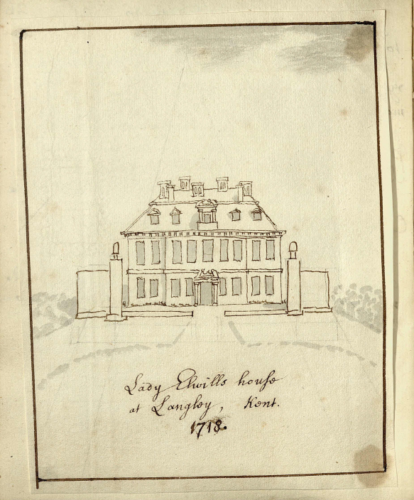
Stukeley's 1713 sketch of Lady Elwill's house (Elizabeth Style)
Courtesy of the Bodleian Library.
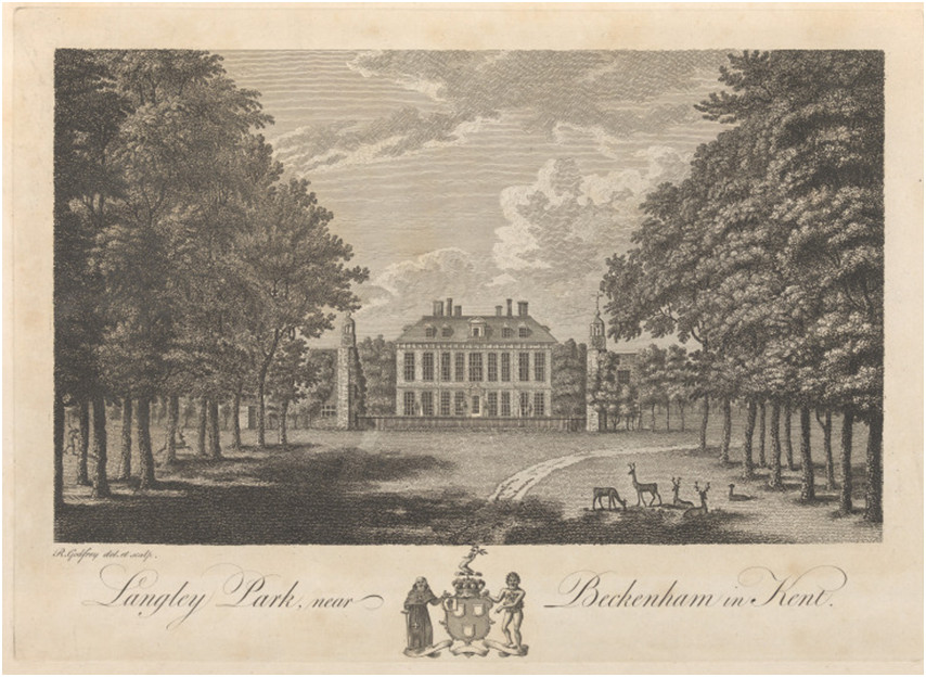
Langley Park from Hasted 1778 in the possession of Peter Burrell I
This print shows the avenue which look like oak trees but have been described as chestnut or horse chestnut. The foreground of the house has two obelisks and wings on either side which appear to be Tudor towers and ranges of buildings. The building differs significantly from the later one which burnt down in 1913 evidencing rebuilds by the Burrells. Comparison with the Stukeley drawing of about 60 years earlier shows a high degree of similarity.
The
recent (October 2022) delving into G.W.Tookey’s research
material
reveals that
he disputed and proved the descent of Langley from Ralph Langley to the
Style
family and could not discover a link to the Violets. We transcribed his
account
of Langley herewith:
THE
ACQUISITION OF THE LANGLEY ESTATE BY THE STYLE FAMILY. (G.W.Tookey)
In 1453 the Langley estate was in the hands of Ralph Langley By his
will of
that year Ralph Langley left small sums to Beckenham Church including
3s.4da.
for the ‘new bells' and 6s.8d. for making up the road between
the
church and
the well (which was in the dip in the Bromley Road). He directed that
his
dwelling-house should be divided in half to provide accommodation for
his wife
Alice and his daughter after his decease, and that subject to the
legacies and
his wife's right of dower his estates should be sold for charitable
purpose He
must have died between 1453 and 1461 because in the latter year all his
lands
were sold to Stephen Fabian citizen and draper of London by a deed to
which the
Rector of St. Michael's Crooked Lane London was a party. Stephen
Fabian's
interests in Beckenham in the latter part of the 15th century are well
authenticated by contemporary documents which have become available for
study.
The old historians do not mention him at all, but say that the Violet
family
took over the Langley estate on the death of Ralph Langley. It is
possible that
some of the Langley lands went to the Henry Violet who died in 1505
holding
property in Beckenham, but there is no documentary evidence that he was
the
substantial successor to the Langley property. Stephen Fabian died
before 1500.
His son-in-law Henry Fincham, who married Elizabeth Fabian, succeeded
to much
of his property, and there were various dealings between Henry Fincham
and John Stile and others in the years
1500-1504
relating to lands in Beckenham, some of which dealings involved
litigation. The
transfer of the Kent House estate from the Fabian and Fincham family to
John Stile is well documented, but no
document directly affecting the main Langley estate can be identified,
unless
it be included as a part of the very large estate referred to in a
grant of 6th
October 1501 (789D). John Stile acquired
other property in Beckenham and Bromley during the years 1500-1504,
including
Simpson's Place (on the: river at Bromley South) and Land +in the
Tootswood
area. It is possible that .the house at Langley was at this time of no
great
significance, compared for example with Kent House, and that it was
John's son
Humphrey who built the Tudor period
mansion and chapel, the remains of which can be seen in the
engraving in
Hasted's Kent, The first documentary reference to a Style ‘of
Langley’
is
contained in a deed of 1548 (ref. 788J) signed by Humfrey Style and
describing
him as 'Humfridus Style de Langley in Parochia de Bekenham in Com.Kant
‘miles
filius et heres Dne Elizabeth Yarford',
In the year 1510 when according to Borrowman Langley was sold by the
Violett
family to John Style, the latter was already dead and his son Humfrey
was only
about 11 years old. (end of Tookey’s article)
We may be able to add more upon further investigation of Tookey’s research, some of which we rediscovered independently and some needs revisiting particularly at Kent (Maidstone) Archive.
Philipot said of Langley (1659): Langley in this Parish is a
second Seat of eminent
Account, which
was in elder Times the Possession of John de Malmains, who
obtained a
Charter of Free-Warren to his Lands in Bekenham, in the twelfth
year of Edward
the second,(1319) which was renewed to Henry de Cliffe, to whom
they
accrued by Purchase from Malmains, in the third year of Edward
the third;(1330) but stayed not long in the Tenure of this Family, for
before
the going out of Edward the third,(1377) I find the Propriety
invested
by Sale in Langley, to which Family the Foundation of that
House owes in
part its Original, on which they ingraffed their own Name, which hath
flourished under that Title ever since, though the Family be withered
away and
gone, the last of which Name at this place was Ralph Langley,
who with Roger
Twisden, Stephen Monins, Edward Monins, John Edingham or Engham,
Richard
Edingham, John Berton of Cotman
in Shouldon, John Berham, John Betenham of Shurland in Pluckley,
and others, Gentlemen of prime Rank in this County, were summoned to
appear
before Robert Poynings and John Perry, in the twelfth
year of Henry
the sixth,(1434) to disclaim the Title of the House of York,
and this Ralph
died in the year 1451, and ordered Langley and other demeasns
at Bekenham
to be sold for the discharging his Debts, the purport and Effects of
which Will
were accordingly performed, and his Estate at Bekenham and Langley,
passed away by Sale to John Violett, whose Successors enjoyed
it until
the Beginning
of Hen. the eighth,(1509
but Stile owned it at his death in 1505) and then it was conveyed to
John
Stiles Esq; (d.1505) who much inlarged the House with a supply of
Buildings, and from him is it by Descent devolved to be the instant
Possession
of his Successor Sir Humphrey Stiles Knight and Baronet.(d1552)
Hasted (1778) said a bit more about Langley over a hundred years
later
but it
can be confused with Langley near Maidstone but we find that the
Domesday entry
which Hasted quotes with the mention of a fishery relates to
Seal
near
Sevenoaks and the fishery must be on the river Darenth or consisting of
fish
ponds.
Hasted's entry: LANGLEY-PARK is a seat of
eminent
account in this parish, which was formerly accounted a manor, and in
the reign
of the Conqueror was part of the vast estate of Odo, bishop of Baieux,
and earl
of Kent; and is thus, if I mistake not, described in the general survey
of
Domesday, taken in that reign: (regretably Hasted did mistake it)
Goisfridus de Ros holds of the bishop (of Baieux) Lasela. It was taxed at 7 shillings. The arable land is . . . . . . . In demesne there are 3 carucates, and 31 villeins, with 14 borderers having 16 carucates. There are 10 servants, and one fishery producing fourscore and 10 eels; wood for the pannage of 55 hogs. The whole manor was worth, in the time of King Edward the Confessor, 30 pounds, when he received it 16 pounds, and now 24 pounds, what Goisfridus held; what Richard of Tonbridge held in his lowy was rated at 6 pounds; what the king held of this manor, 22 shillings. Brixi Cilt held it of King Edward.
This place afterwards came into the possession of the family of Malmaines, who were settled at Waldershare in this county, in the time of the Conqueror. John de Malmaines obtained a charter of free warren for his lands in Begenham, in the 12th year of King Edward II which was renewed to Henry Malmaines, of Cliffe, in the 3d year of King Edward III.
It appears by the Book of Aid, in the 20th year of King Edward III that Nicholas Malmains held half a knight's fee of the king in Begenham. He died, in the 23d year of that reign, possessed of much land in this county; before the end of which, the property of this manor was transferred by sale to Langley, a name most probably taken from this place, though the family itself has been long since extinct. These Langleys of Beckingham were, most probably, a distinct family from those of Knowlton in this county, who were originally descended from a family of that name in the county of Warwick.
The
last of this name here was Ralph Langley, who died in the 30th year
of King Henry VI. and by his will directed Langley, with the rest of
his
demesnes in Beckenham, to be sold for discharging his debts; in
pursuance of
which it was passed away by sale to John Violett, who bore for his
arms, Gules, three coronets, or, whose descendants enjoyed it
until the
beginning of the reign of king Henry VIII when it was conveyed to John
Stile,
alderman of London.
He was the son of William Style of Ipswich, was afterwards
knighted, and
of the Drapers Company, and dying in 1500, was buried in Allhallows
Barking
church, London. He married Elizabeth, daughter and coheir of Sir Guy
Wolston of
London, by whom he had Sir Humphrey Style, of Langley, who was one of
the
esquires of the body to King Henry VIII and sheriff of this county in
the 35th
year of the same reign. He died in 1557, and was buried in Beckenham
church. He
procured a grant from Sir Thomas Wriothesley, garter principal king at
arms,
reciting, that not being willing to bear arms in prejudice to the other
branches of his family, he had petitioned for a coat, with a proper
difference,
which the said king at arms, in 1529, granted, under his hand and seal,
viz. Sable,
a fess engrailed between three fleurs de lis, within a bordure or, the
fess
fretted of the field.He procured, with others, an act of parliament in
the 2d
and 3d years of king Edward VI for
the disgavelling of his
lands in
this county.
By his first wife, Bridget, daughter of Sir Thomas Baldrey, he
had three
sons; Edmund, born at Langley, in 1538; Oliver, who was sheriff of
London, and
ancestor of the Styles, of Watringbury, barts. and Nicholas, who was
knighted.
From Edmund Style of Langley, esq. before-mentioned, eldest son of Sir Humphrey, descended Sir Humphry Style of Langley, eldest son of William, who was gentleman of the privy-chamber to king James, and cupbearer to king Charles I. and was created a baronet, by privy-seal, on the 20th of May, 1627. (fn. 26) But though this branch was the elder to those of Watringbury, yet these last were the senior baronets, being created April 21, 1627, anno 3 Charles I. He died in 1650, and was buried in the vault at Beckenham church, and leaving no issue, his title became extinct, and he was succeeded in this estate at Langley by his half-brother, William, the eldest son of William Style by his second wife, Mary, daughter of Sir Robert Clarke, one of the barons of the exchequer.This William Style of Langley, esq. was bred a barrister at law, and was of the society of the Inner Temple. He married Elizabeth, sole daughter and heir of William Duleing, by whom he had two sons, and two daughters, and dying in 1679, was buried in this church.
Of the sons, the second, but only surviving son Humphry, succeeded his father at Langley, in whose time there were several coats of arms, as well of this family as of those they had intermarried with, painted in the windows of this house, but dying without issue male, his only daughter and heir, Elizabeth, carried it in marriage to Sir John Elwill, bart. who died in 1727, without issue by her. This family of Elwill was of Exeter in Devonshire, who bore for their arms, Ermine on a chevron engrailed, between three eagles displayed gules, three annulets or, and were advanced to the dignity of a baronet, in the person of Sir John Elwill, in the 8th year of queen Anne's reign. He was twice married, but left issue only, by his second wife, the daughter and heir of — Leigh of Egham, in Surry, by whom he had two sons, Sir John above-mentioned, and Edmund, who succeeded his brother in title and in this estate of Langley, and in 1732 transferred his property in it, together with the house, called Langley-house, the park, and also the north and south isles of the parish church of Beckenham, to Hugh Raymond of Great Saling, in Essex, esq. who settled them on his only son, Jones Raymond, esq. in tail general; remainder to his eldest daughter, Amy, who married Peter Burrell, esq. and her issue male. On his death his son, Jones Raymond, esq succeeded to this estate, and kept his shrievalty for this county at Langley in 1738, in which year he died, and was succeeded by his son, of the same name, who died unmarried in 1768, on which it descended, by the intail before-mentioned, to his sister, Amy, before mentioned, whose husband, Peter Burrell, esq. in her right, became possessed of it. He died in 1756, having had by her, who survived him, four sons and two daughters. Mrs. Burrell, his widow, afterwards resided here, and died in 1794, on which this seat descended, together with her other estates in this parish, to her grandson, sir Peter Burrell, bart. since created lord Gwydir, of whom a full account has already been given, and he is the present possessor of this seat, with the park and grounds belonging to it. (end of Hasted)
What can we add or even dispute? Firstly, that all of Philipot’s and Hasted’s events are difficult to trace. The Kent Roll of 1274 records a Ralph Langel and the Lay Subsidy Roll of 1334 records several Langele and Langley’s dating the presence of the family name well before Philipot and Hasted’s dates of 1319 onwards. After the Langley or Langele family John Violet cannot be traced or confirmed but the will of Henry Violet of 1505 mentions land in Beckenham which might be anywhere. John, the first Style to inhabit Langley is said to have died circa 1529 but we find two wills for ‘John Stile or Style’ one died in 1505 and we see Langley and Bekynham(sic) in the text. He would appear to have acquired Langley before he wrote his will and also some of Kent House by way of repayment of a debt in 1501. A will for Sir John Stile dying in 1529 at East Greenwich(Deptford) does not mention property in Beckenham, he mentions a son Richard and a late wife Kateryn and a Dame Elizabeth. Langley has been connected to Sir John Stile who was ambassador to Spain and Ireland for Henry VIII but we are now as certain as we can be that John Style d.1505 is the one in question supported by his wife’s subsequent marriage and her will naming her son Sir Humphrey Style and two daughters, Bridget and Florence. The codicil of the will mentions land in Beckenham, Bromley, Lewisham, Battersea and Tottenham as well as the City of London. When John died in 1505 his children were very young, Humphrey being about 4 years of age so his wife Elizabeth then married James Yarford who was a stapler and an alderman and mayor of London at one time. A stapler was an agent in the wool trade and a source of wealth at the time. Elizabeth and James took possession of Langley and Symson’s Place as John had left his property to Elizabeth during the childrens ‘nonage’. At what point Humphrey took possession is debatable, Yarford died in 1527 and several events happened in 1529 which could indicate Humphrey taking control but Elizabeth still left property to Humphrey in 1548. Langley descended through the Style family with some complication as a later Humphrey Style died without issue and his half brother William possession. There was apparent closeness within the family as wills refer to ‘my dear brother’
I remind you that we are not trying to disprove Philipot and Hasted but to restore accuracy to the record. Those early writers faced more challenges in finding records than we do. We may end up just presenting the available evidence and some possible scenarios and we find certain discoveries make us re-assess events. In any case land ownership is proving more complex than the early histories convey. Althought the Langleys and Langeles paid tax it was apparently on moveable wealth and not land so they may have been enfeoffed to Malmaines and de Clyf. Any documentary evidence will be referred to in the timeline.
When Hugh Raymond purchased Langley and Sympson’s Place in 1732 Langley Farm was shown as being centred on the main house of Langley and other parts of the estate were leased as farmsteads. At that time much of the land surrounding Langley was part of either Burrell's Kelsey estate, part of Beckenham Manor belonging to John St. John or belonging to Lancelot Tolson Tilly of Foxgrove Manor. What became Langley Farm later was based on a field called Starve Acre and other fields which was part of estates belonging to Foxgrove Manor. As Foxgrove Manor was divided and some passed through the ownership of John Cator eventually the site of Langley Farm house was constructed next to Starve Acre on a messuage formerly called Cuts Croft. This was probably after 1793 land exchanges between Burrell and Cator. As parts of Langley were leased what became Langley Farm was more autonomous and HENRY HOLLAND 1745-1806 may have built Langley Farm on land leased from the Burrells. He is another contender for architect of the Beckenham Place Mansion but probably too young in 1760. He married Bridget Brown, eldest daughter of ‘Capability’ Brown (real name Lancelot). Henry’s eldest son, Lancelot Holland, married Mary Peters and they lived at Langley farm with their 15 children from 1828.
The maps believed to be drawn up for Hugh Raymond and later copied for his son Jones Raymond circa 1750 and a Schedule of sale of part of the estate by Lord Gwydir in 1820. These two maps show south and north Langley respectively. A separate map of 1735 of Sympson's Place for Hugh Raymond shows the adjoining estate.
The Raymond maps show the footprint of Langley and its landscaping which is a collection of buildings with long water features and a canal leading from a spring fed pond.67. A long avenue of trees from the house toward Pickhurst Rise is terminated with a gatehouse on the 1750 map which perhaps indicates that this was originally a stately long drive from a formal entrance such as appears in other stately homes.
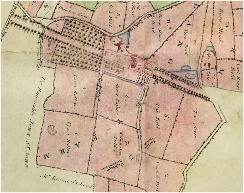
In Borrowman’s book of 1910 he describes Langley after the death of Goodhart in 1903 “who died in 1903 at an advanced age. Since that date the mansion has been untenanted “and will no doubt, ere long, share the usual fate of mansions near London, and be demolished. He goes on to describe “a large rambling building in a bad state of repair with rooms of all sorts of shapes and sizes. The greater number of the principal rooms were very lofty and well lighted. The North East corner or higher portion of the building was evidently of a different date to the other which is much lower and covered with white stucco. The porch which is on the west side was insignificant and the carriage drive approach was also mean compared with the size of the mansion. Although the dining room and library were fine rooms, the principal room was undoubtedly the drawing room a magnificent apartment about 45x30ft with frescoes round the upper part of the walls representing the arts and sciences. There was also a fine marble mantlepiece. An organ, stated to have formerly been in the parish church, used to stand in the library, but it was sold with the furniture on the death of C E Goodhart. From some of the upper windows and from the roof, fine and extensive views were obtained of the park and the “vista” of trees extending from the east front of the mansion to Hayes Lane near Pickhurst Hill.”
The 1769 Andrews, Drury and Herbert map of Kent shows Langley and although the inherited errors such as inaccurate road orientations and place name spellings it does show some interesting features. For instance the two outbuildings or wings of Langlay house which appear in Hasted's print are visibe on the east side of the building and also some buildings adjacent to Hayes Lane at the end of the avenue of trees. Mrs (Amy) Burrell is shown as owner/occupant of Langley indicating that she had taken up residence at or before the time of the death of her brother Jones Raymond.The 1809 Burrell estate map shows Langley after Repton's suggestions are apparently mostly ignored? The avenue looks intact but long ponds near the house have either been partly filled in or abandoned. Some evidence of them still exists. The only lakes or ponds were on the earlier maps already and not sweeping river vista is evident. The old road from Wickham Green looks abandoned and a track from Red Lodge to the avenue is shown plus the newer roads at the left of this image. Some alignment of trees from Wickham Green toward the house indicate either the old road or even close to the alignment of the Roman Road.
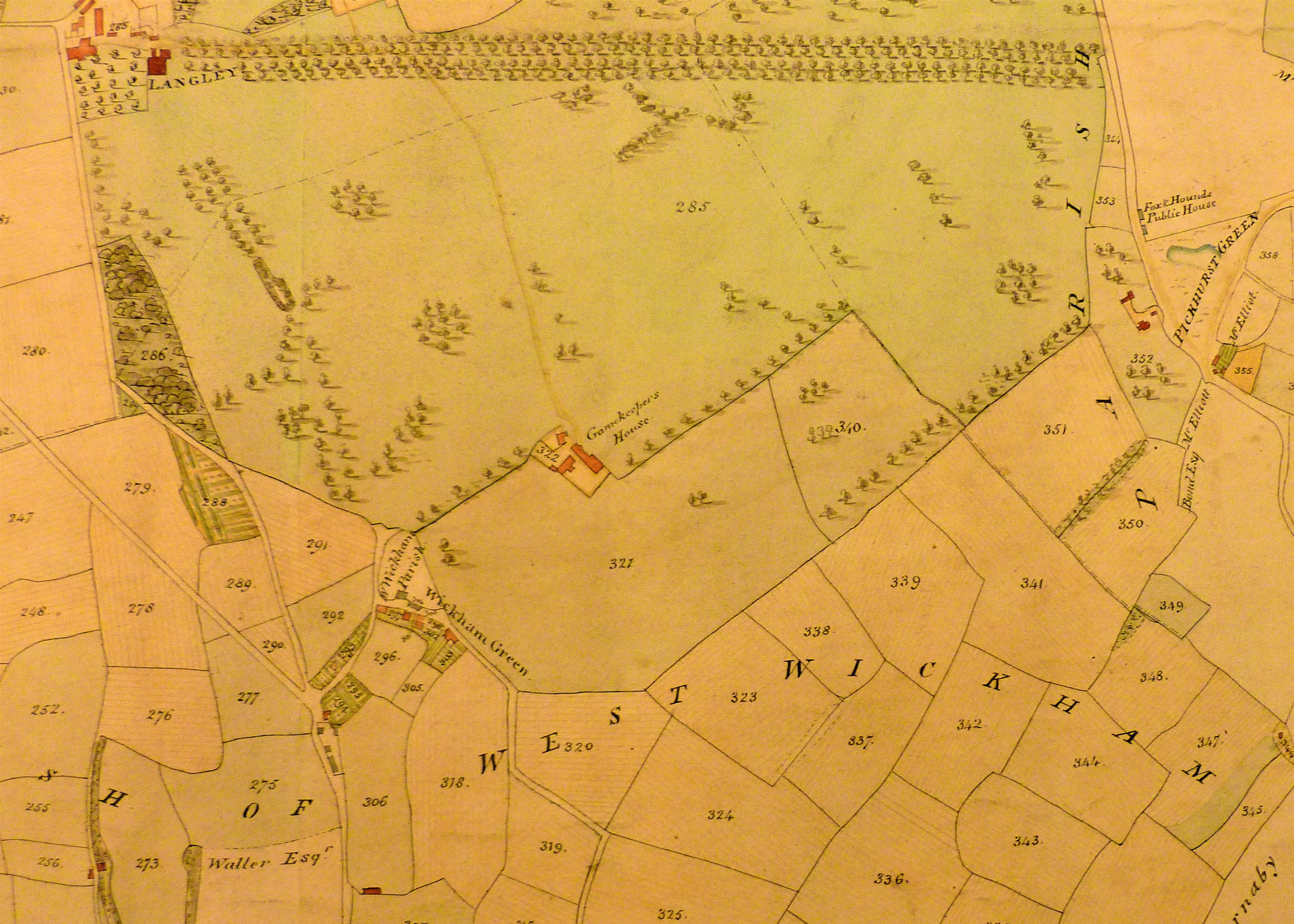
When Emanuel Goodhart aquired Langley and Langley Farm the farm was leased to Lancelot Holland and this below is believed to be part of the lease deeds showing the farm "mansion" and grounds. The footprint of the building appears to include the former Starve Acre or Cuts Croft building shown on the circa 1780/93 map which indicated that parts here had been owned by John Cator after he acquired parts of Foxgrove Manor circa 1757/59. The names Starve Acre and Cuts Croft have been lost by this time through the Burrell ownership period. and transition to "Langley Farm".
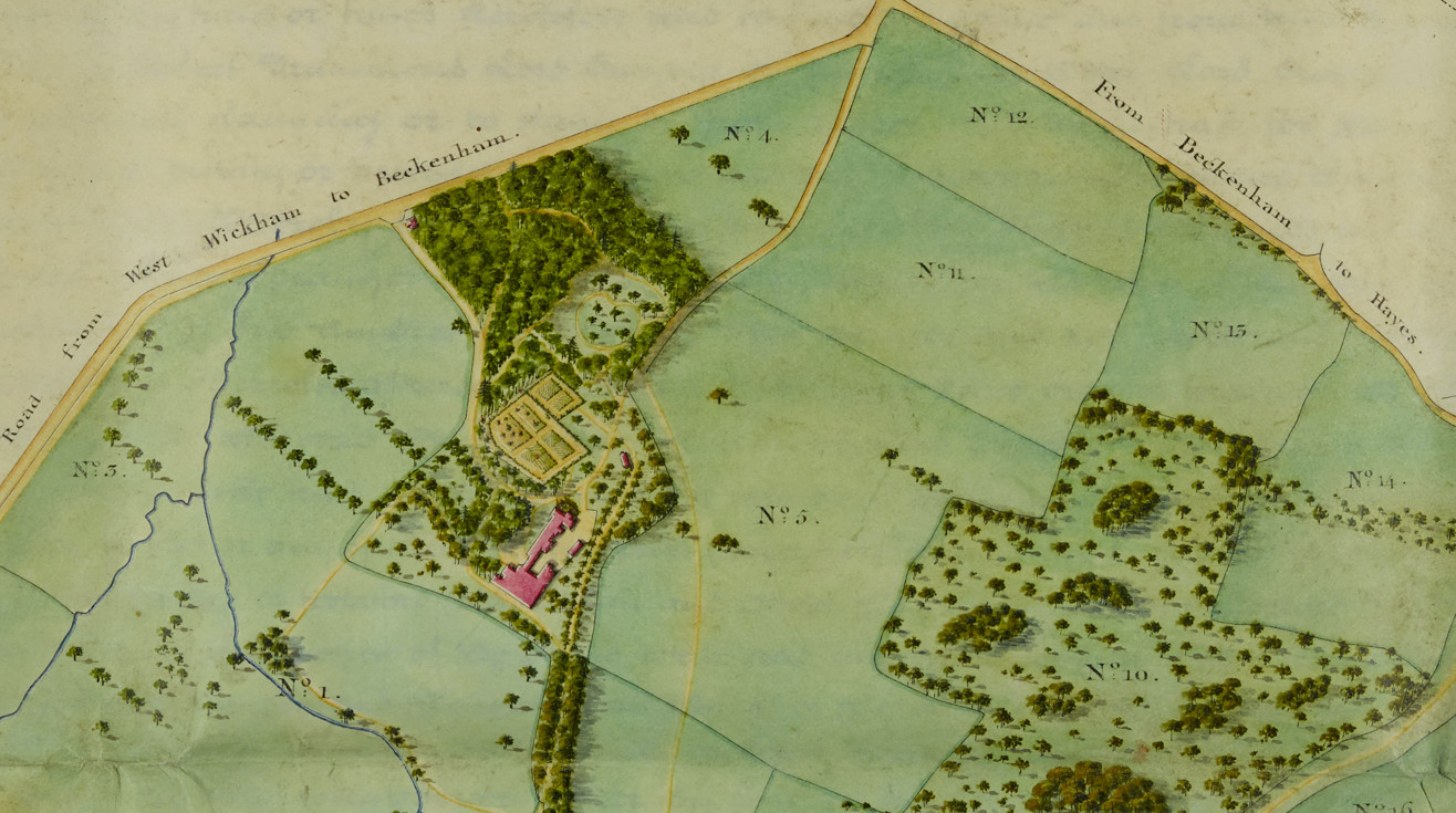
Starve Acre/Cuts Croft below. Neither of these two maps is not orientated north uppermost so some rotation is required.
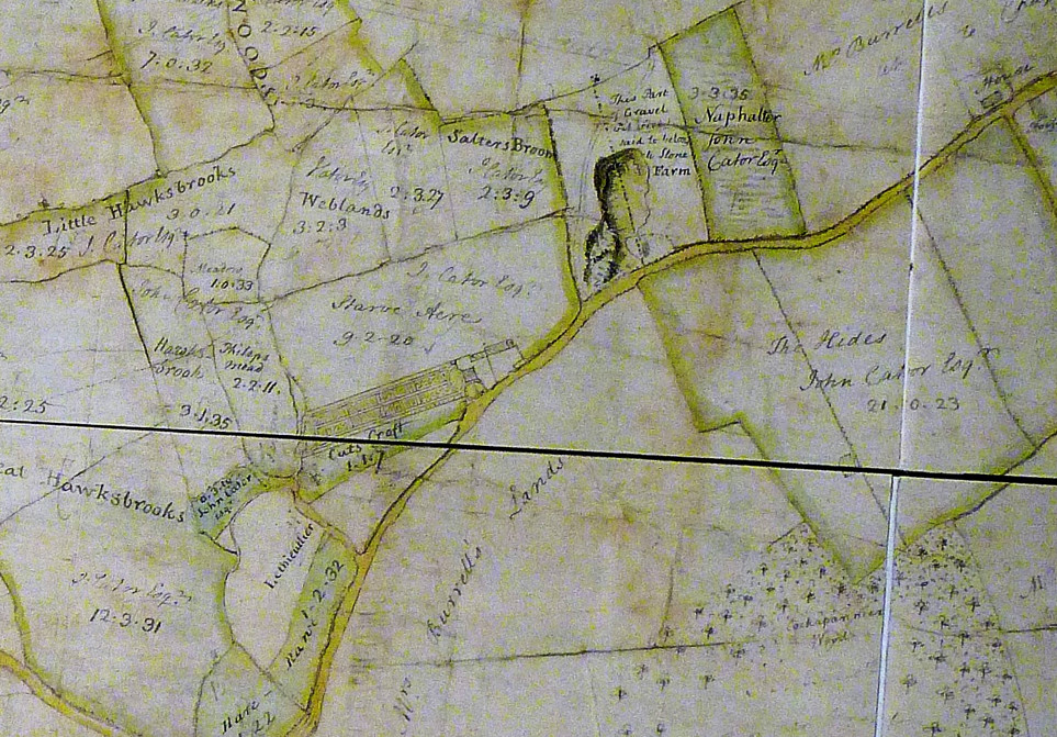
The 1838 Tithe map shows Langley in a high degree of detail. A small Ice House was to the south of the house just below the bottom of this map extrac and next to a long water feature which would have been the source of ice. The Tithe returns are numbered to identify the house and outbuildings. The house next to ‘860’ and the other buildings just described as Farm Yard and Buildings. Everything including Langley Lodge is owned and ‘in hand’ by Emanuel Goodhart.
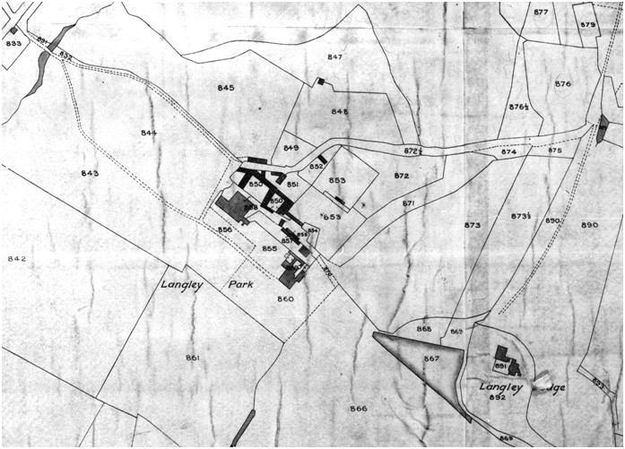
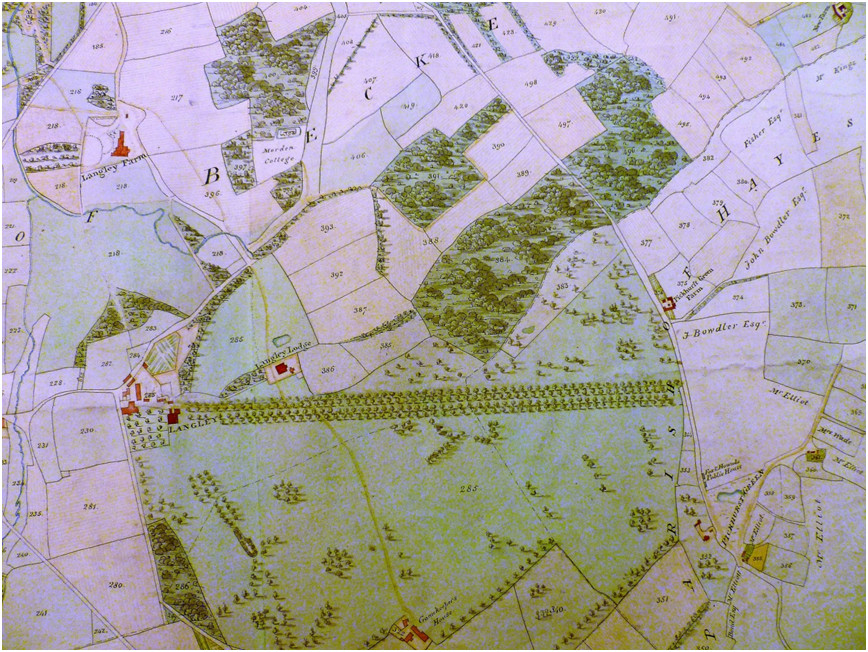
Langley main buildings 1838 tithe map Langley in relation to Langley Farm 1809 Burrell map
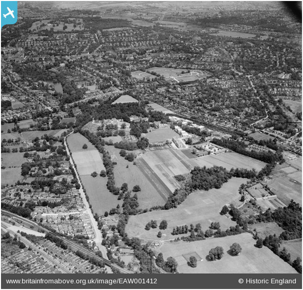
Langley Ponds and Roman Bath
The Jones Raymond map and the ‘Second Schedule’ map dated to a copy of 1735 show a pond south of Langley house with a long canal toward the house which feeds three long ponds of varying lengths, the longest running west to east was about 500 feet in length. A bathhouse or cold bath, the term 'Roman Bath' seems to have been applied later, was probably to an 18th or 19th Century folly but shown on 19th Century ordnance survey maps between the southern pond and the the canal. We cannot say whether the Styles, Raymonds and Burrells were aware of the Roman Road running close to Langley as it was most likely already buried and no contemporary roads follow its course. But certainly during the occupation by the Goodharts it was referred to as the Roman Bath and was seemingly remodelled at least once. As already stated, the diarist John Evelyn, a keen gardener, describes several garden water features as Canals, they being long narrow stretches of water. The bath is said to be fed by a spring and the old maps show several ponds and streams in the area being the Beck and/or Hawksbrook, pond at Wickham Green and around Langley House. Water sheds off of the hills of Addington and Spring Park (aptly named) and the Beck runs through High Broom Wood and passes to the west of Langley House. There is some confusion as to what people refer to as the Roman Bath, either the pond or the bathhouse.I would regard the bathhouse as the Roman Bath as it resembles in some ways the Fridgidarium which was part of ancient Roman baths.
Second Schedule map rotated to align images
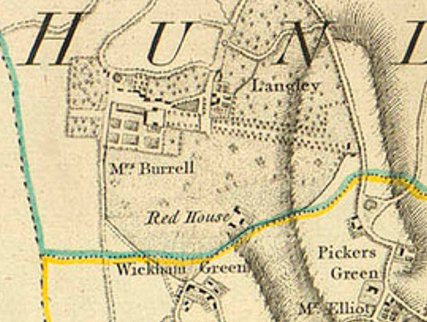
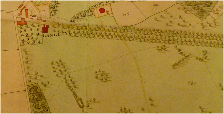
Langley House and Langley Lodge top of map, ‘bath’ feature at bottom just right of woodland. The Burrell map excludes the canal and long ponds ner the house as though they have been abandoned and possibly partly filled in and drained.
The sale particulars of 1820 describe a 'Cold Bath' and whether this just means the pond at the spring or the additional bathhouse is unclear. Recent clearing of the overgrown bathhouse remains shows that the structure of the bathhouse was with former demolition rubble of varying ages. Borrowman also describes a Woe Waters pool at Langley which was said to be a bad omen if it dried up. We have observed that the water flow varies with the seasons unsurprisingly so particularly dry periods may lead to the pool drying out. The pool and bathhouse structure form a dam or weir impeding the flow from the spring.
Tookey Collection photograph, the plunge pool in the bathhouse.
Langley Farm and Langley Court
Langley Farm which later became Langley Court was created circa 1793 after exchanges of land between John Cator and Peter Burrell/Lord Gwydir.
As already said, the circa 1740, probably 1735, Jones Raymond's map of Langley shows Langley House as the epicentre and referred to as ‘Langley Farm’ and some of what land became the later Langley Farm was partly in the possession of the Tolson Tilly’s as part of Foxgrove Manor. Other parts called the Hides were part of Beckenham Manor owned by Sir John St. John.
Mary Tilly's will of 1743 divided Foxgrove between various kinfolk who sold their shares, some came into the possession of John Cator and some to Jones Raymond. Some Beckenham Manor land then in the possession of Frederick St. John also became Cator’s after 1773 including parts close to Langley Farm. When Jones Raymond died in 1768 his property came down to his sister Amy Burrell who was by that time widowed from Peter Burrell II. So Amy and her son Peter Burrell III were still exchanging land with Cator from 1759, some in 1777 and the rest in 1793 after Amy’s death in 1789. Peter Burrell III had died in 1775 which might have prompted the small exchange with Cator in 1777? So in 1789 Peter Burrell IV (Baron Gwydir) inherited the whole. We believe the Burrells had carried out alterations and rebuilds of Langley House and also leased Eden Park so Langley Farm was created out northern parts of Langley and of some lands acquired from about 1759 onwards which had been Foxgrove Manor or Beckenham Manor land. Some smaller acquisitions locally by the Burrells maybe involved as the names of Lethieullier, Gatton and Hare are on some smaller properties in the area.
Much later after the Burrell 1820 estate sale Langley Farm was rebuilt as Langley Court in 1886 eventually becoming the Wellcome Foundation.It is necessary to compare the 1838 Tithe map showing Langley Farm with the map of the northern section of Langley described as the ‘Second Schedule’ from Kent Archive ref; U1435/T20 described as Including conveyance by trustees of Lord Gwydyr with map annexed 1826, and conveyance to Emmanuel Goodhart of Langley Park; 1829; the conveyance of 1826 having two Maps annexed, one contemporary, the other a copy of an original dated 1735.
This latter map does not show the buildings of Langley Farm but comparison with the tithe map puts Langley Farm in a field named Starve Acre and further comparison with a map from the British Library shows a messuage called Cuts Croft in this approximate position which is shown on the 1720/1766 Foxgrove map and the 1780 Burrell map.
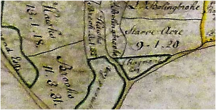
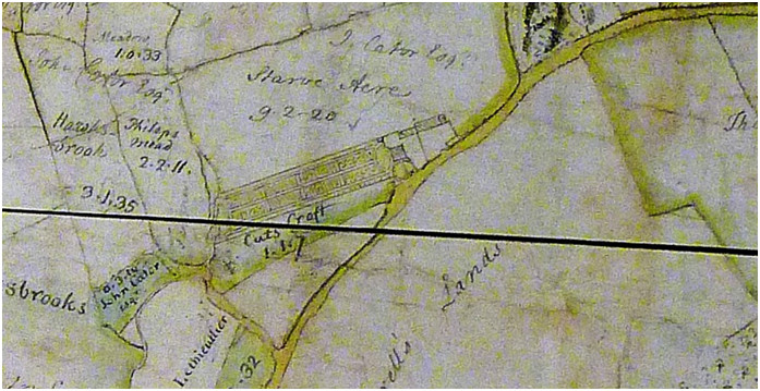
Foxgrove map 1766 compared to Burrell map 1780, Starve Acre belonging to Cator, Cuts Croft to Jones Raymond and later the Burrells
Starve
Acre and Cuts Croft (formerly Waiters Broom),
extract of a map shows Cator property around Kelsey and Langley prior
to 1793
exchanges and believed to be part of deeds related to the 1793 property
exchange in Burrell documents placed in the British Library.
The
long footprint of the building in Starve Acre/Cuts
Croft, could have been incorporated into the new or extended Langley
Farm. On
this map the road junction top left corner is where the Chinese Garage
roundabout
is today and the road ran roughly parallel to what is now Wickham Way.
What
later became Langley Farm from
around 1793-95 was created out of parts of the northern Langley Estate
and
other land which had come into the ownership of the Burrells from the
intermarriage of Peter Burrell and Amy Raymond and exchanges of some of
John
Cator’s land which had been parts of either Foxgrove Manor or Beckenham Manor
that he acquired.
This was because the property of all these local estates was more
intermingled
than would be imagined and is evidenced by a series of estate maps and
property
conveyances.
The
1793 exchange of property
between Peter Burrell IV (Lord Gwydir) and John Cator consolidated
Cator
property mainly north of the village and Burrell property mainly south
of the
village. We may consider that Manors and Estates had been sufficiently
re-arranged by this time to render old manors and estates as
disseminated but
significantly Langley and Kelsey including Eden Farm were Burrell and
substantial parts of Beckenham Manor and Foxgrove including Kent House
were
Cator although the Burrells had the old Beckenham Manor house and
grounds from
an earlier exchange with Frederick St. John (2nd Viscount Bolingbroke)
in 1757.
Hence,
Langley Farm was created probably on the site
of a former house called Starve Acre or Cuts Croft.
This
“New” Langley Farm was leased by the Burrells until
the Burrell Estate sale of 1820. Langley Farm covered about 250 acres
(described by Borrowman) and was occupied by A.W. Colvile in 1820 and
probably
from 1806 who had married Marie Louisa Eden in that year, daughter of
William
Eden who leased Eden Farm from the Burrells. Andrew
Colvile (born Andrew
Wedderburn; 6 November 1779 – 3 February 1856) was a
Scottish businessman,
notable as the governor of the Hudson's Bay Company, a huge
organisation
set up for the North American fur trade but also
instrumental in the
early history of Canada. He was also chairman of
the West India Docks
(and other more questionable activities?). Although we have no evidence
from
the Burrell 1809 estate book of Langley Farm being occupied by Colville
he had
other farm property leased from Burrell near Chancery Lane.
We are left with the possibility that after the Burrells acquired the former Cator held property mid 1790’s that Cuts Croft was later improved for leasing to Colvile in the same manner that Eden Farm was leased to William Eden.
Eden Colvile was born at Langley Farm in 1819 (Wikipedia) "Colvile was born at Langley Farm,[1][2] part of the Langley Park Estate, near Beckenham, Kent, England, son of Andrew Colvile and
Mary Louisa Eden. His father was a merchant and member of board of the
Hudson's Bay Company. His mother was fifth daughter of William Eden, 1st Baron Auckland,
and thus connected to an influential family of politicians and
diplomats.". In 1824 Eleanor Colvile was buried at the age of 16,
being the only Colvile recorded in Beckenham burials we assume the
Colviles were still resident at Langley Farm until that date.
Emanuel
Goodhart bought Langley and Langley Farm in
the 1820 sale and leased Langley Farm consisting of 96 acres (1838
tithe
schedule) to Lancelot Holland who lived there in 1830 (Borrowman
mentions a Henry Howard in occupation in 1820 but it needs confirming)
and shown on
the 1838 Tithe and 1841 census with a large family and several servants
and on
the 1851 census he is described as Colonel and Magistrate, he died in
1859. In
1861 Lancelot’s widow Charlotte is head of the household with
three daughters
residing. Mrs. Holland, the widow who died in 1876, was buried in the
St.
Georges Churchyard but had apparently moved out of the farm by 1871;
one of her
sons occupied Beckenham Place for a time. The eldest son, Henry
Lancelot
Holland, born 1808 in Dorking, moved to Marylebone and then Wimbledon.
This son Henry, a Governor of
the Bank of England from 1865 to 1867 apart from his other business
interests,
married a daughter of Peter Cator of The Hall, Bromley Road, Martha, in
1844.
A
subsequent tenant of Langley Farm described as
“mansion”
on the 1871 census was Mrs. Caroline Cator wife of Admiral Ralph Cator,
and
widow of Adam Gladstone. Ralph Cator was the eldest son of Peter Cator.
Ralph and Caroline were aged about 40 and 45 respectively at the time
of their
marriage and Caroline’s only children were by her first
marriage to Adam
Gladstone, an East India merchant. The 1881 census shows only a butler
and
staff in occupation of Langley Farm so Ralph and Caroline may have been
visiting elsewhere, Caroline probably with a sister in Leamington. We
may
assume that Ralph Cator may have been on active service as in 1861 he
was
listed as Commander in Bangalore, East Indies. By 1891 Ralph and
Caroline had
moved to Hazelwood Mansion in Abbotts Langley, Hertfordshire.
The
Goodharts had sold Stone Farm in 1868 which
they had also purchased in 1820. It adjoined Langley Farm so a sale
record for Langley Farm is sought either to
Ralph Cator or most likely later to James Lloyd Bucknall who had it
demolished
in 1886 when Langley Court was built on the same site, the architect
being
James Barnett, of Beckenham. On the 1911 census record the house was
occupied
by James Loyd Bucknall a shipowner. He most likely live there until his
death
in 1917, he and his wife who died in 1899 were buried at St. Georges.
Langley
Court was taken over in 1920 by the Wellcome Foundation Laboratories
when they
moved from Brockwell Park, since when extensive premises for medical
research
have been added. The Copeland Bromleag magazine article says the Court
was
occupied as a WWI prisoner of war camp in 1916.
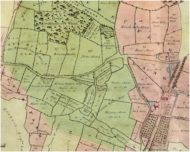
Part of the ‘Second Schedule’ map courtesy of Kent Archive
The names of Tolson Tilly, St.John, Lethieullier and Maudlin(Morden) can be seen on various fields as annotated prior to John Cator acquiring some as part of his acquisitions from Foxgrove Manor and Beckenham Manor. For explanation as to how Tolson Tilly acquired the lands you will need to follow the descent of Foxgrove Manor.
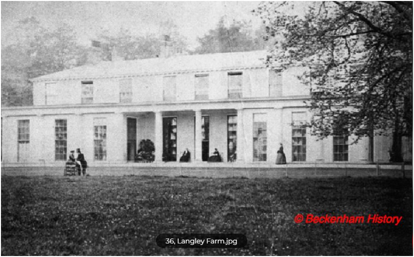
Langley Farm mid 19th Century (courtesy of Beckenham History)
Langley Farm was sold by the Burrells as part of the 1820 sale of the Kelsey and Langley estates. The farm was demolished and Langley Court constructed
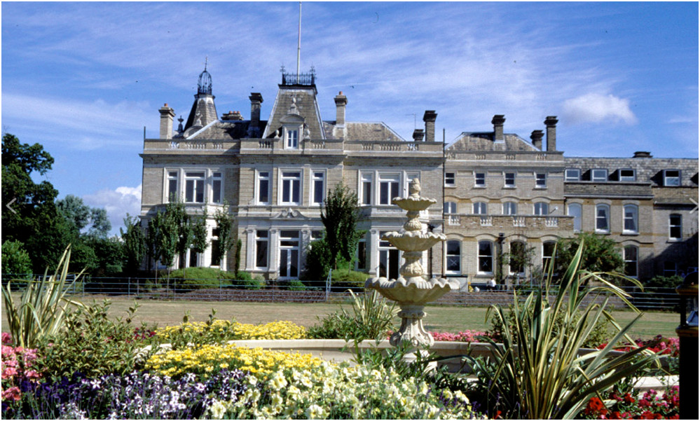
Langley Court image courtesy of Beckenham Heritage Group
The Burrell Chapel
Robert Borrowman described the chapel in his 1910 Beckenham Past and Present, estimating that it might be the oldest building in Beckenham. Whether the Burrells build it is in question as a Chapel is described as being built by the Stiles of Langley, but that may have been one of the wings of the building in the image we have of Langley from Hasted. However, here is an image of the building
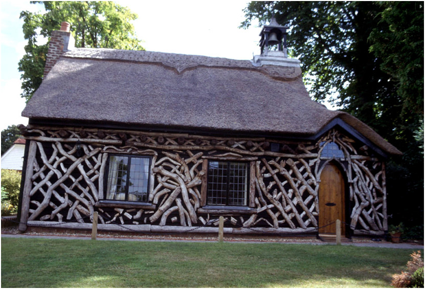
I assume the log décor is a more recent addition.
Is part of the Langley Park estate and due to the discovery of panelling which has ended up in the Philadelphia Museum of Art may be dated to 1529 and the Style family although this is subject to some discussion. The actual origin is debatable but it may be a lodge built by John Style and added to by his son Humphrey Style. The name is memorialized in the name of Red Lodge Road and is in West Wickham Parish as the Langley estate extended into Beckenham, West Wickham, Bromley and Hayes. This piece of provenance for the panelling describes the Lodge.
“Red Lodge was the name given to a small house which occupied a site in the fields near Wickham Green on the borders of the Langley Estate - the Frithwood of medieval times - which belonged to the manor of West Wickham. Translated into 20th century parlance, that means a site to the north of St. Mary's church in The Avenue and in the garden of St. Mary's vicarage. When Lord Gwydir, owner of the Langley Estate, died in 1820 his estates were broken up and sold at auction. The sale catalogue of the Langley Estate contained "Lot 1, Pt Item 322, Gamekeeper's House, Yard and Garden la Or 35p (acres,roods,perchers) ", in fact, Red Lodge.
Frithwood is difficult to define since other woods are called Frith which can apparently mean refuge or safety. Possibly Frith Wood covered a much larger area at one time like the Great North Wood.
Red Lodge was purchased, together with Langley House, by Emmanuel Goodhart. The Goodhart family occupied Langley House until 1903 when the then owner, Charles Goodhart, died and left the property to seven heirs, none of whom was inclined to live there. Possibly the estate was in a trust or 'in tail' for descendants as Charles' father Emanuel had put in his will that property was 'for the use of' which could imply it was intended for property to follow the family line.. The reason is given that because London or urban development was rapidly encroaching on the neighbourhood. In 1910 Langley House became the clubhouse for the new Langley Park Golf Club. Red Lodge continued life as a farmhouse where Victor Stock was the tenant farmer in 1921.
Gordon Maxwell wrote The Fringe of London (1925) in which he mourned the passing of the Langley Estate. "Another of the big country estates that lie on the Kentish fringe of London is in its death throes, its throat being cut by the housing shortage. This is Langley Park, Beckenham, and although but 12 miles from the heart of London, anyone wandering there today will still be in the heart of the country. Fine old trees, pleasant meadows, ponds half-hidden amongst the greenery, and woodland groves, are all that meet the eye of the rambler, over what is certainly one of the finest estates in the Home Counties." Gordon Maxwell also wrote about the Bath House which Emily Hall of Ravenswood had visited in 1877. “The Bath House, about a quarter of a mile from the site of the mansion, is also worth inspection. Here is a stone—built bath, after the Roman fashion, fed with spring water. Close by are the remains of the old Ice House where ice from the ponds was stored underground in winter for use in summer.“ Gordon Maxwell continued - "A small farm - Red Lodge Farm - near the Venison House, [referred to earlier in the text as a "memory of the days ... when Langley Park was one of the finest deer-parks round London“] is a delightfully picturesque little place, whose farm-yards extend to the woodlands that cloak one end of the estate. By the courtesy of the bailiff I was able to inspect the farm-house. Some of the upper rooms contain some very fine 16th century oak panelling, which proves this house to be the oldest existing building on the estate. It is a charming little place, which I sincerely hope will be left with enough land to preserve its quaint beauty. Sadly that wish was not be fulfilled for Red Lodge was sold soon after. The ancient oak panelling was offered to a granddaughter of Charles Goodhart, Mrs. Frederick McCormack- Goodhart, of Langley Park, Maryland, U.S.A., but she was obliged to decline the offer not. having the appropriate space in which to erect the panelling. It was sold in 1923 to E.H.Budd of Reading who, in turn, sold it to Acton Surgey Ltd. The Pennsylvania Museum of Art (now the Philadelphia Museum of Art), was able, with finance provided by an American, William L.McLean, to acquire the panelling which is now on display in the museum. The Revd. Sir Henry Denny, rector of St. John the Baptist church, West Wickham, inspected the oak panels before they were removed. He wrote to the Beckenham Journal on 15 September 1928: "They cover the walls of an upper room and are evidently in their original condition ... The date 1529 appears repeatedly as do also the following badges, the Tudor Rose, the Prince of Wales feathers, the fleur-de-lis of France and the pomegranates of Aragon - but I could discover no armorial bearings. Round Medallions bear heads, some of which may be portraits of Royal personages." The Pennsylvania Museum Bulletin of November 1936 elaborated : "The panels which form the Wainscot have each a wreathed branded medallion. In the vertical panels this forms the central feature of an arabesque design, with vases, leafy stems, pairs of dolphins, scrolls or cornucopias and occasional birds ... A further romantic interest is given to the room by the suggestion advanced by the Revd. Sir Henry Denny of West Wickham that it may have served as a trysting place for Henry VIII and Anne Boleyn — the presence on the panelling of the royal badges with absence of private armorial bearings, has been taken to suggest that the house was a royal hunting lodge where the king used to stay on his visits to Wickham Court. Efforts were made to save Red Lodge and the Revd. Sir Henry Denny argued that it should be scheduled for preservation and used as a local museum. But all to no avail. Red Lodge was demolished sometime between 1947 and 1954. These latter dates are deduced and confirmed from available map and aerial photo evidence.
If we review the details of Red Lodge we might come to different conclusions. No dating evidence apart from the panelling is recorded. The print of Langley in Hasted's history of Kent shows what appear to be Tudor wings to a perhaps later house. We might conjecture that the panelling was removed to Red Lodge when Tudor buildings were demolished? Red Lodge would be a very modest sized building even by Tudor standards for royalty. The earliest visible record we have of Red Lodge is the circa 1750 map of the estate then belonging to Jones Raymond and it is shown as a farm leased to a Richard Cooper. On the subsequent 1809 maps drawn for Lord Gwydir(Peter Burrell IV) it is shown as a gamekeepers cottage and later described as having a 'venison house' presumably for the butchering of deer from the park. The Goodharts acquired the lodge along with much of the Langley estate in 1820 and it was sole by them around 1910.
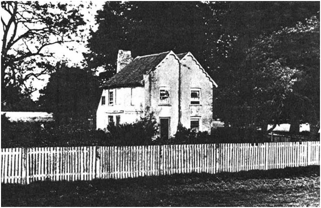
Red Lodge prior to demolition,
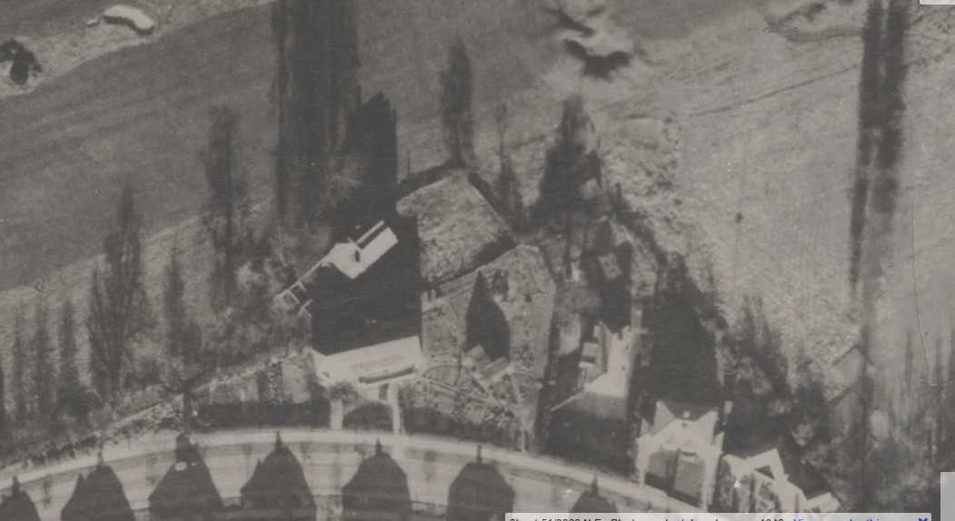
Kent
House and Farm
Kent
House is recorded from the 13th Century and acquired the
name because the Surrey border at Penge was nearby and this was a
nearest
house on the Kent side of the county border.
Some have said erroneously that it is the first house in Kent
from
London. Other places were obviously close to the border i.e. Kent
Hatch, Kent Gate. Where records have been discovered it is mentioned in
the
timeline.
Hasted only mentions it after it became the property of the
Lethieullier family
and Philipot didn’t mention it at all possibly because no one
of
high
enough
status was known to have resided there. However it was the property of
several
tradesmen, aldermen and merchants. In 1871 Thomas Covell was farming
Kent House
as a
tenant of the Cators. Edwin Covell was later a tenant of Beckenham
Place but in
1871 was resident at Beckenham Lodge (See Beckenham Lodge paragraph).
Philipot does not mention Kent House but Hasted writes this brief account:
"KENT-HOUSE is situated on the very edge of this county, towards Surry, and seems to be so called either from it’s having been once the outer bounds of this county, or from having been formerly the first house on the entrance into this parish within this county, from that of Surry. It was for some generations in the possession of the family of Lethieullier; the first of whom was Sir John Le Thieullier a Hamburgh merchant, who had raised himself by his industry in trade, and settled in this parish. He devised it at his death to his son, William Lethieullier, of this parish, esq. who by his will gave it, with his mansion and other estates in Beckenham, to his second son, Manning Lethieullier, esq. whose son, John Greene Lethieullier, esq. alienated it, in 1776, to Thomas Lucas, of Lee, in this county, esq. who died possessed of it in 1784, leaving his widow surviving, who re-marrying John Julius Angerstein, of Charlton, esq. he is, in her right, at this time possessed of it."
To address Hasted’s account firstly, in Hasted’s appendix of errata he states that Kent House is occupied as a farm at the time of his writing or publishing. Sir John Lethieullier certainly acquired Kent House in 1709 from John Reynolds. Lethieullier also had substantial other property in Lewisham such as a large house near Lewisham church, St. Mary’s and property at Bromley and Wickham. Subsequent family wills describe property in Essex, Suffolk and elsewhere whether acquired by John Lethieullier or accumulated through family intermarriage is too complicated to investigate here. Manning Lethieullier describes Kent House occupied by a Mr Bolt and a subsequent advertisement by John Green Lethieullier to sell the estate describes rental income. If the Lethieulliers did reside at Kent House it wasn’t full time and they had several other properties such as the Manor House at Lee. They are also credited with building Clock House circa 1710-1723 which was a residence for some of the Lethieullier family. Subsequent to John Julius Angerstein acquiring it by marrying Thomas Lucas’s widow Elizabeth, Kent House was acquired by John Barwell Cator from the Barings in 1829.
Earlier records can be found relating to Kenthous (sic) Kenthouse and Kent House at the National Archive and elsewhere and these have lead to more research. Len Hevey believes it was originally part of Beckenham Manor like Foxgrove and Langley and over time these parts became separated from the Manor. As it is possible or likely that certain villagers had freehold property since before Domesday and the Crown and Church weren't recorded in Domesday then the earlier ownership of land is still a mystery in many respects.
We
can
put together a chain of owners or occupants possibly from 1324 and it
is
mentioned by name in 1346 that “Master Henry de Clyf, clerk,
deceased,
lately
granted by his deed to Henry de Seccheford, now deceased, and Alice his
wife to
hold a messuage, 140 acres of land called Kenthouse
in Beghenham,
co.
Kent, of him, rendering 40s. yearly to him, so that if Henry and Alice
should
die without an heir of their bodies, the messuage and land should
remain to
Hugh son of John de Balne, and Master Henry granted by his deed to Hugh
the said
40s. yearly, Hugh has released to Alice, who now holds the messuage and
land,
the said 40s. rent and all his right and claim in the messuage and
land.
Witnesses: Sir Maurice le Brune, Sir William le Brune, knights, John de
Huntyngfeld, Peter Godesone, Andrew de Seccheford, Hugh le Hatter of
Croidon,
John le Mazon of Beghenham. Dated
at Beghenham on
Wednesday
after St. Mark, 1346.
Memorandum that Hugh came into chancery at Westminster on 27
April
and
acknowledged the preceding deed. (BHO)”
All references to Kent House have been entered into the timeline even if they are overlooked in this summary. A record from 1503 indicates a family called Fabyan held Kenthouse with land in Beckenham, Lewisham and Battersey probably from as early as 1469. Certainly the Style family are associated with Kent House in 1501 and 1624 seemingly acquiring it in a legal process arising from an unpaid debt and a court case accusing John Style of murder of a Kent House occupant. Before that, in 1346 Henry de Clyf and in 1384 John Leeg is mentioned as the manor of Kent House. From 1691 a bundle of records in Lewisham Archive describe a chain of exchanges and the Lethieulliers acquired Kenthouse in 1709 and are thought to have built Clock House circa 1716/30. Kent House passed through the Baring banking family and John Barwell Cator acquired it in 1828. The 1838 Tithe describes it as a farm occupied by Michael Mathew Senior, tenant of John (Barwell) Cator. In 1861 Edmund King an Army Contractor and Merchant occupies Kent House and the farm is occupied by Charles Ansel a farm labourer. Kent House would have begun to dissolve into urban development along with other Cator Estate property and by the 1880’s there are references to houses and roads on the site of Kent House Farm but the 1881 census shows John Langlands, widower, as farmer of Kent House Farm employing 23 men and 2 boys with some extended family and a cook/housekeeper and maid.
1881
Census for Kent House Farm 400 acres?
Some writers have said Kent House was the first house outside the boundaries of London but its proximity to the Kent/Surrey border is the real reason for its name as described by Hasted. It has been compared to Kent Hatch and New Cross which were other places on the county border prior to county boundary changes. The County Boundary used to extend to where Kings Hall Road and Parish Lane meet on the junction of Kent House Road very close to Kent House and Farm. An 1860’s Ordnance Survey map shows Kent House still as farmland with New Beckenham Station annotated as “closed”. By 1894 New Beckenham Station has been moved to its current position, Alexandra Park is firstly established as an athletics ground and cycle track. A few houses are on Kings Hall Road but the Farm buildings and much associated land is still open. The priority for the Cator estate seems to have been to lease Copers Cope Farm property first.
Evidence for possible boundary changes is the extension of the Beckenham parish boundary in the region of Penge which diverts from a line following a watercourse called the Boundary Stream which flows into the Pool River in Cator Park. The stream is now mostly under culverts. Robert Borrowman describes an anecdote whereby the parish boundary was diverted when a body was discovered at Rockhills and only Beckenham parish would claim and bury the body but that may be a red herring as what looks like an extension in the parish boundary is in fact a boundary of an outlying part of Beckenham Manor as shown on the 1623 (1768 copy) Beckenham Manor map.. Penge was in Battersea parish and four boroughs meet at the top of Crystal Palace Parade. In earlier times London did not extend south of the Thames until the metropolis grew into Greater London by encompassing villages which became its suburbs. Kent House will be found referred to in the timeline.
Hasted had only recorded Kent House from the time it came into the possession of the Lethieulliers. It passed through a few owners until it was acquired by the Cators in 1828 and was leased to various farmers or occupants of the house until housing development covered the area. As Kent House Farm and Copers Cope Farm were joined along the course of the Pool River under the Cators it looks like some tenants farmed both together and it is probable that at this time the rivers and streams were straightened to improve drainage and farmland. Also, the Kent House Brickfield became established.
The Canal was established by an Act of Parliament in 1801 and the Croydon Canal opened on 22nd October 1809 and ran from a junction with the Grand Surrey Canal near new Cross Gate to a basin which was situated on a site now occupied by West Croydon station and an adjoining bus station. With 28 locks grouped into two flights, and numerous swing bridges, the canal linked the Thames to Croydon via Forest Hill, Sydenham, and Penge Common. It was a financial failure, the £100 shares falling in value to just two shillings in 1830. The proprietors realised that the coming of the railways was an opportunity not to be missed, and they sold the canal for use as the course of a railway. It closed on 22nd August 1836. Today if you take the stopping train from London Bridge to West Croydon you will follow the route, for much of the way, of the Croydon Canal. There is little trace of it left - only a few remnants remain such as Dacres Wood Nature Reserve and Betts Park near Anerley Station.
The Company was involved in various law suits with local landowners such as John Barwell Cator.
This map thought to be circa 1830 shows part of the route through Sydenham, across Penge Common, via South Norwood and across Croydon Common. The heavily dotted line is the Kent / Surrey border.
The Abbey Farm
This was part of Beckenham Manor's section that was on Penge Common and Rockhills. The Beckenham Manor map 1623 shows it as occupied by Baldwin. The parish registers have entries for burials and baptisms.| 12 Jul 1564 | 1564 | BALDWINE | Robert s of Richarde | |
| 27 Sep 1567 | 1567 | BALDWYNE | Richard (ye younger) | bap 12/9/1567? |
| 29 Apr 1611 | 1611 | BALDWIN | John | bap 1562? |
| 22 Aug 1616 | 1616 | BALDWIN | Richard | |
| 4 Jul 1618 | 1618 | BALDWINE | Edmund | bap 1574 ? |
| 9 Apr 1618 | 1618 | BALDWINE | Edmund s of Edm. | |
| 28 Jul 1624 | 1624 | BALDINE | Alice w of Rich | The Abby |
| 26 Feb 1649 | 1649 | BALDROIN | child of William | Not related ? |
| Baptised | Name | Father | |
| 6/5/1562 | Baldwyn | John | Richard |
| 16/9/1565 | Baldwyne | Nicholas | Richard |
| 12/9/1567 | Baldwyne | Richard | Richard |
| 31/3/1574 | Baldwine | Edmund | Richard |
| 12/5/1576 | Baldwyne | Richard | Richard |
| 20/2/1581 | Baldwyne | Alice | Richard |
| 10/4/1584 | Baldwyne | Elizabeth | John |

133. I. Ordered that Daniel Shetterden shall repay the money advanced
by Giles
Theyer. Dorso,
133. II. Receipt by Giles Theyer for £5. 3s. 4d. received of
Daniel
Shetterden.
18th May 1644.
133. III. Ordered, that as the above-named sum was omitted to be
allowed to Mr.
Shetterden upon the passing of his former sequestration accounts, the
same be
allowed to him out of such sequestration money as is now in his
hands.(end).
Several clergymen were sequestered from their parishes during the Civil War and Republic. Works such as John Walker’s (1674–1747) biography relate the sufferings of the clergy.
The burial records for St. George’s show a few generations of Thayers with spelling variations or transcription differences, several males bearing the name Giles, the first one dying in 1642 could have been the father of the one subjected to the Parliament fine.
A table of baptisms and burials will be inserted here. It shows the common number of premature deaths
St. George’s burial records go back to 1539 so I assume these were the earliest Thayers in the district and the origins for the name of the farm.In 1710 we find Gyles Thayer, son of Gyles Thayer (d.1715?), Farmer of Beckenham being bound apprentice joiner in London to master joiner Joseph Palmer. This may indicate that farming had become unprofitable or a lease on the farm is expiring? This Giles Theyer is traceable until his death in 1774, he apparently married three times.
Apprentice Indenture, Ancestry.co.uk
In 1726 a land transfer describes Thayers Farm as having been leased latterly to John Thayer by the Elwills (heirs of the Stiles) in 1726 for 21 years but John appears to have surrendered the lease or ceased to pay rent or perhaps is employed by Thomas Motley. So the likelihood is that all of Thayers Farm was part of the Langley/Simpson's Place estate and a farmstead leased to the Thayers.
In 1734 a document now in Lincolnshire archive as part of the Ancaster papers (ex-Burrell) shows that Hugh Raymond of Saling Hall, Essex who had acquired Langley and Simpson’s Place sold parts of what became Elmers End Farm and Thayers New Farm to Thomas Motley. The document describes Elmer Farm and land which had been leased to John Thayer by Sir John Elwill, husband of Elizabeth Stile. Elwills heir had sold the property to Raymond in 1732. This property around Elmers End, Backs Lane and Thayers Farm is described as having been part of the Simpson’s Place estate. Since we find nearly all the estates had outlying and remote properties attached to them this is indeed feasible. It further raises questions as to how or whether the Elmers (Aylmers) owned Elmer Farm or were leaseholders or feoffees. See 1734 for more detail.
In 1736 the farm belongs to Thomas Motley and partly let to William Lewin. So where the later Thayers lived, worked and died is a mystery. It’s possible they remained as labourers on the farm. John Thayer, son of Giles dying in 1786 and buried at St. George’s is the last record, “Thares” is either a misread/transcription/variation error. The drawing up of the map may have related to Motley’s acquisition of the property but it is contemporary with other maps drawn around this time such as the Burrell Kelsey estate maps 1723 and 1735 and the Foxgrove Manor map 1720. I believe that undated maps of Langley are circa 1738 as well. So the dates of the maps may have been to clarify local land ownership given the complexity of interlocking and overlapping boundaries, exchanges, inheritance and marriage settlements. The gaps in the 'map' record probably occurred because maps got distributed with land deeds and could be in any private or public archive, unlisted, lost or destroyed?
There is still some mystery as to how the farm came into Motley’s possession but in 1734 Motley purchased land from Hugh Raymond called Elmer Farm consisting of what became parts of Elmers End Old and New Farms and Thayers New farm which abutted Thayers Old farm. The land transfer describes Thayers Farm as having been leased latterly to John Thayer by the Elwills (heirs of the Stiles) in 1726 for 21 years but John appears to have surrendered the lease or ceased to pay rent or perhaps is employed by Motley.
Motley is shown as occupying Thayer’s Old Farm (fields 1-8 on the left of the map) and Lewin occupied the new farm. There is a slight shading difference as well as the field numbers. It is probable that Motley did not farm but occupied the house while labour was employed from within the village where later census records (1840/50) show there was a good supply of farm labour. Not much can be found about the Lewins apart from burial records, they may have worked both parts of the farm.
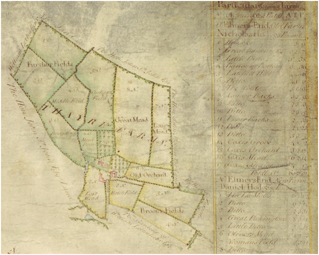
Kent Archive; Thomas Motley 1736, spelling variation “Thayre”. Land bounded by Lethieullier, St.John and Weston
William Lewin apparently died in 1743 and an unnamed relative died in the workhouse in 1792 aged 75. Four Lewins died in infancy between 1723 and 1734. Feasibly, the Lewen dying in the workhouse in 1792 may have been another Thomas and the infant deaths all fall within a similar time period 1723-34. The workhouse mentioned is probably Beckenham workhouse which was situated near The Hall, Bromley Road (Clay Hill), a small institution no more than a cottage with a field shown on some maps.
|
14 Feb 1716 |
LEWEN |
Thomas |
||
|
23 Jun 1726 |
LEWEN |
Thomas |
inf |
|
|
4 Apr 1792 |
LEWEN |
Workhouse |
75 |
|
|
24 Jan 1686 |
LEWIN |
John |
||
|
27 Sep 1825 |
LEWIN |
Mary |
Croydon |
73 |
|
16 Dec 1734 |
LEWIN |
Peter |
inf |
|
|
4 Oct 1730 |
LEWIN |
Tho. |
inf |
|
|
31 Dec 1743 |
LEWIN |
Wm |
||
|
10 Feb 1681 |
LEWIN d. 5.2.1681 |
(Mrs) |
||
|
27 Nov 1727 |
LEWIN(LEWEN?) |
Mary |
||
|
18 Jun 1723 |
LEWIN(LEWEN?) |
Wm |
inf |
Problems with accessing Beckenham births and marriages prevent a fuller account. We know that Thayer’s Farm descended from Thomas Motley to the Austin family through intermarriage. Thomas Motley’s daughter married Francis Austin and their son, Francis Motley Austin went on to acquire the estates of the Lennards of Kippington near Sevenoaks and other property through his activities as a lawyer and advancing a mortgage to the Lennards which they were unable to repay. The Austins and Lennards were cousins through intermarriage. Francis Motley Austin married Elizabeth Wilson, daughter of Sir Thomas Wilson of West Wickham (d.1774). The Austins were related to Jane Austen who visited the Sevenoaks property but is not known to have visited Beckenham. Austin and Austen are just spelling variations. Thomas Motley also owned the “Old” and “New” farms at Elmers End and the mansion house in the High Street whose grounds covered Thornton’s Corner, called The Mead in 1736 with extensive formal water features which later were re-landscaped to be the informal grounds of Village Place. A series of maps give a good idea of the structure of the village from 1623 but it is probably that several lowly dwellings are omitted until we get to the Burrel estate maps of 1809. Francis Motley Austin died in 1815 and the Cator Estate map of 1833 shows Thayers Farm still owned by “G. Austin Esq.”. Francis Motley Austin and Elizabeth Wilson had nine children by my estimation, one named George who may be the G.Austin on the 1833 map. As F.M.Austin had immense wealth and properties maybe George got Thayer’s Farm as part of his share. References to Thayer’s Farm in archives are elusive but we have a few.
In 1769 Thayer's Farm is shown as "Nottelly Farm" on the Andrews map but this is a corruption of "Motley" from the time Thomas Motley owned Thayer's Old and New Farms and occupied the Old Farm while Lewin leased the New Farm. Motley died in 1757 so the name hung around for some years it seems.
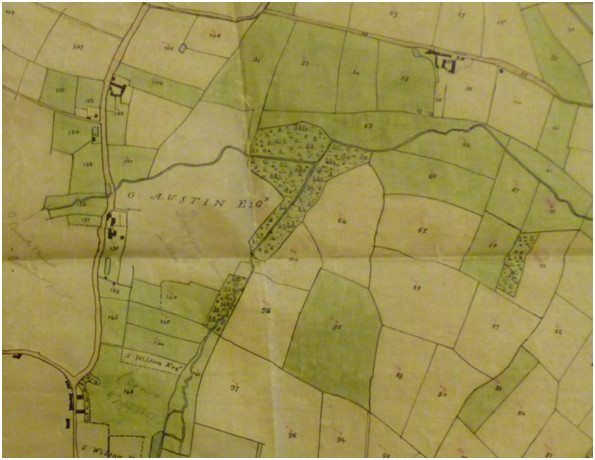
Bromley Historic Collections; Cator estate 1833
Very faintly, the G.Austin property is annotated in pencil “Thayers Farm L.Wilson” at an unknown date, which I take to be Cornelius Lea Wilson of Village Place but no supporting evidence so far. The confluence of the Beck/Chaffinch and Pool rivers in the woodland above is now in Cator Park, Kings Hall Road. That woodland is numbered “100” indicating it is Cator property acquired from St.John/Bolingbroke as part of Beckenham Manor lands by John Cator in 1773.
In
1837 Thayers Farm is
acquired by Albemarle Cator from the Forster and Austin
family
and
others. The complexity associated with the long list of names defies
explanation except that they may be trustees of the
property’s
inheritance?
Bromley Collections ref 989/4/1/2 of 2/12/1837 describes; Conveyance of
Thayers
Farm, Beckenham between Sir John Cholmeley, of Easton, Lincolnshire;
William
John Campion the younger, of Itchen Abbots, Hampshire; Samual Forster,
of
Lincolns Inn, Middlesex, esquire and Henry Forster, of Southend, Kent,
Captain
in the Royal Artillary (1st part);
Henry Goodford, of Chiltern Cantels, Somerset, esquire; Stephen
Cholmeley, of
Wainfleet, Lincolnshire, esquire; the Reverend John Thomas Austen, of
Aldworth,
near Reading, Berkshire, Clerk and Thomas Phillip Waite, of Louth,
Lincolnshire, esquire (2nd part);
The Reverend Richard Stewart Evelyn Forster, of Carlton, Lincolnshire,
Clerk
and Catherine, his wife (3rd part),
and the Reverend John Brownrigge Collisson, now residing at Charmouth,
Dorset,
Clerk and Sarah, his wife (4th part),
and Albemarle Cator, of Beckenham Place Park, Kent, esquire (5th part).
In consideration of the sum of £2000 paid to the 1st parties
and £2000
paid to
the 2nd parties, the property is conveyed to Cator. Includes a map of
the
property.
And this lease looks like it is to give Cator immediate possession? Bromley Collections ref 989/4/1/1 dated 1/12/1837 Lease of Thayers Farm, Beckenham from Sir John Cholmeley, of Easton, Lincolnshire; William John Campion the younger, of Itchen Abbots, Hampshire; Samual Forster, of Lincolns Inn, Middlesex, esquire; Henry Forster, of Southend, Kent, Captain in the Royal Artillary; Henry Goodford, of Chiltern Cantels, Somerset, esquire; Stephen Cholmeley, of Wainfleet, Lincolnshire, esquire; the Reverend John Thomas Austen, of Aldworth, near Reading, Berkshire, Clerk; Thomas Phillip Waite, of Louth, Lincolnshire, esquire; the Reverend Richard Stewart Evelyn Forster, of Carlton, Lincolnshire, Clerk, and the Reverend John Brownrigge Collisson, now residing at Charmouth, Dorset, Clerk to Albemarle Cator, of Woodbastock (Woodbastwick) Hall, Norfolk, esquire, for a year at the annual rent of a peppercorn.
Some question arises regarding the descent of the property from Francis Motley Austin to G.Austin Esq. and then to this group of trustees including Austins and Forsters. The Rev. John Thomas Austen eludes tracing so some research into the Forsters is necessary. F.M.Austin had married Margaret Wilson, daughter of Sir Thomas Wilson of West Wickham which prompts a search for connections with Cornelius Lea Wilson which has not emerged so far.
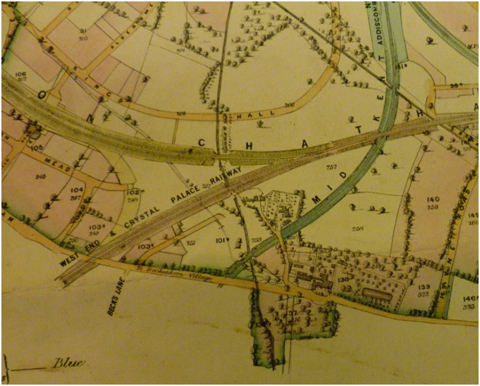
Bromley Historic Collections; Cator estate map 1864 (revised to September 1889)
Note the meanders in the Chaffinch and Beck have been straightened probably as land improvement, drainage and changes in field boundaries.
This map (1864/1889) shows Thayer’s Farm as numbered plots within the Cator Estate confirming that it had been acquired by the Albemarle Cator. Roads and railways which resemble closely today’s layout are shown. A report which accompanies the 1860’s Cator Estate map may reveal the acquisition and any tenants (Bromley Collections 989/7/1). At that time the Cators were either long leasing land (99 years) to builders or to speculative property developers for ground rents as the estate report describes as well as leasing agricultural properties such as Copers Cope and Foxgrove farms. Shaded parts of the estate map indicate leases. Certain gaps in the record remain undiscovered. As the area became carved up by roads and railways what is now Cator Park once covered part of Thayers Farm as a recreation ground but that was reduced to facilitate building on Kings Hall Road. What used to be Cyphers sports ground was part of the farm
The building of the railways took place in the mid 19th C. so there must have been some long term upheaval and the map shows a bridge or access between part of Clockhouse grounds and the house. The Chaffinch River is mostly in a culvert through this area now.
In 1886 we find the Cators leasing land to a local builder; Bromley Collections ref. 989/6/89/1 04/11/1886 Duplicate agreement between Albemarle Cator, of Woodbastwick Hall, Norfolk, esquire and Alfred Moss, of High Street, Beckenham, Kent, builder in relation to a piece of ground on the north west side of Thayers Farm Road. Cator agrees to let the property to Moss for 90 years at the annual rent of £5 for the 1st year, £13 for the 2nd year and £20 12s 6d thereafter. Moss to commence building works within 3 months and to expend £1000 within three years in erecting 5 pairs of semi-detached houses.
This latter Albemarle Cator would be the son of the one who purchased Thayers Farm in 1837 who died in 1868. This latter Albemarle Cator died in 1906 and the estates descended to his son, John Cator (1862-1944).
On 01/07/1896 Duplicate agreement between Albemarle Cator (a person of unsound mind, so found by inquisition by Thomas Henry Burroughs) of Woodbastwick Hall, Norfolk, esquire and Alfred Moss of High Street, Beckenham, Kent, builder in relation to two pieces of ground on the north east side of Thayers Farm Road and one piece of ground on the north side of Chaffinch Road, Beckenham, Kent. Cator agrees to let the property to Moss to hold for 90 years at the annual rent of £10 for the first year, £25 for the second year and £40 thereafter. Moss is to commence building work within four months and to erect houses. Includes a map of the property.
On the 3/7/1896 Moss’s wife Selina is included in the agreement, perhaps because Moss is ageing but it relates to a different part of the property, south east as opposed to north east. Counterpart lease of a piece of ground on the south east side of Thayers Farm Road, Beckenham, Kent beyween Albemarle Cator (a person of unsound mind, so found by inquisition by Thomas Henry Burroughs) of Woodbastwick Hall, Norfolk, esquire (1st part); Alfred Moss of High Street, Beckenham, builder (2nd part) and Selina Moss, his wife (3rd part). In consideration of the costs incurred through erecting the property, Cator demises the property to Selina Moss for 90 years at the annual rent of £5.
This shows that the Cators are long leasing land for building and I assume Moss is sub-leasing or renting out property. The houses built are in many cases the houses that still stand in Thayers Farm Road and adjoining roads. Albemarle Cator (the second) was thought to suffer from porphyria.
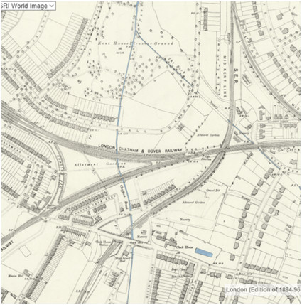
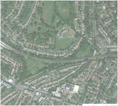
OS 25inch revised 1897 (National Library of Scotland archive) and satellite image
These images show Alfred Moss’s developments in Thayers Farm Road and Chaffinch Road, the development of Barnmead Road with the already disused loop line. Minimal development of Kings Hall Road thus far in 1897. Cator Park was called Kent House Pleasure Ground with a layout much the same as today’s. We know that many houses built in the mid 1930’s were the first houses built on Cator estate land with deeds signed in the name of the John Cator who died in 1944. What might be regarded as land almost resembling farmland is the allotments between the railways and the grassed area of the ex-Cyphers ground.
The complexity of transactions in the process of urbanization makes it impractical to go further with this account but I’m sure others will fill in gaps in the record. I assume householders on the property will have deeds recording the Cators, Moss and other developers. The leasehold status of property has over time become freehold and Thayer’s Farm only survives in the name of the road and surviving records.
With thanks to the various sources including Ian Muir for burial records and Keith Baldwin for research. British Library, Kent Archive, Bromley Archive and National Library of Scotland for images and records.
Not to be confused with the “Elmers End Farm” which was at Upper Elmers End and part of the Eden Park estate for a time. The origins seemingly go back to a moated house which was in what is now South Norwood Country Park. Only the ghost of the moat is visible from aerial photographs. Some remains were found by archaeologists dating it to the medieval period. Len Hevey’s publication on the history of Elmers End is viewable on the Bromley Borough Local History Society website resources. Len Hevey wrote; The earliest known documentary evidence of the district is found in four deeds from the reign of Henry III (1216-1272), which refer to the lease of land from Ralph Aylmer and his son Richard, to others. In one of these, Richard Aylmer leased ten acres to William Wodegrove, for anannual rental of 21d; and as the following extract from it shows, the location is precisely defined, and the place in which it lay is destribed as Westhurst; “Be it know that I, Richard, son of Ralph Aylmer, have given, conceded, and by this deed confirm to William Wodegrove 10 acres of my land with its motes, hedges, and forelands, and everything else pertaining thereto lying in a place which is called Westhurst in the parish of Beckenham and extending in length from east by the land of Lord Richard de Rupella, Lord of Beckenham, and extending in length from towards west as far as lands of said William. And in breadth between land of William de Bosco on the south and the way which leads from the house of William Pikenot towards Penge on the North.” William Wodegrove had land adjoining west of this site which would be probably in what is now South Norwood, Croydon, Surrey. Len Hevey goes on to describe the Eylmers paying taxes in the 14th Century. Pikenot is also mentioned in taxation and other references. While we might nitpick a few of Len Hevey’s details it is broadly a good description of the situation but he omits the passage of Elmers End from Thomas Motley through the Austin family.
Records are scarce regarding the Elmers or Aylmers of Elmers End especially regarding the descent of the property between the 14th and 18th Centuries. The National Archive has a record from 1357 for Debtor: Thomas Aylmer of Kent of Beckingham. Creditor: Thomas Fermbaud, knight [held part of a fee in Battlesden, Manshead Hundred, Beds] for Amount: £40. Before whom: Simon Fraunceys, Mayor of London; Andrew Aubrey, Clerk. When taken: 19/05/1356 First term: 02/06/1356 Last term: 29/09/1356 Writ to: Sheriff of Kent Sent by: Henry Picard, Mayor of London; Thomas de Brisworth, Clerk. Endorsement: London' Coram Justic' de Banco in XV Trinitatis. 1357 Apr 20.
Another 1357 record describes Thomas Aylmer as Chamberlain(secretary) to Bartholomew de Burghersh who is linked to Foxgrove Manor and another possible link is between the Elmers or Aylmers and the Carew/Carreus who have been connected with other land dealings.
The family name disappears from the district before burial records begin in the 16th Century. A recent (2022) viewing of a 1734 document in Lincolnshire Archive shows that Thomas Motley got land called Elmer Farm from Hugh Raymond of Langley and it appears from the list of fields in the transfer that Motley divided some between both Elmers End Old and New Farms and some were attached to Thayers Farm. It raises the question as to how and when Hugh Raymond came to possess it which was as part of his purchase of Langley and Simpson’s Place in 1732 which is described in the document as Raymond acquiring it from the Elwills who had inherited from the marriage of Sir John Elwill to Elizabeth Stile.
The Motley map’s illustration of a site called La Motes may indicate an old family name or just that the site was two concentric motes. Part of the land is now in Croydon, Surrey and the county boundaries did move over time but land ownership was not particularly influenced by county boundaries. Similar to Thayers Farm, Thomas Motley's map of 1736 illustrates these and how they were related to neighbouring landlords: the St.Johns, Burrells, St. John Humphrey. The name Elmer was in earlier times often spelt Aylmer, Eylmer Ailmer. It is a family that appears in references as early as 1308 regarding the taking of timber to repair the church and early tax rolls in 1328 and 1345 as well as some archive documents but it was not recorded in the Kent Roll of 1274 unless the name Wymer is a transcription error. We haven’t been able to find how Motley acquired the land but like other landlords he also had property elsewhere. As Motley acted as trustee on several Lethieullier wills and transactions it’s possible that he acquired land from the Lethieulliers perhaps parts of Kent House Farm? What we can add to Hevey’s account is the descent of Elmers End Farms to Francis Austin, Motley’s son in law, and Francis Motley Austin, Motley’s grandson, which then passes to Ambrose Austin who is apparently no relation to the two Francis Austins.
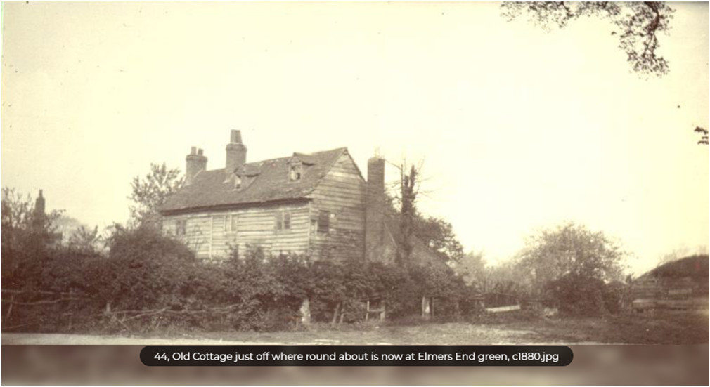
This picture of a cottage or quite substantial 3 storey building gives a idea of the earlier appearance of buildings with timber frame for the most part with weatherboarding can perhaps explain how so few old buildings remain in the area along with lack of desire to preserve them.
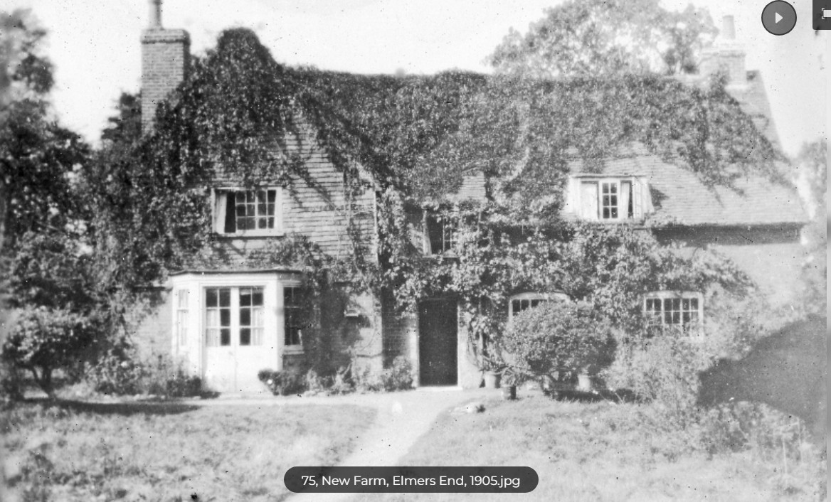
Elmers End New Farm in 1905, it would be nice to think this is at least in part some of Thomas Motley's property.
Monks Orchard
Monks Orchard sits at the southernmost part of Beckenham parish on the West Wickham borders and is largely ignored by early historians. Once part of Surrey and Addington St. Mary's parish It is reputed to be called so because back in 1552 it was in the ownership of a family named Munke of Addington. There was a reference to Monksmeade circa 1662 and a 17th Century (1661) plan held by Surrey Archive of Monks Orchard Copps and Meade with three houses shown, Thorogoods House and Monks Gate on the road at the bottom of the map and a house near “Paddox and Furse”. Land abutting Monks are annotated Rogers Lands, Brucombs Land, Shorlie Hoath (Shirley Heath?) and Comm Land (Common Land?). We cannot say whether Rogers and Brucomb were owners or tenants. The plan shows land on the same footprint as the 1809 Burrell map but changes in farming practices and buildings are reflected in the different field pattern etc.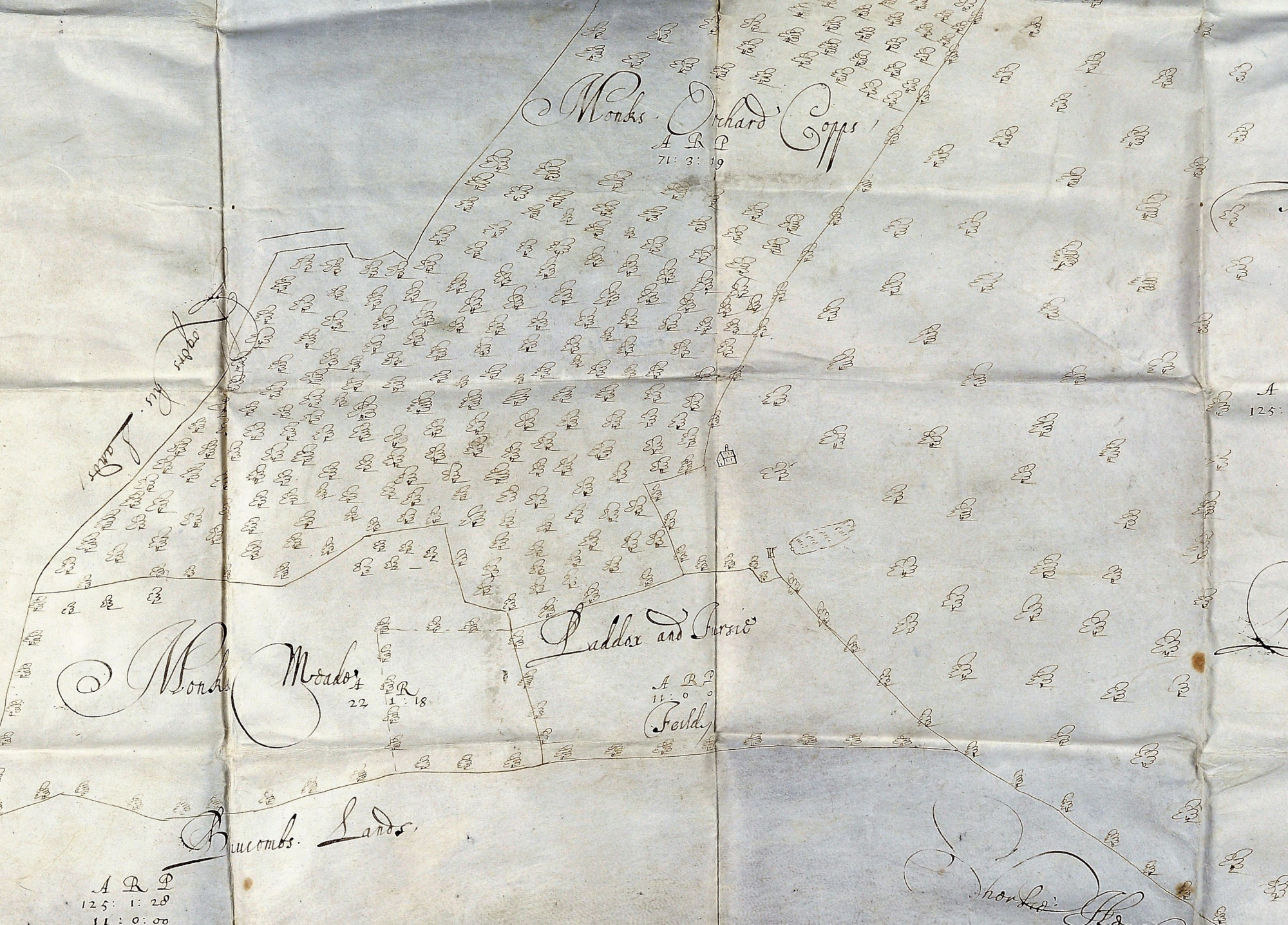
part of the Monks Meade, Monks Orchard map from Surrey Archive. North toward the left margin. Most likely the map accompanied a transfer of property.
Much material is held by Bethlem Museum of the Mind including the full 72 page sale catalogue from 1920 which shows it by that time to have straddled the county and parish boundaries to include 1540 acres in Beckenham, West Wickham, Croydon and Addington consisting of a mansion, several farms, 3 public houses and a golf course.
It originally formed part of Leigh's Addington Estate which as we show elsewhere had close links to Beckenham through Aguillon, Bardolf, Leigh and Trecothick. Latterly John Cator also owned parts of Chelsham & Farleigh which he purchased shortly before his death in 1806. It was from Sir John Leigh of Addington’s decendants that Barlow Trecothick purchased the estate in 1768. When he died Barlow in 1765 he left the estate to his nephew James Ivers on the insistence that he adopt the surname and arms of Trecothick. James Ivers was originally from Boston Massachusetts and Barlow Trecothick died owning Long Island.
The estate remained intact until 1802 when James Ivers Trecothick got into financial difficulties after suffering losses on his estates in Grenada. His creditors agreed to allow him two years to sell his estate and settle his debts. The estate as a whole was firstly offered for sale at £109,500 by the trustees William Coles & Westgarth Snaith but there were no takers, it was then divided into 22 lots. The mansion and park became the subject of a court case (Coles v Trecothick 1804) and Thomas Coles (father of William Coles) bought the property which in 1807 he then sold to the Archbishop of Canterbury.
We have not found details of the sale but it is evident from the Surrey Land tax and Jury Qualified Freeholders lists that some leaseholders chose to purchase the freeholds. One of these was John Smith MP (designated as such in 1805) who bought Coldharbour Farm (aka Spring Park) assessed at £328. His tenure was short, Coldharbour is recorded as being held by Charles Thelluson in 1800 and in 1807 John Smith is supposed to have sold Monks Orchard to Lord Gwydir (Peter Burrell) to extend his Langley Park estate.
In 1803 Lord Gwydir owns land valued at £148 leased to Joseph Cooper who, in 1802 had held land valued at just £70 from James Trecothick and which in 1800 can be seen to be distinct from Coldharbour. This could be Monks Orchard, which looks likely as the tenant, Joseph Cooper and latterly John Turner, is the same as on Ham Farm, but this throws doubt on whether John Smith ever had Monks Orchard in addition to Spring Park.
In his History of the Monks Orchard Estate 1957 G W Tookey claims that when Lord Gwydir died Park Farm and Ham Farm were sold to John Maberley (of Shirley Park) for £6000 and £10500 respectively. We have not seen the post 1819 Surrey land tax returns to corroborate this but have determined that the subsequent owner was Paul James Le Cointe who was included in the Jury lists of 1820-1824 as of Park Farm. He died in 1825 and his widow immediately sought to sell the estate described as 235 acre estate with newly erected mansion (circa 1823) but it failed to sell until the middle of 1828, fetching £13,900 at auction.
The purchaser was Henry Alexander but the estate (now called Wickham Park) was again offered for sale in 1834 stating that £35000 had been spent on improvements within the last 13 years.
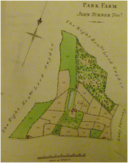
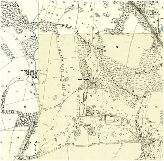
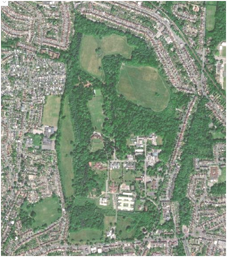
Park Farm leased by the Burrells encapsulates most of todays Monks Orchard/Bethlem Hospital compared to circa 1900 OS map showing old county boundary and satellite image showing that the northern boundary includes a little of what was Eden Park Farm.
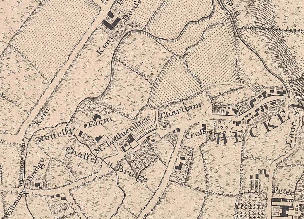
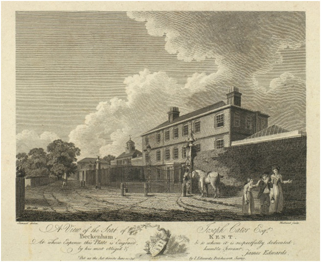
Clockhouse print 1782 Joseph Cator
Some points to mention here are that F.P.Watts says that the 1769 map doesn't show an occupant but it quite clearly says Mrs. Holland. A comparison of the 1776 Foxgrove Manor map shows that "Mr Cator" possessed the property. John Green Lethieullier sold Kent House to Lucas in 1776 and the press advertisement regarding the sale of property is dated 1776. Other evidence shows that John Cator of Beckenham Place is still actively buying property in the area.
We see on the 1776 Foxgrove Manor map that the Clockhouse site is appears to be identified as Mr Cators so current thinking is that Clockhouse reverted to Lethieullier ownership (John Green Lethieullier? son of Manning L.) and JGLethieullier may have sold it to Cator when he sold Kent House Farm to one Lucas. Its possible that Mr Cator was Joseph Cator, the brother of John of Beckenham Place or perhaps John Cator bought it for his brother who had recently returrned from working for the East India Company in India. John Green Lethieullier dies shortly afterwards in 1779. His will is perhaps the shortest of the family, leaving his wife and brother in law as execturs and directing that his property and effects are divided on share and share alike basis between his children.

From Joseph Cator's estate plan (courtesy of Bromley Historic Collections)
No record of a purchase has been found either by Brett or Joseph Cator but we have the map of the house and grounds which is in Bromley Historic Collections. The collection of maps we have images of can show that on the 1776 Foxgrove Manor map the land on which Clockhouse stands is annotated as John Cator. This implies that after Sarah Painter's second husband, Stephen Holland dies in 1768 she may have sold Clockhouse to Cator and that her 'Beckenham House' left to Warren is The Ridge ie Village Place. So far we only have the map evidence and no documents have come to light.
Substantial 'Lethieullier' property records are in Kent Archive and need investigation.
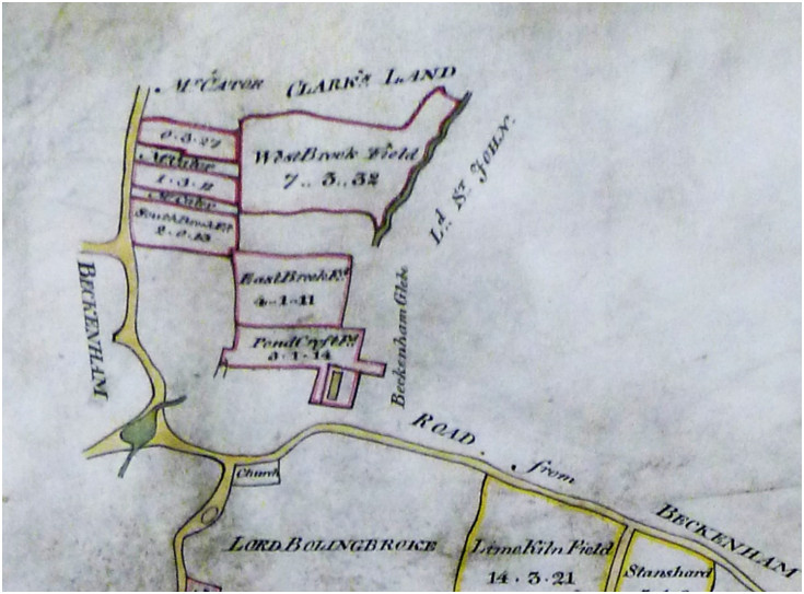
Part of the 1776 Foxgrove map. Westbrook Field can be identified on other maps as adjacent to Clockhouse grounds.
On Joseph Cator's death in 1818 it was left in trust to Joseph’s sons William and Bertie Cornelius. Joseph’s wife Diana was a joint executor of his will and may have lived at Clockhouse until her death in 1829? But by 1838 the Tithe map and returns show it had been absorbed into the Cator estates under John Barwell Cator being leased until its demolition. On the 1838 Tithe it is described as owned by John (Barwell) Cator but unoccupied. Both William and Bertie never resided at Clockhouse as they had careers in the army and navy respectively. There is some possibility a pre-existing building was on the site indicated by the 1623 Beckenham Manor map, possibly an earlier farmstead but this is one of the many outstanding unknown details. The Lethieulliers lease much of their property in Beckenham, Penge, Lewisham and elsewhere in Kent and they refer to dwelling houses in Lewisham and Beckenham. One such house may have been on the site of Village Place or even Clock House but references to fields called The Ridge and Bun Hill are made and The Ridge describes the site of Village Place.
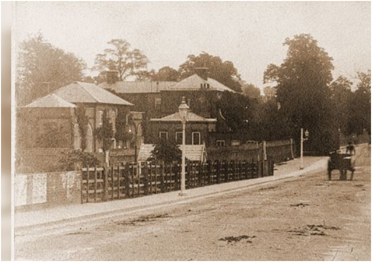
Clockhouse some time after the building of the railway and clock removed to Beckenham Place (courtesy Beckenham History)
Some 19th Century tenants can be traced on census records such as 1871, Francis Barry a Portuguese Merchant and Consul for the Republic of Portugal with his family and several servants. Eventually Clockhouse and its grounds were sold to the Beckenham Council by Albemarle Cator for a nominal sum and the Technical Institute, Library and swimming pool now occupy the site.
Stone Farm, Wickham Road.
The first definitive evidence is the 1766 copy of the 1720 Foxgrove Manor map which shows Stone Farm as belonging to the Tolsons in 1720, they having presumably bought it from the Leighs who previously owned Foxgrove Manor. Stone Farm was part of Foxgrove Manor and after changes of ownership it was moved, renamed and then renamed again. A family named Stone are in St.George’s records from about 1700 but we have no evidence that they are connected to the farm. The Farm was originally adjacent to the lake in Kelsey Park and its fields extended toward Clay Hill and Langley. John Cator acquired it from an heir of the Tolson Tillys, Joseph Groves, circa 1758 and exchanged small parts of it with the Burrells and Raymonds for other land in 1759. Cator exchanged the rest with the Burrells in 1793 and the Burrells apparently absorbed the part adjacent to the lake into Kelsey Park. The land was rearranged and a new farm house built at the junction of Wickham Road and Hayes Lane called Home Farm. This was later renamed Stone Farm so although the farmhouse and buildings were moved and rebuilt the fields constituting the farm to the east of Wickham Road remained much the same. Robert Borrowman describes how in making excavations for new houses on the side of Wickham Road in 1898 some brickwork remains were found of a building of some extent being about four feet thick and going down about six feet. A map assumed to date to 1780 which shows Cator owning Stone Farm and and house called Barnfield House on it could well be this structure. We can only guess.
The Tithe map of 1838 shows the then owner as Emanuel Goodhart and occupant is William Rogers junior after the 1820 Burrell estate sale. One map showing the farm buildings near the site of what is now the Chinese Garage associates the buildings with Nabhalter Farm on the edge of the Langley Farm and Place estates after the sale of the Burrell estate in 1820. In the following map (note that north is toward the right) Chancery Lane is to the right edge and Wickham Road runs to the Langley area on the left. The road junction just to the left of The Stones Farm is Hayes Lane junction where the Chinese Garage is today, before South Eden Park Road and Stone Park Avenue were constructed. A lot of the fields not marked ‘Jones Raymond’ or ‘Burrell’ belong to John Cator in 1766 from his purchase of Stone Farm circa 1758 from Joseph Groves. The blank areas are Kelsey and Beckenham Manor lands for the most part. When Cator exchanges land with Burrell in 1793 all of this becomes part of the Burrell estates. It does demonstrate how fragmented and interlocked properties were. By the time of the 1861 census Stone Farm is occupied by Michael Mathews who had earlier farmed Copers Cope Farm which by now is possibly repossessed by the Cators for the purpose of building leases?
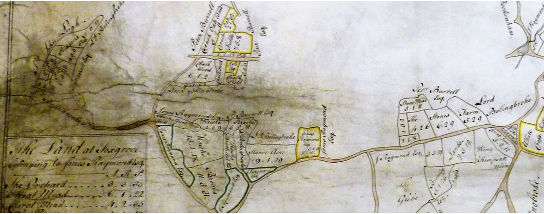
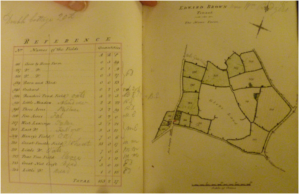
Home or Stone Farm repositioned by the Burrells, farmhouse was near what is now Chinese Garage roundabout
Woolseys Farm, Later named Shortlands House and became Bishop Challoner School
This was on and around Clay Hill, the site of what is now Bishop Challoner's School in Bromley Road. The first pictorial descriptions of it are on the 1723 and 1735 Burrell estate maps held in the British Library and at that time it was under the land holdings of the Burrells of Kelseys. On a separate map of 1735 it appears to be leased to someone believed to be Buxton although the map is faded and the writing difficult to read. An earlier burial record 1666 for Thomas Bedford is shown as “of Wolsees”. Clay Hill was a crossroads on Bromley Road with what are now Scotts Lane and Court Downs Bridge Road. Records recently discovered in Lincolnshire Archive (2022) show that Peter Burrell acquired Woolseys Farm in 1705 on a 500 year lease. Prior to that in 1693 Isaac Loader of Deptford, Co. Kent, anchorsmith leased it to Samuel Shephard, Citizen and distiller of London but Shephard defaulted on payment of his mortgage so Loader sold/leased it to Burrell. This changes our earlier assumption that Burrell acquired it from the Brograves along with Kelsey. Now we are seeking evidence for Woolseys earlier evolution. It could be that it can be traced back to Richard le Lacer who’s daughter inherited it along with lands in Bromley and she carried it in marriage to Maurice le Brun. It was then perhaps disposed of by sale as it did not constitute part of Beckenham Manor. All this is still being researched.
From 1735 the site changed landlords a few times becoming part of Raymond estates after the Raymond and Burrell families intermarried. The 1766 Foxgrove Manor map shows Woolseys Farm under Jones Raymond, whether by some arrangement between Jones Raymond and Peter Burrell who were brothers in law, but in 1759 Peter Burrell exchanged it with Frederick St. John (Bolingbroke) for the Beckenham Manor house and grounds. Then John Cator acquired as part of the purchase of Beckenham Manor land from Frederick St. John/Lord Bolingbroke in 1773. It was leased to George Grote and subsequently John Barwell Cator sold it in the early 19th Century. From a farm it became upgraded to a large house with associated farm. It was a hotel for a time before becoming the school. The Shortlands, Clay Hill, Clayherst (pdf) document will have more information.
The Lincolnshire archive documents describe 42 acres although additional land is referred to. By 1825 it was in the possession of John Barwell Cator and leased to George Grote. The description of Grote’s leased property describes 146 acres. We also have to take into account the changes in farming practice which led to field boundary changes and alterations to drainage.
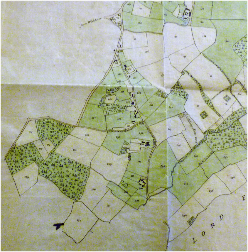
The area of Clay Hill and Woolseys Farm from the 1833 Cator Estate map. Frustratingly a key to the field numbers and names has not been found.
Map evidence indicates that a 'messuage' existed on Stumps Hill before 1749 according to Rocque's map. The 1766 Foxgrove map shows John Cator as landowner of the site of the house and some fields. Cator’s father in law, Peter Collinson wrote a note in his catalogue of plants in which he records a visit to Beckenham Place in 1762 which had been built between 1760 and 1762. The house was then called Stumps Hill and in Cator’s letters to correspondents he refers to his house at Stumps Hill. Collinson’s note and letters to friends record how he admires the grounds and planting around the house.
In 1762 Cator did not own all of the subsequent parkland and the remaining park contains little if any of the Beckenham Manor land acquired from Frederick St. John in 1773. Complex purchases and exchanges are described in the timeline along with several questions and facts regarding the Cators and the other landlord families.
Cator could not acquire the original manor house to Beckenham Manor because it had been exchanged between Frederick St.John and Peter Burrell II for other land in 1757 so Cator used his Stumps Hill house as his residence as Lord of the Manor.
In Hasted's History of Kent which we have found to be incorrect in several respects he briefly describes Beckenham Place as the seat John Cator as Lord of the Manor of Beckenham and states that it was built in 1773 on the purchase of Beckenham Manor from Frederick St. John. But Cator had acquired land which was part of Foxgrove Manor from the late 1750's and his exchanges of various plots of land with Jones Raymond and Amy Burrell brought him into possession of the site of the current Beckenham Place mansion.
In 1825 the historian W.H.Ireland describes Beckenham Place as having been much improved by Cator's heir John Barwell Cator.
Details of the features within Beckenham Place mansion can be found in Cultivated Leisure by David Love.Copers Cope Farm
Copers Cope Farm occupied a substantial part of what were described as the Beckenham Manor demesne lands and as such most of it is included in Beckenham Manor for its chain of landlords. The 1623 Beckenham Manor map shows the area as a series of fields in the Manor. The demesne lands of the manor may have consitituted a 'deer park' and this is perhaps supported by the names fields like 'Spring Park'. The St.John's who acquired the Manor leased the manor properties to others perhaps creating the farmstead for leasing and the house is described as 'late 17th Century' in the English Heritage description of its grade II listing. In 1765 John Cator is described as being one of the local landlords leasing manor land from the St. Johns perhaps including Copers Cope Farm. After 1773 when John Cator had purchased the manor property he probably leased the property. By 1825 it also encompassed some fields hitherto part of Foxgrove Manor. The area of the farm within those demesne lands is thought to have been a deer park and some parts were called Spring Park possibly because some springs were present there in the viscinity of Stumps Hill. The farmhouse still survives on the corner of Southend Road and Copers Cope Road. It is sometimes referred to in records as Cokers Coke, Cokers Cope or Coopers Copse. The original field pattern shown on the 1623(1768 copy) Beckenham Manor map was later altered to that which appears on the 1838 Tithe map. The occupant in 1825 was John Philips on lease from the Cator Estate but by 1838 Michael Mathews senior held the lease. This entry from Bromley Collections describes the lease conditions in 1850 "Agreement between John (Barwell) Cator of Beckenham Place, Kent, esquire by Peter Cator as his agent (1st part) and Michael Mathew of Beckenham, Kent, farmer, in relation to farm and lands called Copers Cope Farm in Beckenham. Cator agrees to let the property to Mathew from year to year at the annual rent of £528 when the average price of a quarter of wheat and a quarter of barley shall amount to 88s. The rent is to increase by £1 a year for every shilling above the average prices. Includes map and schedule of lands."
As the area was gradually given over to built development after the 1825 Cator private act of parliament obtained permission for such development a road pattern was laid out and with the building of St.Paul’s church in Brackley Road it developed into the area of ‘New Beckenham’ originally with large villas on 1 acre plots leased from the Cator Estate. Various ups and downs of the housing market led to the establishment of some large sports grounds owned by banks and insurance companies but now those open spaces are under threat of development. These sites were designated as Metropolitan Open Land but are increasingly falling prey to developers.
The Manor of Old Court
A small part of Beckenham came under this manor which was based in Greenwich. A small parcel of land identified on some maps as belonging to Morden College and said to include Langley Farm are described by the archivist of Morden College but it looks like the site was limited to a plot betwee Cocapaniers Wood and Little Cocapanniers Wood.
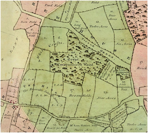
Various records such as Close Rolls Henry VIII: Grants, Ric. Long, King's servant. Lands in Greenwich, the "Queen's lands" in East Greenwich, West Greenwich, Dexforde (sic Deptford), Levesham, Kedbroke, Charleton, Wolwyche, Beknam, and Chesselhest, Kent, forfeited by Hen. Norres.
The Manor of Old Court was acquired by Sir John Morden in 1699 and apparently the Beckenham land was exchanged for property in Lewisham between Peter Burrell/Lord Gwydir and the college trustees in 1813. The land in question is probably mostly in the Wickham Way/Park Langley area today.
We have not so far discovered any maps or detail of the extent of Old Court apart from this 1389 Foot of Fine for an unnamed property which seems to match other descriptions;
(685)
Morrow of the Ascension 13 Richard II Querant: Thomas de Bland
Deforciant: Hugh de Midelton and wife Elizabeth 7 messuages, 280 acres
land, 8
acres meadow, 40 acres wood and 28s rent in Estgrenewych, Leuesham,
Kettebroke,
Eltham, Chesilherst, Charleton, Beckenham and le Lee. To hold to Thomas
and his
heirs. Warrant against the heirs of Hugh. Thomas gave 200 marks. (Kent
Archaeology)
See also 1399 and 1414. The impression we get is that the property was a collection of disjointed fields and woods which would be similar to the make up of the other estates and have been subject to renting out to tenant farmers or husbondmen. Further information is being sought but this link holds a good explanation of the passage of the manor. Sources; https://enderbywharf.wordpress.com/early-history/ and accounts in Hasted and Lysons.
The Manor of East Greenwich was extensive and became divided and parts ended up in Morden’s possession. Samuel Travers map of 1695 http://www.royalobservatorygreenwich.org/devblog/wp-content/uploads/2018/01/Greenwich-map-1695-97-Travers.jpg illustrates the parts retained by the crown which now encompass Greenwich Park, the Naval College, The Queens House and Maritime Museum etc.
Like many of the Manors we have researched there was considerable ‘satellite’ property attached which could be some distance away from the centre of the Manor.
Village Place, The Ridge or The Cedars
Variously named during its history and ending with Lea Wilson who was described as the village squire by some. There are various records in Bromley Collections in the papers of Lea Wilson. The property was requisitioned by the Army in WWI and found to be dilapidated in 1919.
We may identify that the site on the north side of the High Street was part of the Style of Langley property descending to Sir John Elwill and then sold with Langley to Hugh Raymond as annotated on the Burrell Kelsey map of 1723 and 1735.
As property exchanges between Burrell and Cator took place up until 1793 we find on the Cator estate map of 1833 that the site is in the name of S. Wilson.
In May 1722 a lease and release between Thomas Motley and Willis; Lease and release between Thomas Motley, late of the parish of St Mary Matsdon alias Whitechaple, Middlesex, gentleman, now of Beckenham, Kent; Joseph Nutt of the parish of St John Wappin, Middlesex, brewer; William Davies of the parish of St John Wappin, Middlesex, chirurgeon; John Dodd; Thomas Davies of the parish of St Dionis, Backchurch, Fenchurch Street, London, gentleman; John Willis of London, merchant and Micajah Perry, Leadenhall Street, London, merchant in relation to a capital messuage in Beckenham and land known as The Ridge and a moiety in a seat or gallery in Beckenham Church. In consideration of the sum of £1575, the property is released to Willis and Perry forever.
Motley's estate on his map of 1736 shows he possessed farms and a property opposite the George Inn.
In 1725 Willis purchases some meadow from the St. Johns, part of Beckenham Manor land. Lease from Henry, Lord St John of Battersea and the Honorable John St John to John Willis of Beckenham, Kent, merchant of a parcel of meadow in Beckenham for a year at the annual rent of a peppercorn. (1 membrane) Release is between the same parties. In consideration of the sum of £10 10s, the 1st parties bargain and sell the property to Willis. (1 membrane)
The Lea Wilson papers can illustrate a trail of property exchanges related to the site.
The Village
The early village would have been dominated by the Parish
Church and Manor
House opposite. We might imagine a house with its estate establishing a
family
chapel and the evolution of a settlement. An estate with farms
obviously
requires labour so some accommodation for people and livestock would be
involved. Some documentary evidence could even imply that the Rector of
the
Church, Martham for one, did occupy the manor house for some
time but this needs conclusive
evidence.
The mix of estates and the number of farms would require a good number
of
people and the early population of Beckenham has been stated as about
1000.
Church records would be the most comprehensive record via births, deaths and marriages after 1539 when records began. Unfortunately the baptisms and marriages part of St. George’s records were damaged during WWII but some transcriptions are in Bromley Historic Collections. Various property documents reveal names of small property owners, leaseholders and tenants. As well as the estate landlords some names cropping up are Willis, Pugh, Grote, Batt etc.
The available maps from 1623 onwards illustrate some buildings but maybe only more dominant houses were shown. The maps had more to do with recording property ownership than accurate representation of landmark details. Some land ownership documents refer to 'closes' which could be groups of workers cottages or hovels. It seems the term 'hovel' was a bonafide description of a lowly residence. Although the village was small there was a correspondingly small 'workhouse' at Clay Hill and the almshouses next to the church for the impoverished. The Parish system provided some poor relief but if anyone falling on hard times was from a different parish then measures were in place to remove them to their home parish which had responsibility for them.
The
village had
several large houses called Grete (Great) Houses or mansions as well as
the old
manor house. The Mead was owned by Thomas Motley near Thornton's
Corner in 1735 and evidence suggests he acquired it from Hugh Raymond
circa 1734. Raymond in turn got it with Langley from Sir John Elwill's
heirs who had acquired it through the marriage of Sir John Elwill to
Lady Elizabeth Style so the Styles could have had this site from as far
back as the 16th Century (1501 ish.
Another large house was on the site of the Greyhound Public House or
now closed
public conveniences and on the Kelsey map is called Ship
House.
The early house associated with Kelsey was nearer
the
village than the later mansion and is shown on both the 1623
Beckenham Manor map as John Brograve's and on the Kelsey 1735 map.
Village Place was also on the High Street nearly opposite the
Village
Way junction and was perhaps called the Warren when it passed through
the
ownership of the Lethieulliers but this was a later build, perhaps
early 19th Century. Beckenham Lodge once owned by the
Banyer family
was near the War memorial/Barclays Bank site with its own grounds. Some
landowners owned significant portions of the village and of the two
public
houses, The George was owned by the Beckenham Manor landlords and the
Three
Tuns was owned by the Kelsey landlords and leased to victuallers. The
'Wood House' had the appearance of a saxon hall with one main room
which had been later divided and whether a copy or a
building that predated the Manor house we will never know as it was
swept
away with most of the old buildings of Beckenham.
The estate maps of the Burrells dated 1809 and the Cators dated 1833
and 1868
show a lot
of detail of the village and surroundings before large scale
development took
place. The writings of Borrowman, Copeland, Inman, Tonkin and Manning
are the
best sources of information about the 19th century village. As
one
works
backwards the details become harder to define.
The picture galleries on beckenhamhistory.co.uk have a good collection of old photographs and postcard images.
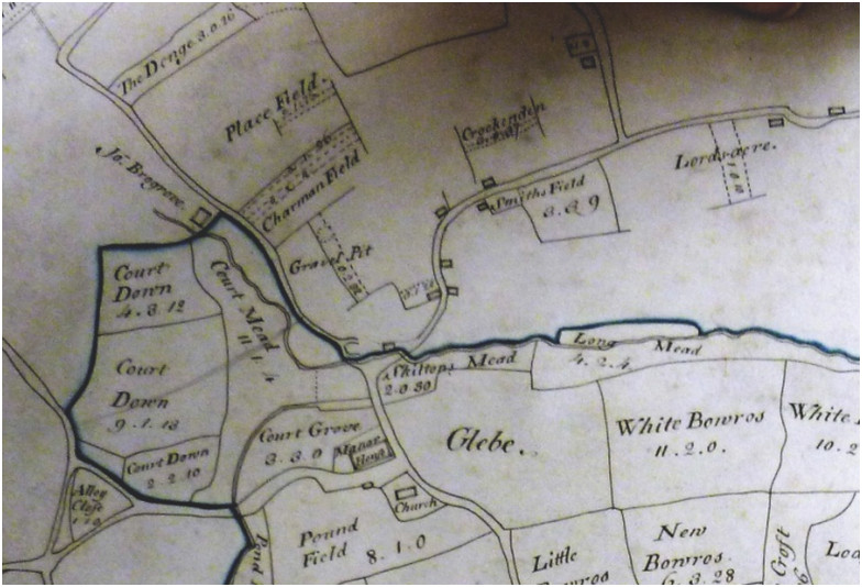
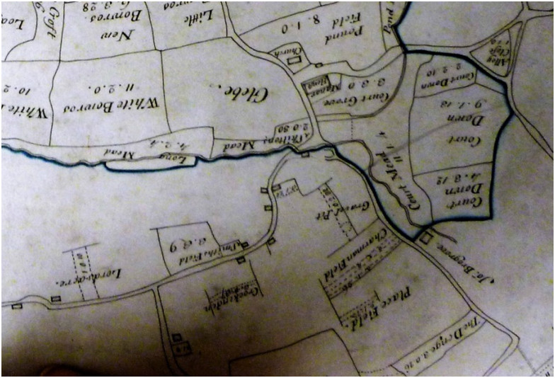
The Village on the 1623 Beckenham Manor map (1768 copy)
With a rotated copy to match orientation north uppermost of modern maps
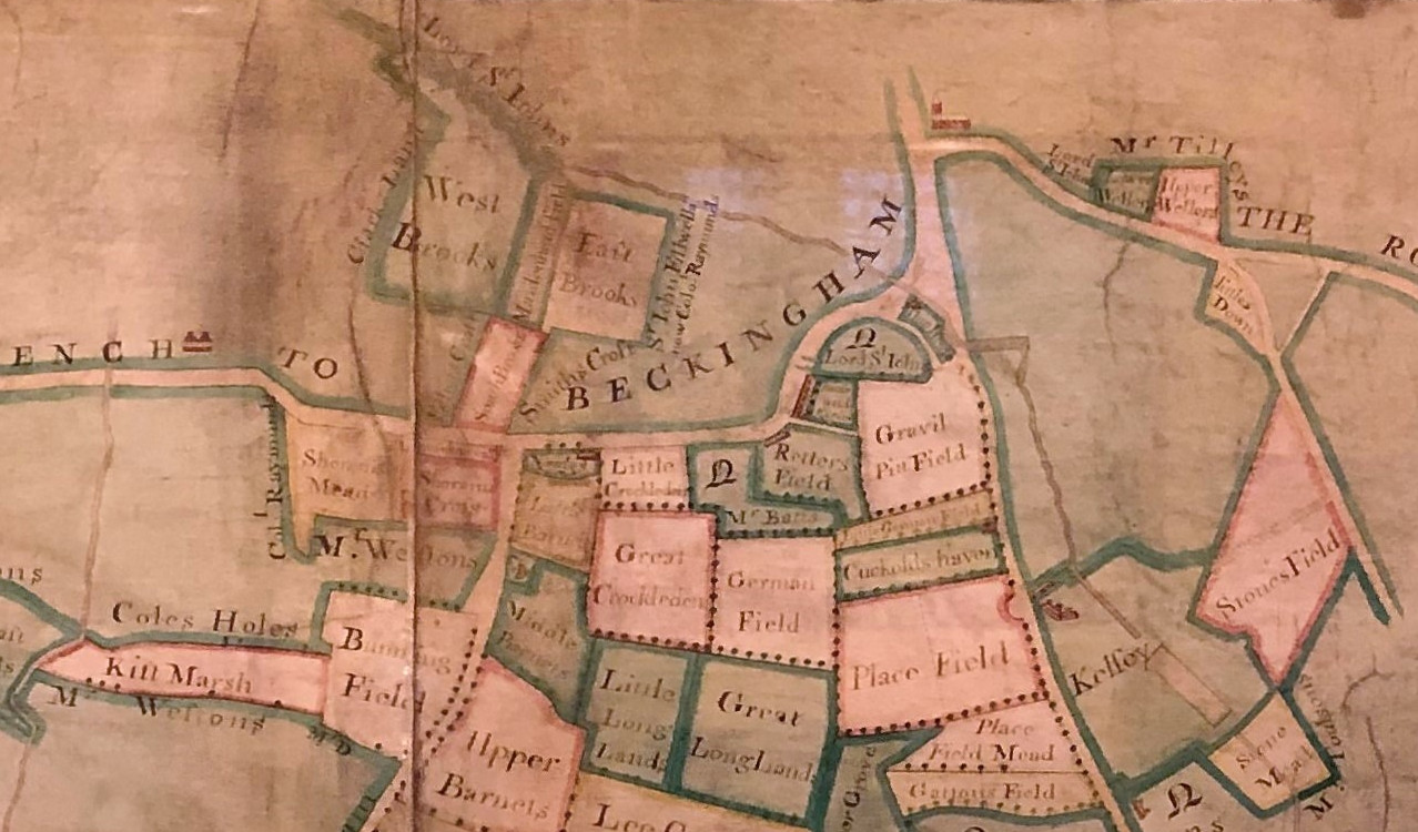
1735 Burrell Kelsey map (Knepp Castle)
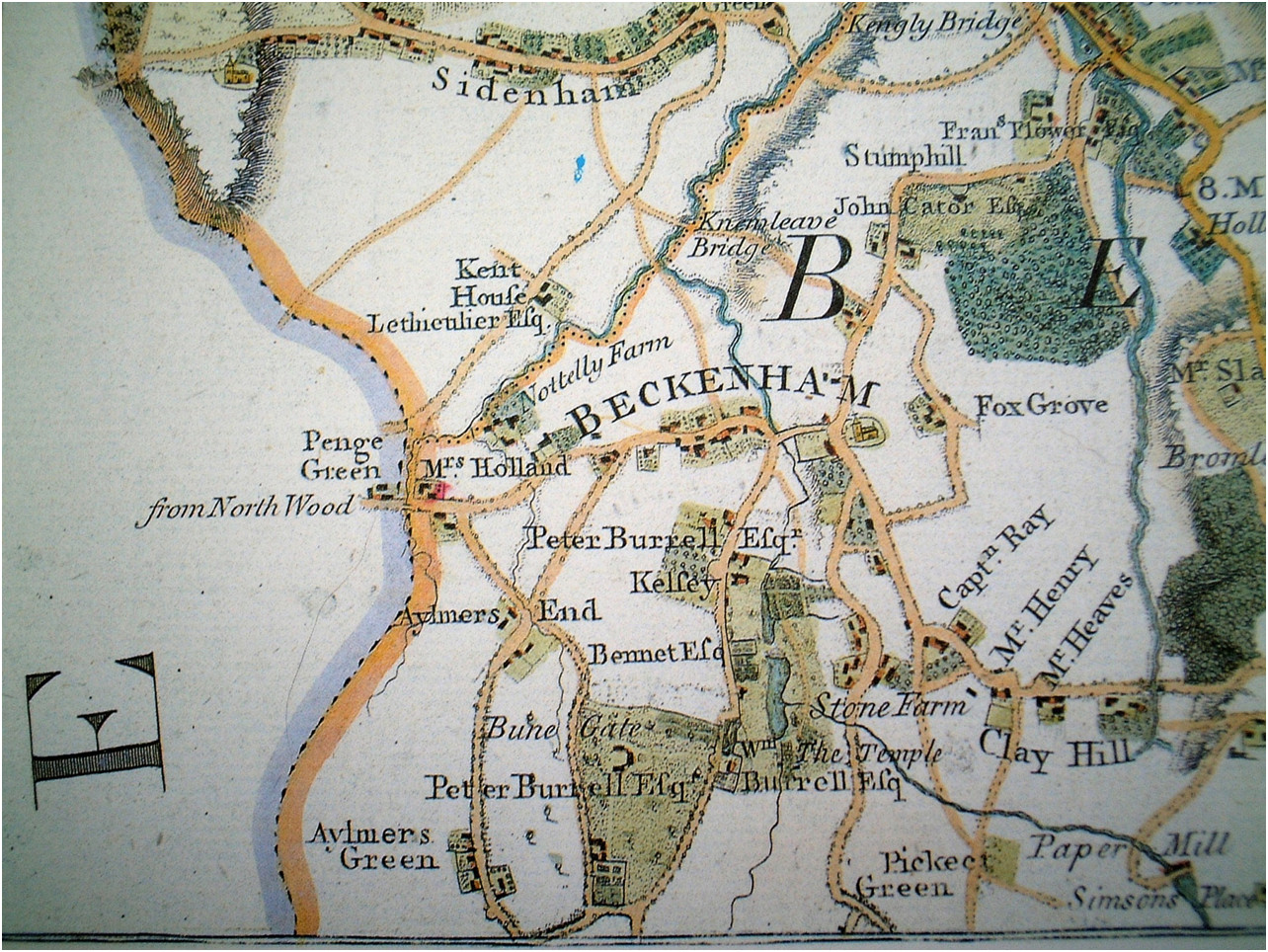
Andrews Drury and Herbert map 1769
Several errors on this map e.g. the Ravensbourne river is shown flowing to Kelsey Lake, Thayers Farm is shown as Nottelly Farm, Pickhurst Green shown as Pickect and the road layout is distorted.
But certain information is discernable such as the residences of the Burrell family and the footprint of properties. Probably the names of residents was because they subscribed to the maps printing
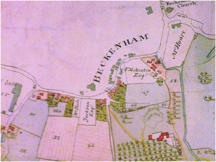
1809 Burrell estate map, The Village
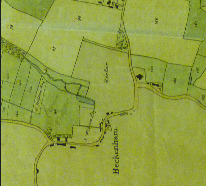
1833 Cator Estate map village section
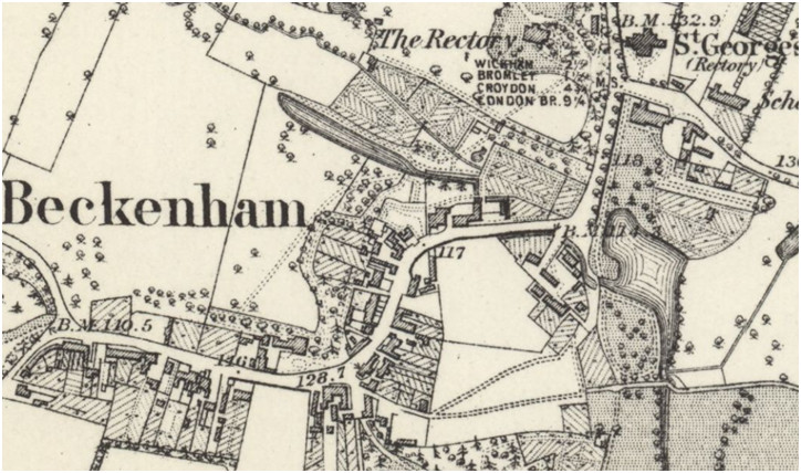
1860’s Ordnance Survey
Borrowman 1910 wrote in detail about the church in which he had in depth knowledge. We hope to include his text in this account soon.
St. George's is the parish church for Beckenham and until additional 19th century churches were added for the growing population and different faiths such as St. Paul's New Beckenham 1872 it was the only church apart from Bromley Parish church, West Wickham parish church and Lewisham parish church. Prior to 1539 and the dissolution of the monastaries and separation of the Church of England from the Catholic Church of Rome the parish church followed the Catholic faith. The date of the establishment of the church is debatable, some sources saying circa 810 AD but its proximity to the location of the Manor House may indicate that it was a chapel attached to the Manor. In any case the record of church Rectors goes back a long way and some Rectors were Lords of the Manor having leased the Manor from the main landlord.
The church also acted as the 'local' church for Penge which was originally in the parish of Battersea (Battricksey) and a long distance from Battersea parish church which is by the Thames.
As the church was repaired, altered and rebuilt several times thoughout its history then many early parts of the church have been lost and what we see now is almost totally a Victorian rebuild.
The early church and clergy were also part of the political and judicial process and the parish council preceeded the later corporations and district councils. As part of this process the poor rate was set by church wardens with the input or influence of the Lord of the Manor. The poor were provided with any available relief by the church and people were, lets say, native to their parish and if found in poverty in another parish could be returned to their home parish for any charity or relief.
The better off would pay the poor rate based on the value of their property and at death many made bequests to the church 'for the poor'. In early records these bequests were often valued in marks and one mark seems to have been valued at 13shillings and 8 pence. More recently sums in the regiion of £5 were donated and often 'charities' were set up with the church. A list of charities is on a list in the entrance to the church. Sometimes land was donated to the church or tied to the church so that the income from rent would go to church funds for the poor. The early workhouses were set up by the parish usually being some lowly property adapted for its use.
The local gentry often had private pews within the church and some records refer to he ownership of these or disputes over ownership. We also have local landlords involved in acquiring materials to repair the church. In the 16th Century Oliver Style, one of the sons of Sir Humphrey Style had an aisle added to the church which housed the family vault. We may see evidence of the additional aisle in the prints below.
Several local landlords constructed their own chapels i.e. at Langley for the Style family, the Burrellls built a chapel near Langley Farm and a chapel was constructed for Kelsey after the Burrells had sold that.
The parish records began in 1538/9 at the instigation of Henry VIII. The St. George's records were apparently put into a burial vault, possibly John Cator's, for safe keeping during WWII but became damaged through damp. Some transcripts were made which are now in Bromley Historic Collections and we have a typed copy of burials which is now electronically reproduced in a database form. We are also making electronic transcripts of the baptisms and marriages.
Although the registers give a picture of population growth and change they cannot trace the movement of people and the first impression from marriages is that many people came from outside the parish to marry or marry persons from the parish and similarly many people went to other parishes to marry.
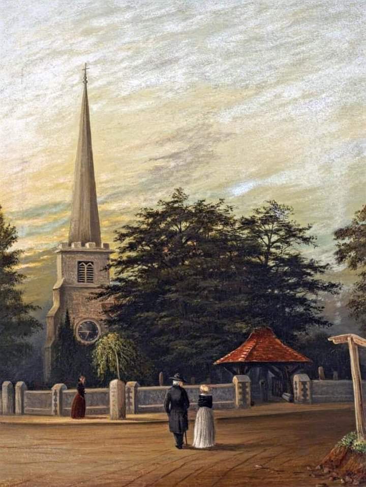
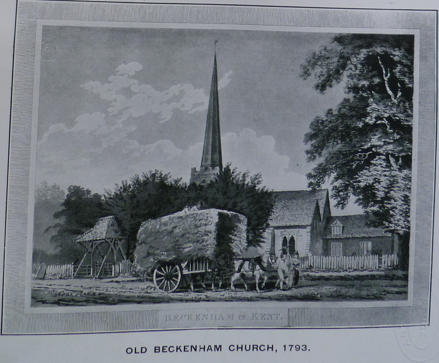
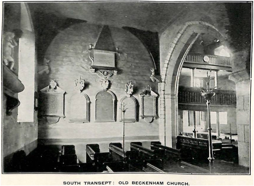
Old Church Interior showing west galleries
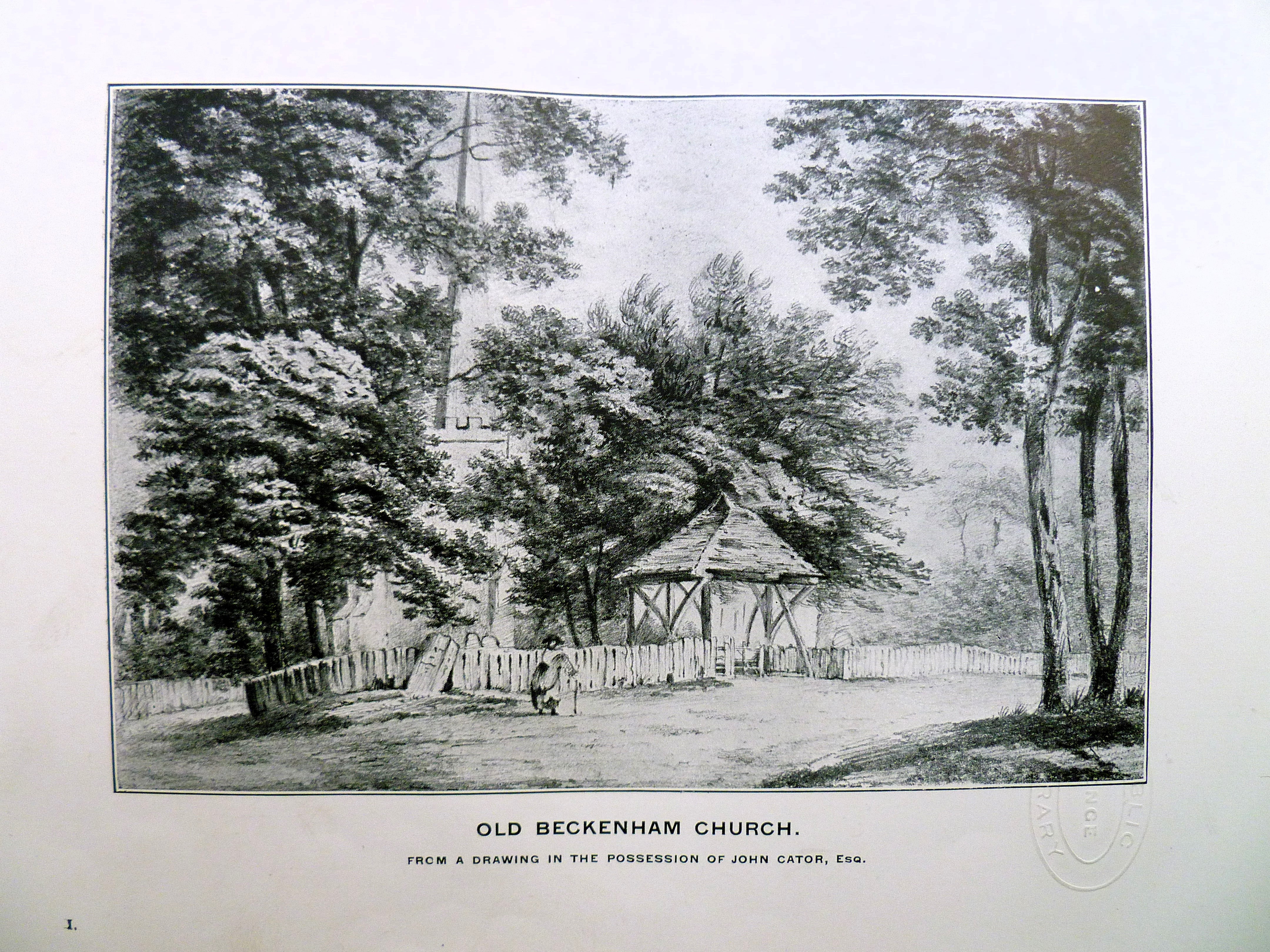
St. George's with spire and lych gate
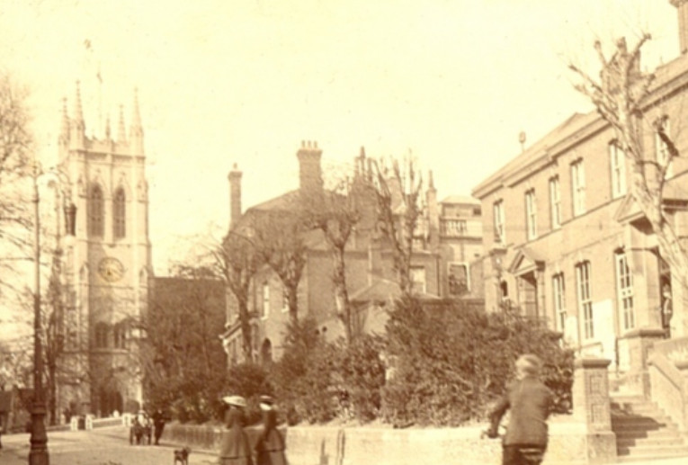
Church Hill 1910
Edward Hasted's history of Kent recorded these Rectors of the church up to the publication date of his work. Robert Borrowman produced a more accurate list upto 1910.
| William de Knapton, anno 22d Edward I. (1293/94) |
| John Bush, anno 35 king Edward I. 1306. (Calendar of Chart Rolls) |
| William Danyell, alias Malham, obt. June 24, 1458. |
| Henry Sherelocke, clerk, buried May 3, 1541. |
| Peter Racwiche, buried Dec. 16, 1545. |
| Nicholas Rokewood, 1551. |
| Robert Coozine, alias Cuyshen, 1552. |
| John Smith, buried Sept. 15, 1557. |
| Hugh Tayler, buried Oct. 16, 1560. |
| Hugh Calverley, buried July 4, 1576. |
| Peter Punter. |
| William Skinner, LL. D. 1628, obt. 1644. |
| John Storer, in 1650. |
| Roger Clisold, in 1659, obt. Aug. 15, 1676. |
| William Asheton, D. D. 1676, obt. Sept. 9, 1711. |
| — (Epiphaneus?) Holland, D. D. obt. Dec. 30, 1730. |
| Thomas Clerk, 1731. |
| William Fraigneau, A. M. 1765. |
| William Rose, A. M. 1778-1829 Charles Cator Andrew Brandram |
Tripartite
indenture, dated 2 Mar,. 16 Ric. II., (1393) whereby (after reciting
the
previous deeds, etc., as well as the death of the said John Colyn) John
Martham, parson of Bekenham, limits the manor and advowson of
the
church
of Bekenham (Kent), and the manor of Forthingbrigge (Hants), and a toft
and
plough-land called Godeshull, in the town of Forthingbrigge (Hants),
and the
manor of Randolveston? (Dorset), to Robert de Marny, for life, with
remainder
to Ingram Brun in tail maile, in default to the said William de Marny,
and the
other remainders noticed in the preceeding deed.
Beckenham
Rectory
In
the
late 18th Century William Rose the Rector had a Rectory built to the
designs of
the Adam Brothers. His 'living' from the parishes of Beckenham and
Carshalton
plus family wealth must have been considerable as he also had designs
for a
substantial stable. Our thanks go to David Love for this article about the
Rectory.
Robert Adam came up with a very
elaborate paladian design but two later versions of the plans played
down the
design to something much plainer. It appears that the design for a
stables was
not acted upon. The Rectory had considerable gardens and glebe land
(see https://maps.nls.uk/view/102343453).
Whether Rose's fortunes
affected the project or other circumstances we cannot say.
Some of
the
clergy that followed Rose did not choose to live in the Rectory,
Frederick
Chalmers, Rector was in occupation in 1871 but the Reverend William
Cator chose
to live in a house in The Avenue in the 1881 census and the Rectory was
occupied by St. Mary’s School under Louisa Pace (Gentlewoman)
with her
three
daughters acting as schoolmistresses. The school catered for children
boarders
from families as far afield as Edinburgh, Cornwall, Shanghai, Hong Kong
and six
children from one family in Bombay (Mumbai) , The
Rectory was eventually demolished to make
way for a new Town Hall for Beckenham which in turn was demolished to
make way
for the current Marks & Spencer and car park.
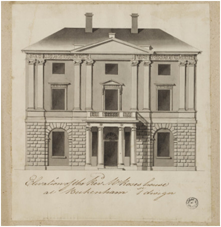
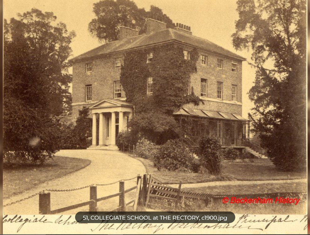
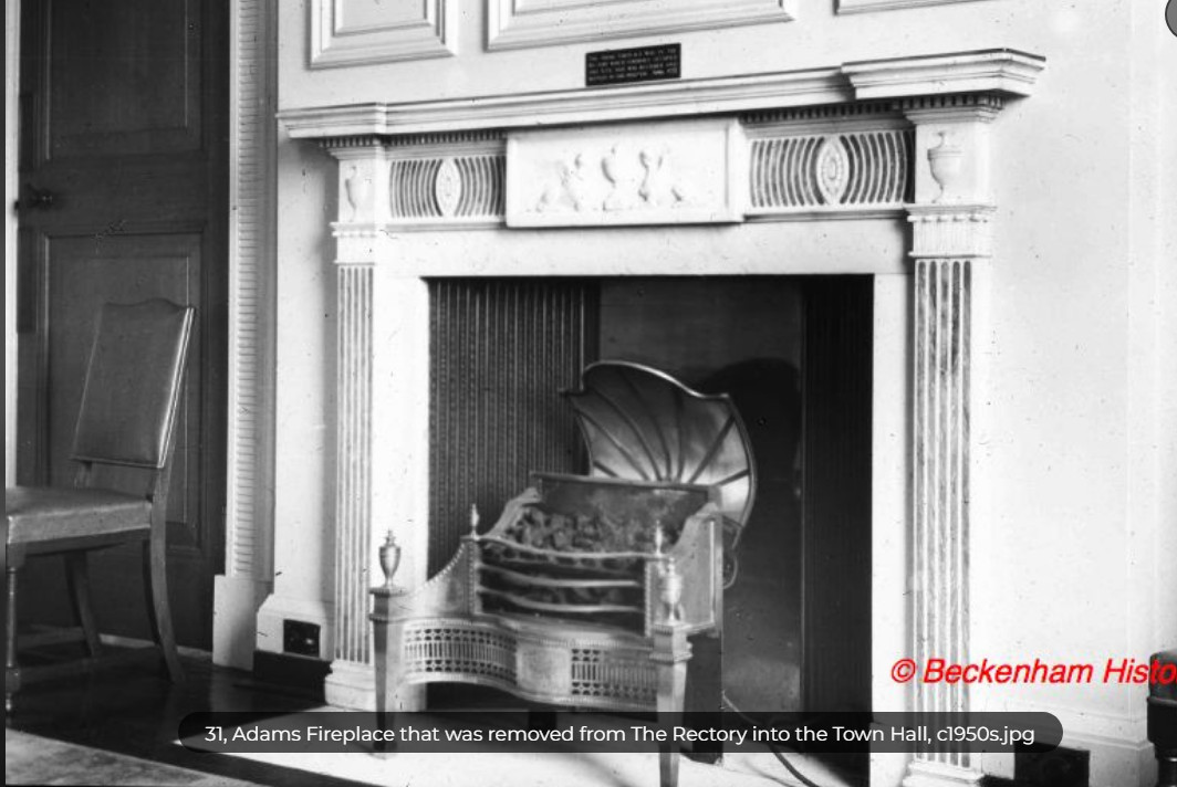
Robert
and James Adam office drawings
© Sir John Soane’s Museum,
London - And
as
built circa 1800 and Adam fireplace
Opposite and to the south of the Church was the Beckenham Manor house and grounds with a large lake. It had been exchanged by Frederick St. John with Peter Burrell III or Woolseys Farm (Shortlands House) in 1759. The Burrells later sold it to Henry Hoare.
The
Wood House
Borrowman
describes it as the oldest building in the village prior to its
demolition. It
was possibly on the site of or adjacent to The Mead which was in the
possession
of Thomas Motley in 1735 or The Mead is to the right and was later
named The
Manor House. Whether the Wood House was modelled on an old Saxon hall
is
debatable but like so much of Old Beckenham it passed into history
without much
regard. Probably it would have become a ‘listed
property’ along with a
few
other buildings had it survived.
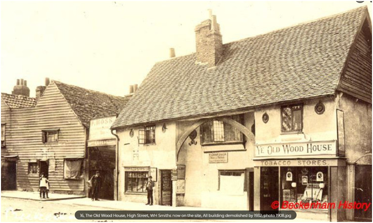
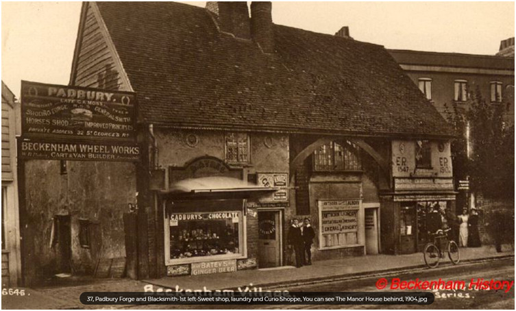
The Old Wood House (courtesy of www.beckenhamhistory.co.uk)
The
Workhouses
A
good
description of the Beckenham workhouse is made by Robert Borrowman
(1910) as he
had access to Parish minutes. He describes the building and its
establishment
and some details of its management and occupants during its active
period. The
building was on the corner of what is today Bromley Road and Oakwood
Avenue
with an adjoining field for the growing of crops to support the
inmates. The
house and adjoining field are said to have been provided by the Stile
family
although the map illustration is from the Burrell 1809 map afte Stile
property
had passed to the Raymonds and thence to the Burrells. The 1766
Foxgrave Manor
map shows that Henry Kempsall, yeoman had property here so perhaps
Kempsall
provided the land. Kempsalls are mentioned in Borrowman’s
book and were
at one
time church wardens and parish registers (registrars).
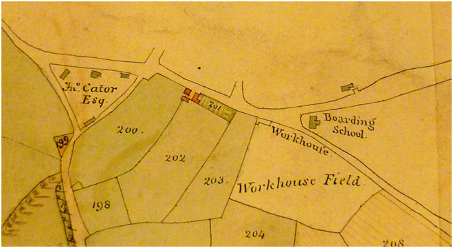
The Beckenham Workhouse position on the Burrell 1809 estate map
The workhouse was closed when a new establishment was built at Farnborough for the whole of Bromley. Although the Poor Law provided for a poor rate legislation under either Elizabeth I or George 1 may have prompted the building of the workhouse, its establishment is unknown. Borrowman describes its operation from 1776 to July 1836 and the building was subsequently offered for lease by the overseers. In 1801 John Cator is accused of influencing the church wardens in resisting the setting of a poor rate.
A similar institution was established in West Wickham and research prompted by Kate Hollis caused us to look closely at the Burrell 1809 map which shows a “W.Wickham Parish” property at Wickham Green. This is supported by references and material in Kent Archive which describe the next landlord of Langley, Emanuel Goodhart, rerouting a fence and water supply used by the poor and later purchasing the redundant “new” workhouse at Wickham Green and three cottages from the Bromley Union in 1839. Bromley Union had established a new workhouse for the whole borough of Bromley at Farnborough.
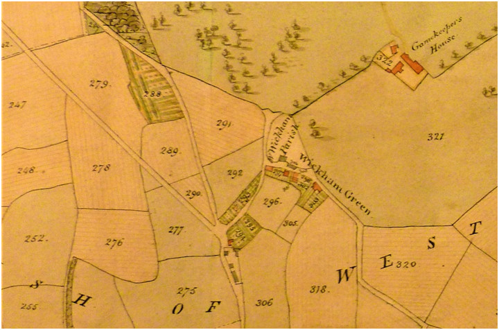
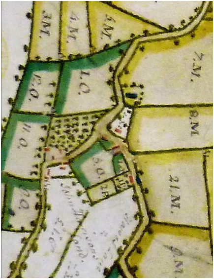
W.Wickham Parish site next to Langley Park boundary fence 1809, The earlier 1750’s Langley Map showing a small plot not belonging to the Raymonds
Wickham
Green was probably a bit of waste or common land adapted for the
purpose of the
workhouse. This picture of Wickham Green from Beckenham History may
indicate the type of
buildings that the workhouse resembled?
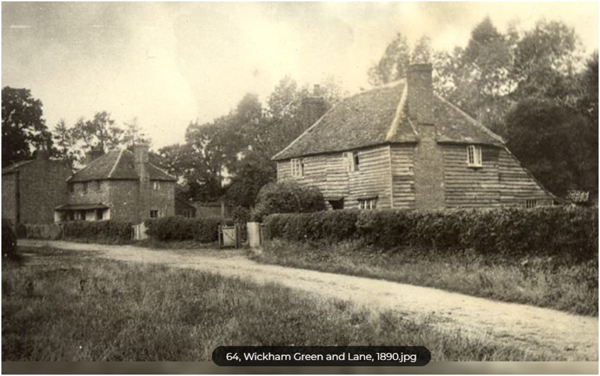
The
Orphanage
The first evidence I saw of an orphanage in Beckenham is from the1871 Census which describes it as No.8 High Street and the matron is Harriet Flora West assisted by three servants, a cook, a nurse and a housemaid. 33 orphans are listed but their birthplaces vary, mostly from the Middlesex parts of London and Poplar, 1 born in France as a British subject, but none shown with Beckenham as their birthplace. More research perhaps in conjunction with the North Surrey District School at Anerley https://www.workhouses.org.uk/NorthSurreySD/
This appears to show that Bromley and Beckenham orphans may not have been accepted at this institution?
In 1885 “The Home of Compassion” lies next to The Rectory (demolished for Beckenham Town Hall 1930s, now M&S Car park). The numbering has now changed (60, High St is Lloyds Bank). This places it nicely next to St George’s Church.
In the 1950s the Children’s Home was in Bromley Road (now demolished) between Chancery Lane and Crescent Road. It was still run by the church.
The census (1881?) enumerator’s route confirms this location. “Brook House” and “Gordon House” are at the end of the lower High Street (1885 Directory) before the turn up Church Hill at Thornton’s Printing Works.
The George Inn
The George Inn gets mentioned in some early records and members of the King family were 'landlords' although the freehold probably belonged to the Lord of the Manor being Bruyn's, St. John's and then John Cator. The 1838 Tithe returns show John (Barwell) Cator as landowner and Wm Cauleutt as tenant/landlord
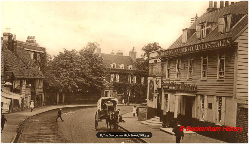
The George Inn in 1912 (courtesy www.beckenhamhistory.co.uk)
Note the Old Wood House on the left and two large houses further on, one of them being the mansion house.
Beckenham
Lodge
This
property was at the junction of Croydon Road and Beckenham Road
diagonally
opposite what is now the cinema. The position of the Lodge and its
grounds can
be seen on the 1809 Burrell estate map annotated as ‘The
executors of
late Lawrence
Banyer Esq’ as he was the owner and died in 1798. The Banyers
are
mentioned in
a bequest in the will of Mrs Sarah Holland who had occupied Clockhouse
and
would have been close neighbours. Sarah left £100 to Mrs
Dorothy
Banyer, wife
of Lawrence or Laurence as his name is spelt in records. Dorothy is in
Beckenham burial records for 1823 and her DOB is estimated at 1737 but
her
husband is not. The executors of Banyer’s will were John
Clarkson and
Hawkins
Wall and in the will Banyer leaves his wife Dorothy £500 plus
household
contents, some income from property and use of Beckenham Lodge until
her death
(in dower). Banyer has property in Suffolk, Norfolk and Cambridgeshire
which he
devizes in the will. He has no direct heirs, a daughter Marianne born
in 1764
appears to have died so we assume these other beneficiaries and
executors are
related in some way. No other records have been traced apart from
Laurence
Banyer baptized in 1732 to Edward and Mary Banyer in the City of London
and his
will of 1798. Presumably the house was sold or leased after
Dorothy’s
death in
1823 and Banyer’s Beckenham property was confined to
Beckenham Lodge
and
grounds. In 1871 the lodge is occupied
by Edwin Covell who would also occupy Beckenham Place for a time.
Covell had a
butchers shop in the village and as a meat salesman supplied meat to
the armed
forces.
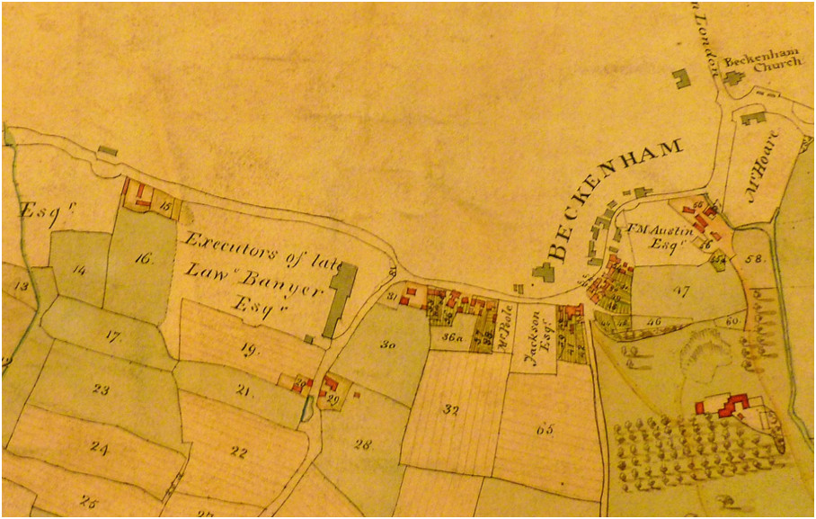
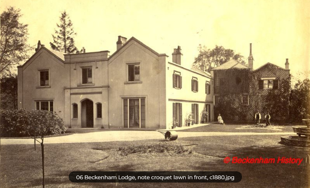
Lodge is annotated "Exec of L.Banyer Esq." Burrell estate map 1809. Numbered and shaded property is Burrell proprietor Image courtesy of Beckenhamhistory.org
The Mead
The name of The Mead may have been short lived as we get it from Thomas Motley's 1736 map of his land in the village and at Elmers End Old and New Farms as well as his acquisition of Thayer's Farm.
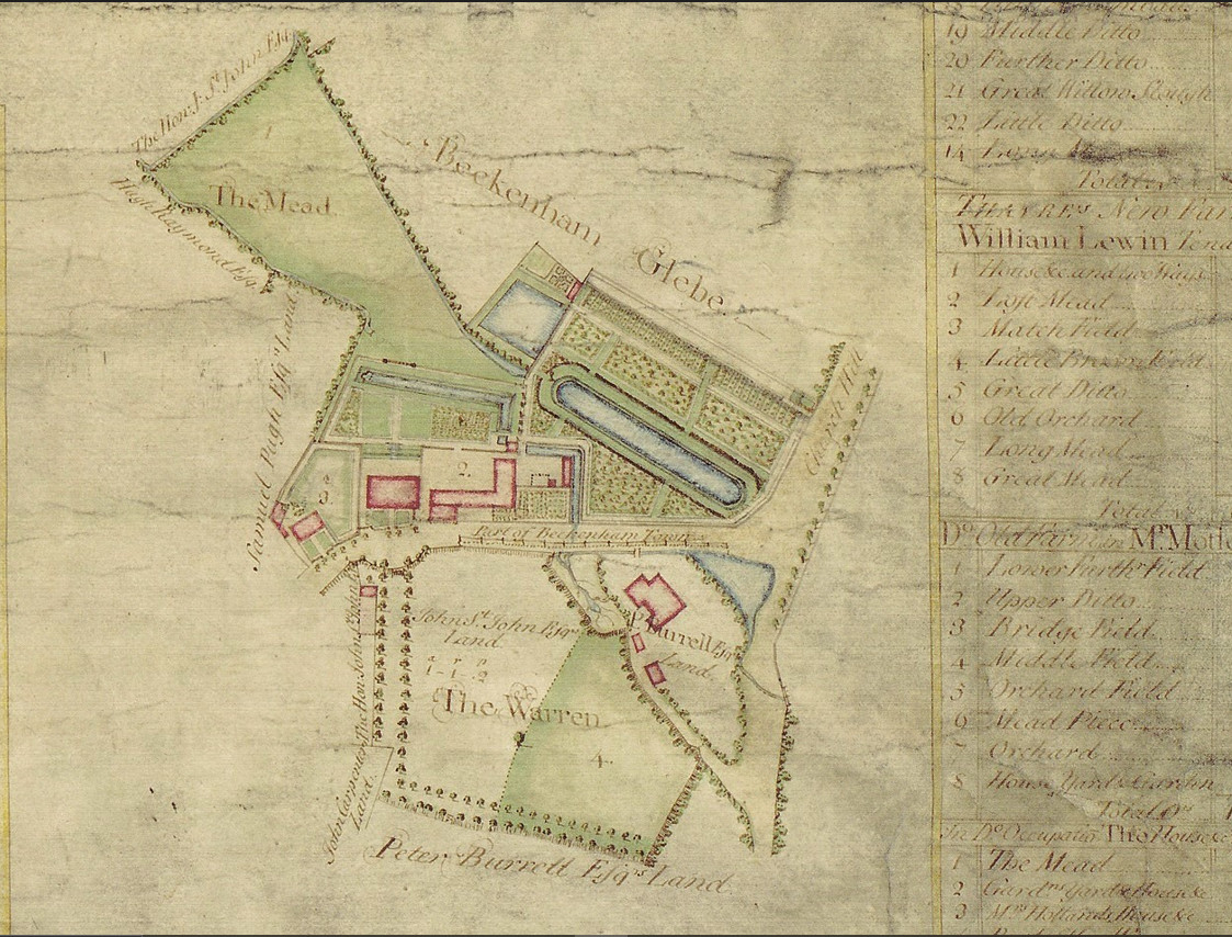
The Mead shows a house and outbuildings almost opposite the George Inn with formal landscaped grounds with a long pool and some narrow canals. The map shows at least some of the water flow from the Beck as being diverted along the High Street to flow into the canals. The house to the left of the Mead is Mrs Holland's house and then Samuel Pugh's land is indicated. Pugh's land looks like the site of the Wood House. Motley's property passed to his son in law and heir Francis Austen then to his grandson Francis Motley Austen. This map and the Burrell Kelsey map of similar date show slightly different detail of the river which does raise some questions. But perhaps flooding in this area has always been a problem. The oblong pond was later re-landscaped into a more fashionable informal lake outline further to the west.
Penge.
Penge has been the subject of several history accounts but our research
has perhaps revealed more or relates a bit more than some of those
accounts. Penge was more associated in ancient times with the parish of
Battersea (Batricksey) and Surrey. The area
became increasingly
connected with Beckenham and absorbed into the parish. Records from
circa 1200
relate to Penge and are signed or witnessed by the clerk and priest of
Beckenham. Some connections came about through the St.John family who
had
acquired Battersea (Batricksey) Manor before they purchased Beckenham
Manor and
part of Beckenham Manor is near Rockhills. It helps to understand the
descent
of Battersea from various links such as;
https://www.british-history.ac.uk/vch/surrey/vol4/pp8-17#anchorn52
And the connections are far reaching as we find that the Rydon/Roydon family of Battersea held land under lease from the church and crown. Their heiress Joanne was widowed and subsequently married Oliver St. John, Viscount Grandison who then obtained the freehold of the manor of Battersea from the crown. Oliver and Joanne died without issue and the Manor of Battersea including parts of Penge were inherited by the St.Johns who subsequently also acquired Beckenham Manor by purchase of the two moieties in about 1639 and 1650. We find that the Rydons were acquainted with other local yeomen families such as theKempsalls and even related with the King/Kynge family with Henry Rydon referring to Henry King as uncle. However Penge originally being in Surrey and Battersea has been the subject of separate study, See the website for ‘Pengepast’ etc.
Within Penge we encompass Penge Place, Penge Farm, Grotto House, The Crooked Billet public house and more recently almshouses. A part of Beckenham Manor extended from Penge Green to Rockhills. As some places were renamed sometimes with changes of ownership, the tracking of changes is often challenging. Detailed maps of Penge and into constituent parts are rare so we have to rely to a great extent of Rocque's map which though including some inaccuracies does seem to show some relevant detail for 1749.
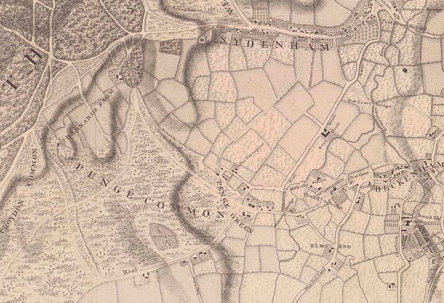
From
“A History of the County of
Surrey”: Volume 4. Originally published by Victoria County
History,
London,
1912.
"The 'hamlet' of Penge was part of the ancient ecclesiastical parish of Battersea. The curious anomalies of its local government led to its formation as a separate urban district and its transfer to the county of Kent in 1900. (fn. 49) Penge was a wooded district, over which the tenants of Battersea Manor had common of pasture. (fn. 50) The boundaries of the hamlet on the north in February 1604–5 were the common of Rockhills (evidently Rockhills in Upper Sydenham, immediately north of the Crystal Palace) and the 'Shire Ditch' leading past the house called 'Abbetts' to the north corner of 'Lord Riden's Wood.' The Shire Ditch also bounded the hamlet on the east and was crossed by 'Willmoores Bridge,' half in Kent and half in Surrey. On the south it was bounded by the waste or common of Croydon, the green way from Croydon to Lewisham. On the west was a wood 'of Mr. Colton's' in Camberwell parish, which stretched from Vicker's Oak to the Low Cross near Rockhills. (fn. 51) There seem to have been several tenants of the manor at Penge in 1596, (fn. 52) but in 1725 the vicar of Battersea returned to Bishop Willis that there were only thirteen houses and sixty inhabitants in Penge, who went to Beckenham Church, and for whose care he paid a trifling consideration to the incumbent of Beckenham. (fn. 53) The whole common was inclosed under an Act of 1827. (fn. 54) There were then 320 acres already inclosed and several houses standing there. In 1853 Mr. Schuster sold his park on the summit of Penge Hill to the Crystal Palace Company for the re-erection of the gigantic building made by Sir Joseph Paxton for the Great Exhibition in Hyde Park in 1851. (fn. 55) The Palace was opened by Queen Victoria in 1854. (fn. 56) In 1877, owing to financial difficulties and to the 'Greenwich fair characteristics,' which had replaced the former educational objects of the Palace, the company was reconstituted. (fn. 57) The Palace, as originally planned, was the exhibition building of glass and iron which had served for the Exhibition of 1851 in Hyde Park, re-erected on this site, with the addition of high water towers to supply the fountains in the grounds. Inside courts were erected to illustrate the arts and architecture of different periods, from the Egyptian monarchy to the Italian Renaissance, and there was a great collection of plaster casts of famous statues. (fn. 58) A School of Art and Music was established, and later a School of Forestry and Engineering, which has continued to flourish. The Palace became the chief seat of the highest class of music near London, and the Handel Festivals, under the direction of Sir Michael Costa and Sir August Manns, obtained the greatest reputation, as did the Saturday Concerts so closely associated with the names of Sir August Manns and Sir George Grove. But the public taste did not rise to this level, and the theatre and music-hall exhibitions gradually eclipsed the educational features. The grounds, of great extent, including a cricket field, football ground and a lake, continue to furnish unrivalled scope for exhibitions, excursions, games and firework or aeronautical displays. The land surrounding the Palace was sold shortly before 1875 for building purposes, and the whole site is now for sale.
Between 1821 and 1841 the population of Penge increased very slightly. In 1841 it was 270. In 1851, owing to the establishment of the Surrey School of Industry, the Queen Dowager's Almshouses and the Watermen's Almshouses, it had increased to 1,169. In 1901 it was 22,465. One great cause of this increase was the advent of the London, Brighton and South Coast, and London, Chatham and Dover railways, which constituted Penge a suburb of both London and Croydon. The former has stations at the Crystal Palace, Anerley and Penge; Penge station, on the latter, is within the boundary of Beckenham. A town hall was built in the Anerley Road in 1879. Anerley, Penge and Upper Norwood are the three wards of the Penge Urban District. The ecclesiastical districts of St. John the Evangelist, St. Paul, Holy Trinity and Christ Church were formed in 1851, 1869, 1873 and 1886 respectively."
Penge Common and Crystal Palace
Much of the information about Penge Common is clouded in mystery but we can gather as much material as we can find and hope a clearer picture emerges. The Kent Surrey border seperated much of Penge from Beckenham and Penge was in the parish of Batricksey (Battersea). A section of Penge Common was part of Beckenham Manor as shown on the 1623 Manor map. Before the dissolution of the monastries much of the land belonged to St. Peter's, Westminster Abbey and was leased to tenants. One such tenant or leaseholder was Henry Rydon d.1531 whose will described his lease from the Abbot of Westminster and says "To Robert my sonne my leas or Covent seale with the yeres conteyned in the same I hold and have of my Lorde Abbott priour and covent of Westmynster of the manor or lordeshippe of Battersey for terme yeres and if he die or he come to 21 yeres then to Henry my sonne at 21." and "I will that Robert Ryden my sonne when 21 all my lands as well free as customary in Battersey and Wannesworth in Surrey. I will also that Henry Rydon my sonne when 21 shalhave all my lands, tenements, etc. in Westerham, Bromeley, Beckenham and Lewisham for ever."
Since a lot of it was waste or land unfit for much agriculture is became common land or access allowed for gathering firewood, feeding pigs etc. At the dissolution the land became the property of the Crown and in 1627 was made the property of the St. John family. Oliver St. John had married Joan Rydon (Roydon) so had perhaps taken on occupation of the leased lands.
1763 Frederick St. John sold the Manor of Battersea to Lord Spencer. On the Beckenham Manor map we have parts of Beckenham Manor on land adjacent to Penge and the Common with farmland and property which became Penge Place. The most detailed map evidence so far is John Rocque's 1749 map and Carey's 1779 map both of which display some differences as well as some similarities. Subsequently there is the Ordnance Survey surveyor's drawing dated 1799 which is a draft but supports some Rocque and Carey detail. We should consider how close the ties are with Rydon and later, Oliver St. John who married Rydon's daughter and whether they held sway over the propeerty. In the late 18th C a John Morgan occupied Penge Place and it appears that it was during his lifetime that the name was adopted. Morgan's property was sold to Scott which in turn was bought by John Barwell Cator circa 1820? The most detail we have is perhaps in the 1825 Cator Private Act of Parliament which lists property in Penge and Battersea and some documents in Bromley Collections which list the same field names as the 1825 Act.
In 1794 John Morgan the then owner of Penge Place attempted to enclose Penge Common. He died in 1803 and the property passed to John Scott. Scott then sold his property of Penge Place and the soil of Penge Common to John Barwell Cator in 1813. Various disputes arose between Cator and Scott and the Croydon Canal Company regarding monies unpaid by the company. The Penge Common enclosure act was passed in 1827 but settlements of compensation were still being sorted out in 1837 and a court case decision was made in 1843 regarding John Barwell Cator's suit against the Croydon Canal Company which had become insolvent circa 1822 but was in receipt of monies after the London and Greenwich Railway gained an Act for constructing a railway on the old canal route.
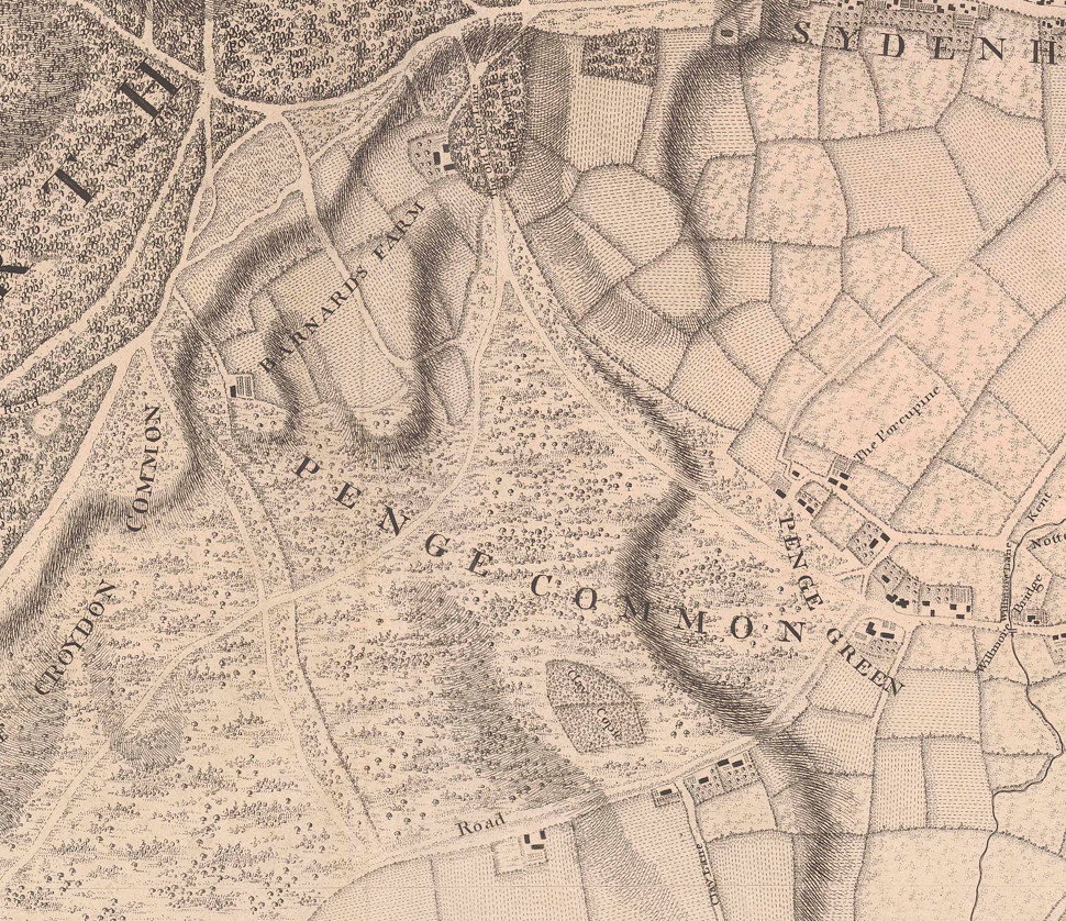
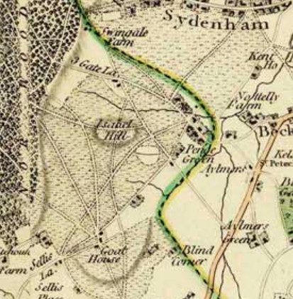
Rocque's 1749 and Carey's 1786 maps which are schematically similar.
Shortlands, Clay Hill,
Scott's
Lane
Shortlands is a relatively recent development which covers the area of
the
earlier Clay Hill which itself was an evolution from Cleyhurst. The
properties
of Lodge Farm and Woolseys Farm have been swallowed up by it and it has
taken
its name from Shortlands Green which goes back beyond the 17th Century.
Shortlands House, now Bishop Challoner's School, is on the site of
Woolseys
Farm. Scott's Lane takes its name from James Scott, a surgeon of
Bromley who
took up residence there. These articles by Linda and Keith Baldwin
trace its
history and some interesting personalities who lived there. Follow Shortlands
and Scott
for
the articles in pdf format.
Eden Farm was created out of parts of the Kelsey estate which nestled between Kelsey, Langley and upper and lower Elmers End. It has been stated wrongly that Eden Farm was part of Langley but map evidence is pretty clear that most of it was from the Burrell's Kelsey estate as shown by the 1735 Kelsey map which shows Langley belonging to Colonel Hugh Raymond to the east. The Burrells leased the land to William Eden, Lord Auckland (1745-1814) from the 1780's to the 1820's. The lease was extended a couple of times but after William Eden's death his son George Eden possessed the lease but apparently did not live there as his career took him elsewhere but his siblings remained in residence. The last lease was terminated so that Eden Park could be sold by the Burrells in the Gwydir sale of 1820 and the new landlord was John Woolley. There is some debate about the house as the Burrell 1809 book of leased properties shows a house with a footprint which could not be the house which appears in some prints purporting to be Lord Aucklands house. Eden Park was created out of the part of Kelsey from fields called Borngates and a house belonging to the Burrells called Bune Gate which was probably a house occupied by one of the Peter Burrells before the lease was granted. At least that is what can be deduced from the Andrews, Drury and Herbert map of Kent of 1769 and the Kelsey map of 1735..
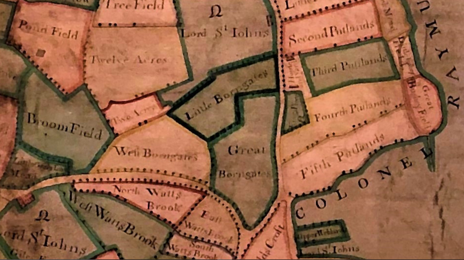
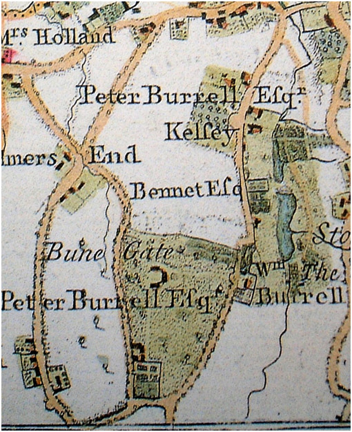
The 1735 Burrell Kelsey map next to the 1769 Andrews map with inaccurate road orientation showing Bune Gate and Peter Burrell with a house approximately of the same footprint as of 1809
The road between West Borngates and North Watts Brook is Bricklers Lane from Elmers End which is later renamed Eden Park Avenue.
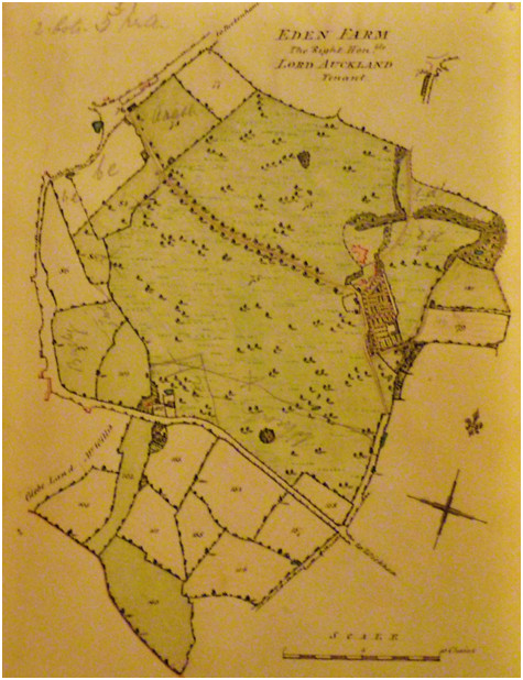
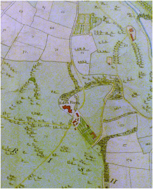
Burrell lease of Eden Park from the 1809 book Burrell map 1809, a clearer image of the house footprint and Kelsey lake top right
This recent discovery (2023) by Keith Baldwin from the British Library digital archive shows a house with wings matching the Andrews and Burrell maps. Most likely it is the house built by the Burrells pre 1769 called Bune Gate on the Andrews Drury and Herbert map and renamed Eden Farm after William Eden took up residence under his lease from 1782 which he extended in 1794.
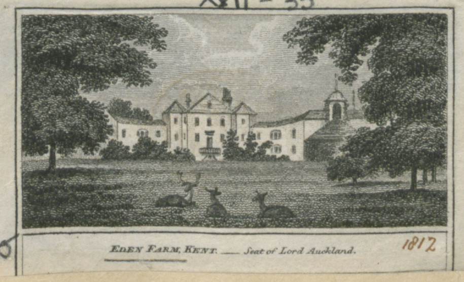
British Library shelfmark: Maps K.Top.17.35. The BL King’s Topographical Collection: "EDEN PARK, KENT, ;"
Title: "EDEN PARK, KENT, ;"
British Library shelfmark: Maps K.Top.17.35.
Place of publication: [London]
Publisher: [W. Peacock].,
Date of publication: [1812]
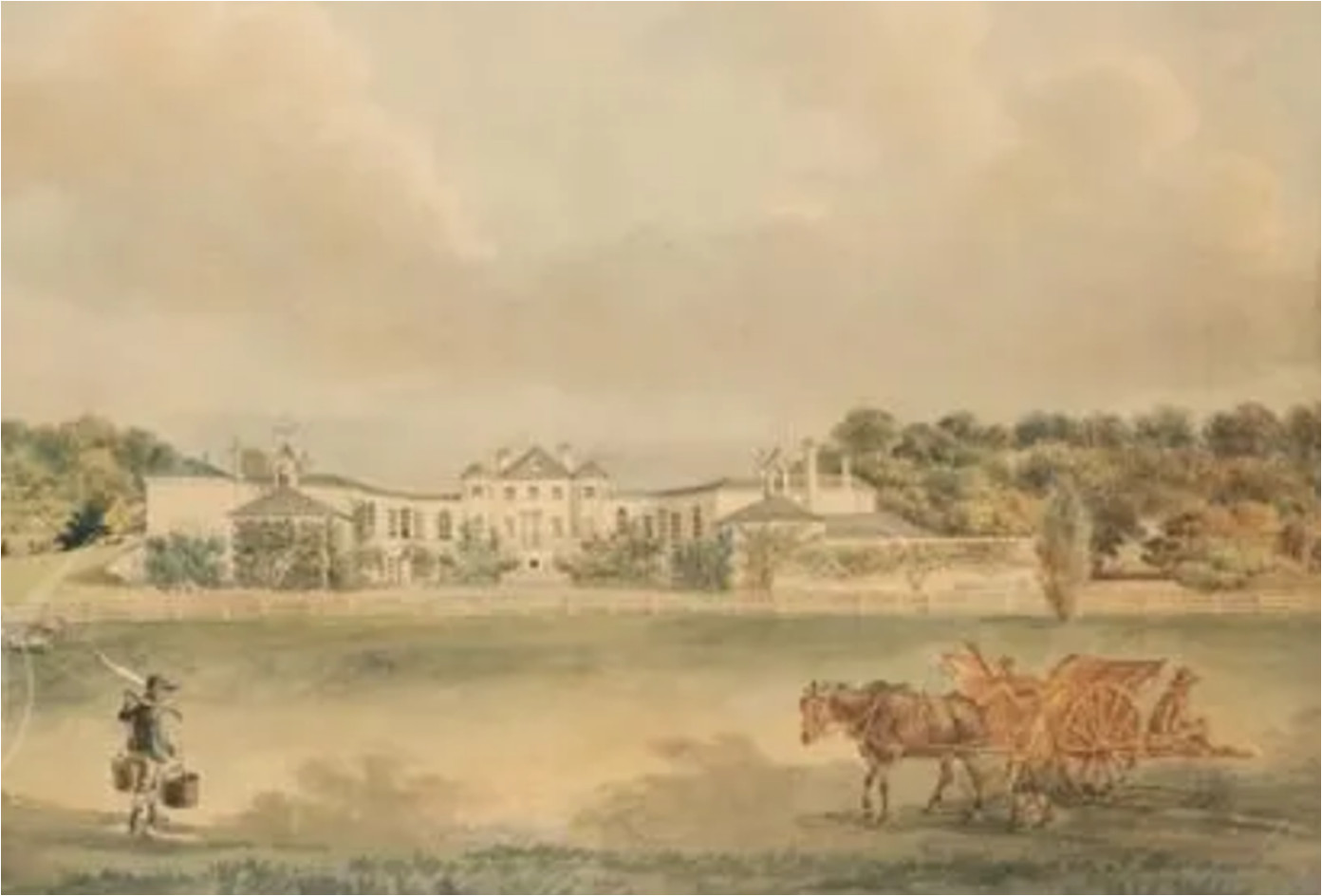
Eden
Park, Seat of
Lord Auckland (William Eden) circa 1789
Painted
by Peter la
Cave, French School artist working from 1789 onwards
The
Royal
Academy Catalogue; 54th exhibition MDCCCXXII
(1822) describes A
perspective drawing of a mansion lately erected for John Woolley Esq,
Beckenham, Kent G.Robins (artist?
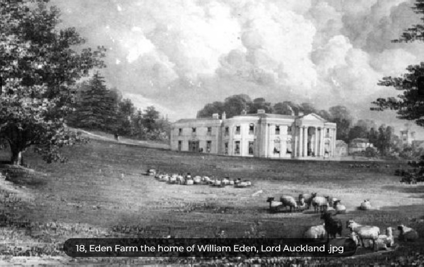
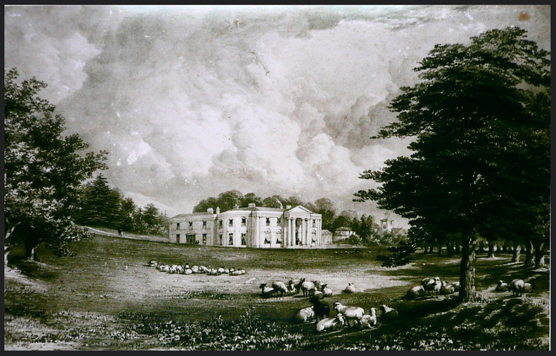
This is the house built by
John Woolley and leased to Edward Lawford.
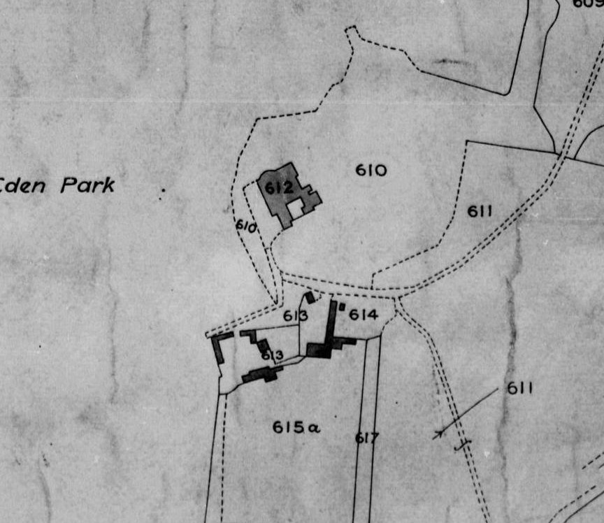
Eden Park 1838 tithe map. The footprint at 612 shows a curved bay on
the northwest corner.
In 1838 Edward Lawford is listed as occupant of Eden Park under lease from John Woolley.
This undated painting is described as Eden Park Farm which was at Upper Elmers End and sometimes called Elmers End Farm (not to be confused with Elmers End Old and New Farms).
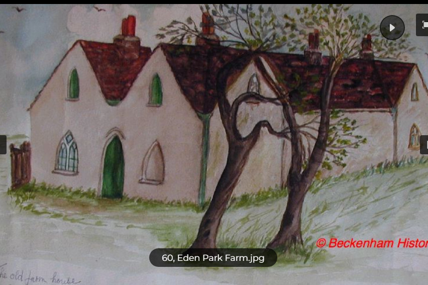
courtesy of Beckenhamhistory.org
Ordnance Survey maps of circa 1870 show the site of Eden Park mansion to be where Crease Park on Village Way is today but the later maps circa 1890 show the house had been demolished and only the outbuildings remain as a farmstead.
Harvington
Harvington
was originally part of a mixed area of fields and farms mostly passing
through the ownership of the Burrells and parts possibly of Foxgrove
Manor. Decyphering available maps shows that the bulk of Harvington was
part of the Kelsey estate and some land
passed from Foxgrove to John Cator or descended via the
landlords of Kelsey and Beckenham Manor. Eventually it became part of
the Burrell estate and was leased to the Eden's as Eden Farm or Park.
Was part of the Burrell 1820 sale and further descent via John Woolley
and
some Victorian villas erected. Most of the large houses have been
demolished for whatever reason? Today it is a public open space which
occupies part of what was Langley
Park and
Eden Park. Bearing in mind that Eden Park was formed mainly out of
Kelsey
property. There were a few grand Victorian villas along South Eden Park
Road
with entrance lodges. All but one of the villas have disappeared
although some
lodges remain. The remains of the foundations of Eden Park Lodge can be
found
in woodland in the north part of the site. When the Burrells had South
Eden
Park Road constructed in the 1780’s it cut off part of
Langley
property.
Beckenhamhistory.org
has this account of Harvington which begins with "In
the early 1870s, five houses were built along what we know today as
South Eden Park Rd. At least some of the land, if not all, belonged to
William Rudd Mace whose daughter Emily had married George Stanley
Lutwyche. The houses most closely associated with them were Elderslie
and Oakfield but there were also Chalfont, Homewood and Harvington. How
did the whole area become known as the Harvington Estate?
It
is all to do with the Petley family, Bertrand Theodore and Florence
Ada, who lived there from 1919 and brought the name Harvington with
them. Harvington was of particular significance to them since it was
the name of the village near Kidderminster where they became engaged to
be married. They took the name to Burmah for their house in the hill
station at Maymyo and then back again for their house in Beckenham at
the bend in South Eden Park Rd.
Harvington
was described as an imposing red brick house with a slated roof,
roughly square in shape with a frontage of sixty feet. A twenty-foot
billiards room had been added to the original building but it had
suffered some damage when a V2 fell near St John’s church
over
the other side of the fields." Read more on https://beckenhamhistory.co.uk/locations/harvington-estate
Why several large houses had such a short life is not fully understood but the one survivor (at time of writing) perhaps shows that large houses were beginning to fall out of favour.
Plaistow,
Bromley
I
have
included Plaistow because the Foxgrove Manor map of 1720 which we have
as a
1766 copy shows an area similar to that of the later Plaistow Lodge
which in
1720 was the property of Lancelot Tolson. Plaistow Lodge is recorded by
Horsburgh and but he leaves some gaps which we can fill in to some
extent.
Sometimes it is confused with the Plaistow and Bromley north of the
Thames.
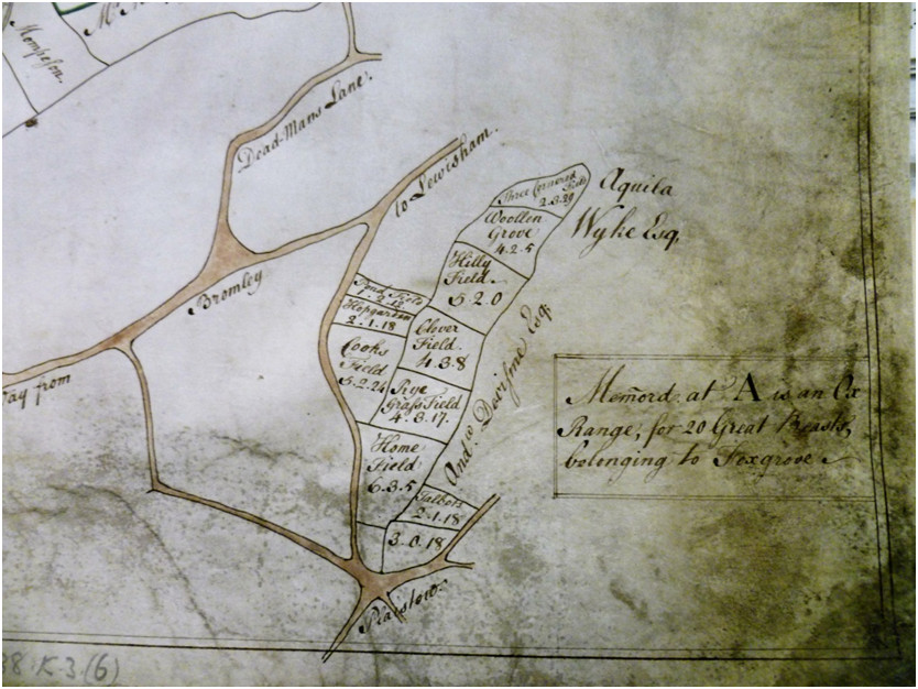
The Foxgrove Manor map 1766 copied from a 1720 version (Plaistow portion)
There
is
still some question as to how this area of Plaistow became linked to
the Manor
of Foxgrove. It may have been part of Foxgrove Manor prior to the
Tolsons when
the Leigh family were the landlords or it may be that John Tolson
bought the
Plaistow property prior to his death in 1712 which he left to his
brother
Lancelot and it became joined to Foxgrove Manor at the sale of Foxgrove
by the
Leigh family circa 1716. Some writers
have claimed that John Tolson bought Foxgrove but a Court of Chancery
directive
in 1716 after John Tolson’s death required
the Leigh’s to sell it to pay Francis
Leigh’s debts after his death in 1713. John
Tolson’s will describes
property in
Bromley which he leaves to his brother but does not mention Beckenham
parish or
Foxgrove Manor by name leading me to assume that Lancelot Tolson
purchased
Foxgrove and added it to John Tolson’s Bromley acquisition.
Subsequently the Tolsons intermarried with the Tillys and Foxgrove was divided and the Plaistow section went by a complex route of inheritance to Joseph Groves circa 1748 and was inherited by his nephew Groves Wheeler in 1764. Joseph Grove had also inherited Stone Farm from the Tolson/Tillys which he had sold to John Cator circa 1758. Horsburgh’s account is worth reading as he mentions Jones Raymond acquiring some property around this area and Jones Raymond did acquire large parts of Foxgrove Manor to add to his Langley estate which he inherited from his father Hugh Raymond but not this site in my understanding. Perhaps there is more to research as these ‘borderlands’ between Bromley, Beckenham and Lewisham could be impacted by the history of the manors of Lee-Shroffold particularly as Shroffold farm in what is now Downham was nearby and the Earl of Rockingham is annotated on the Foxgrove Manor map as having some land bordering and even inside what is now Beckenham Place Park.
The map shows the road from Bromley to Lewisham and Plaistow Green is at the bottom. Aquila Wyke Esq and Andrew Davisone Esq. are shown as a neighbouring landowners. In 1720 the property would have been under Lancelot Tolson.
Simpson’s
or Sympson’s Place, Bromley
Although the centre of Simpson's Place was in Bromley we are
including it in the Beckenham history because it was partly in
Beckenham and it’s more recent
landlords also
owned Langley and Kelsey, which themselves overflowed into neighbouring
parishes of Bromley, Hayes and West Wickham. These overflows make it
difficult
to confine historical accounts to any one parish or borough. Philipot
and Hasted
included
Sympson’s in their accounts of Bromley and Lysons also made
reference
to it.
Probably the best reference is in Horsburgh’s "Surroundings
of Bromley
Town" found
here: Horsburgh's
Surroundings of Bromley
where
he discounts much of
Philipot, Hasted and Lysons and constructs evidence from records in
much the
same way as we have in the Beckenham timeline.
From the time when the Style family acquired Sympson’s and combined it with Langley it then followed through the Raymond and Burrell families mostly being leased to tenants.
However, some links go back further as the early occupants of Sympson’s before it acquired that name had leased additional land from the Bishop of Rochester and from the Bruyn’s of Beckenham. So early documents from the late 13th and early 14th Centuries refer to Bromlegh and Beghenham (sic). Other links include that a subsequent owner, Richard le Lacer had a daughter Alice who married William Bruyn and subsequently Robert de Marny which affected the descent of Sympson’s.About a half of Simpson’s was in Beckenham parish. Although it adjoined Langley parts of Foxgrove Manor overlapped it as shown in the later map drawn for Hugh Raymond after he bought it along with Langley in 1732. Again, the marriage of Peter Burrell II and Amy Raymond determined that Simpson’s along with Langley came into the Burrell family and was disposed of with the 1820 Burrell/Lord Gwydir sale. Hugh Raymond had earlier sold some land called Elmer Farm to Thomas Motley in 1734 which was said to be part of Simpson's. If so then Simpson's had outlying 'satellite' sites just like the other manors and estates.
Hasted said of Simpson’s “SIMPSONS is an estate in this parish, which was formerly of much greater account than it is at present. It was antiently owned by the Bankwells, a family of good repute who resided at Lee in this neighbourhood, as has been already taken notice of. In the 31st year of king Edward I. John de Banquel was possessed of this estate, and had that year a grant for free-warren in all his lands in Bromley, Lee, &c. to him, Cicele his wife, and their heirs. William de Banquel died possessed of it in the 20th year of King Edward III. and left Thomas Banquel his heir, who paid aid for it that year, as the fixth part of a knight's fee in Bromley, which John de Bankwell before held there of the bishop of Rochester. He died, in the 35th year of that reign, possessed of much land here, and in this neighbourhood, and left three sons, John, William, and Robert Bankwell, who became his heirs in gavelkind, and on the division of their inheritance, William, the second son, became entitled to his father's estate in Bromley.
After this family was extinct here it came next into the possession of the Clarks; one of whom, William Clark, in the reign of king Henry V. having obtained the king's licence, erected a strong, but small building here, of stone, with an embattled wall, and encircled it with a deep moat. His posterity did not continue long in the possession of it; for about the latter end of the next reign of king Henry VI. John Simpson resided here, by right of purchase, and having much improved the mansion, it adopted his name, by which it has been called ever since.
In the 11th year of king Edward IV. Robert Simpson died possessed of this seat his descendant, Nicholas Sympson, the king's barber, alienated Sympsons to Alexander Basset, who, in the reign of King HenryVIII conveyed it by sale to Sir Humphrey Style, of Langley, son of John Style, alderman of London; this estate being then held in socage.”
Lysons wrote “The manor of Simpsons was, in 1302, the property of John de Banquel (fn. 17). Thomas Banquel died seised of it in 1361 (fn. 18); and it appears that, upon a division of his estates, his younger son William had this manor. The next owner upon record was William Clarke, who had a licence from Henry V. to fortify and embattle his mansion-house, which was surrounded by a moat (fn. 19). About the year 1450, it came by purchase to John Simpson, from whose family it derived its present name (fn. 20). Nicholas Simpson, his descendant, (who was barber to Henry VIII.) aliened it to Alexander Basset, by whom it was conveyed to Sir Humphrey Style. It has since passed through the same hands as Langley-park in Beckenham, and is now the property of the Right Hon. Lord Gwedir. Mr. Samuel Rickards, the tenant, occupies it as a farm.
William de Latimer, in 1329, obtained a charter of free-warren on lands at Bromley, which he had inherited from his father, who died in 1327 (fn. 21).”
But both Hasted and Lysons are quoting Philipot from 1659 who wrote:
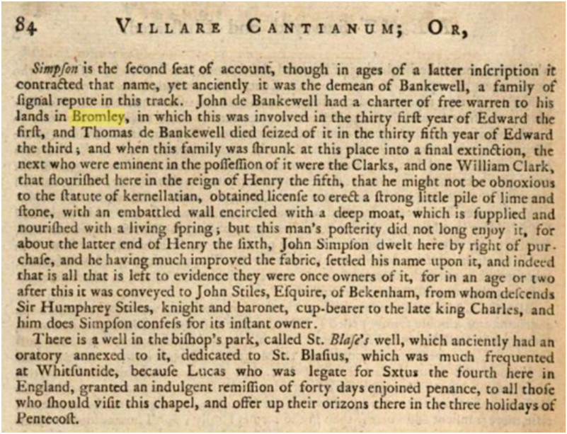
But
probably a more accurate account would come from Horsbrugh who wrote
extensively about Bromley. Certainly the Bankewells held Lee Manor
which had
land in Mottingham and Schroffold (Shroffold Farm once being in what is
now
Downham). But Horsburgh cites the research of Bernard F Davis who
deciphered
some ancient documents. The first from 1310 for William of Bliburgh
“our clerk”
to strengthen and crenalate his house at Bromle(sic), Kent. We have
found that during the Style’s
ownership there
was some involvement of the Bosvilles and some disputes over loans,
mortgages
and non-repayment.
We have collected various references in the timeline showing ‘Symsons’ was held by Robert Symson in the 15th Century. Before that it passed via Mercy Carew. Robert Symson’s will passed it to his son when he came of age and this Robert is said to have sold it to John Style but a foot of fine in 1505 demises it to Thomas Brandon and others perhaps under lease. After John Style’s death in 1505 his widow Elizabeth and her second husband James Yarford took possession but other references between 1505 and 1510 demonstrate that some legal processes occurred which Horsburgh refers to. After the property was settled on Elizabeth and Yarford it descended via the Styles along with Langley. But during the Styles ownership it was leased to the Bosviles with whom the Styles intermarried. It was used as collateral for some loans and some legal suits were brought regarding non repayment of loans. The Civil War etc interrupted the legal process and a kind of expiration of the case ensured that the Styles retained Sympsons which was sold to Hugh Raymond in 1732 having passed to the Elwills via the last Style heiress.
Some references describe Symson’s as being 160 acres but the 1735 map drawn for Hugh Raymond shows that the property is altered describing only about 88 acres. This may be explained by the description of Sympson’s as having parts in Chislehurst, Orpington and Hayes. The title of the map perhaps partially explains why as it refers to an earlier map of an estate belonging to Langley Place containing several farms. If Kings Wood and Bramly Wood are added about another 45 acres is accounted for.
If we assume that the ‘Jones Raymond’ map of the southern part of Langley and the ‘Second Schedule’ map are copies of the other parts of Langley then maybe the ‘whole’ can be deduced. The original acreage of ‘Langley’ hasn’t been identified but may be concealed in some other references bearing in mind some transcriptions exclude details. One map of Langley includes the windmill at Keston as an isolated possession.
Southend
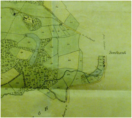
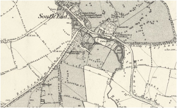
The main watercourses crossing Beckenham are The Beck, sometimes called the Hawksbrook, The Pool river which is fed by the Chaffinch Brook and the Boundary Stream and the Ravensbourne which enters from Bromley. The Beck has some minor tributaries around Langley and it joins the Chaffinch Brook at what is now Cator Park becoming the Pool River, this in turn is joined by the Boundary Stream also in Cator Park. The Ravensbourne and Pool join near Catford Bridge becoming the Ravensbourne which after joining the Quaggy River in Lewisham meets the Thames at Deptford Creek. There are several feeder streams which in some cases are seasonal. Stretches of these watercourses have been culverted or put underground for some distance. The Ravensbourne has several feeder tributaries between Bromley, Farnborough, Keston and Locks Bottom.
We can see from our series of maps that the rivers have been substantially straightened and rerouted from the early 18th Century to both improve drainage, improve farmland or alleviate flooding. There are several recorded instances of periodic flooding. Built development has in some cases diverted watercourses with the installation of sewers and the drying up of the moat at Foxgrove Farm has been attributed to the installation of the West Kent Sewer. Pat Manning published a book on the Rivers of Beckenham.
There are no navigable waterways in Beckenham but the Croydon Canal briefly ran across the parish from Sydenham to Norwood but now a railway runs along its course. The watercourses were utilised to create ponds and lakes in Kelsey Park, Langley, The Manor House grounds, The Mead or Mansion in the High Street and in Beckenham Place. Several millponds were along the Ravensbourne and the Mill mentioned in the Domesday Book is thought to have been in Kelsey but could equally have been on the Ravensbourne ie Monks Mill near the Glassmill in Bromley. Some mills were in Lewisham at Southend for flour and cutlery making.
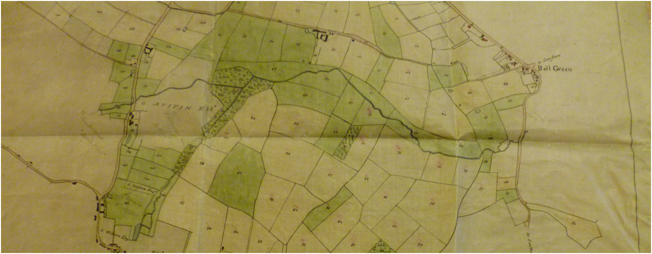
Cator Estate (part of) 1833 showing the Beck from bottom left joining the Chaffinch Brook becoming the Pool and the Pool running into Lewisham near Bell Green.
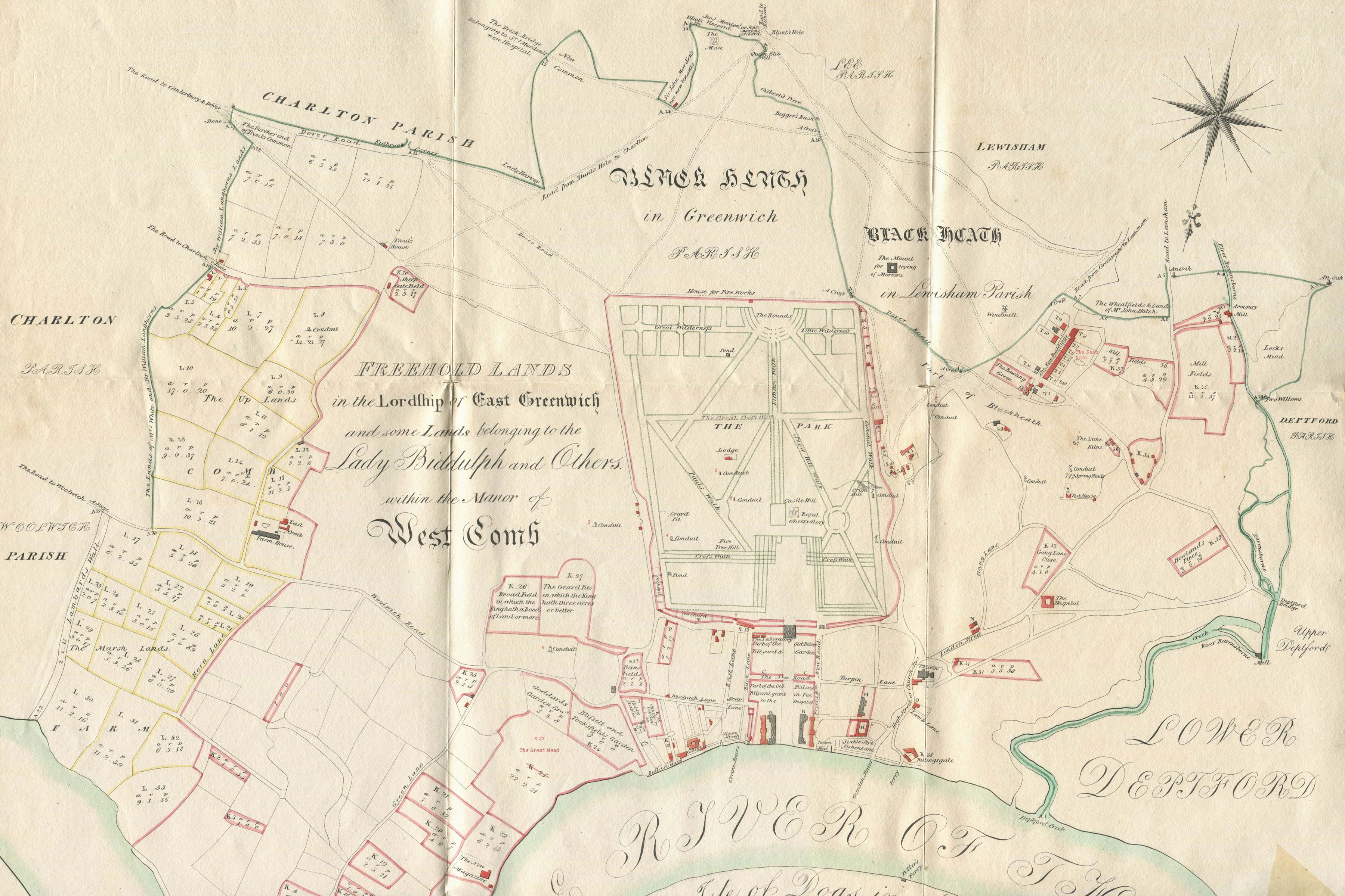